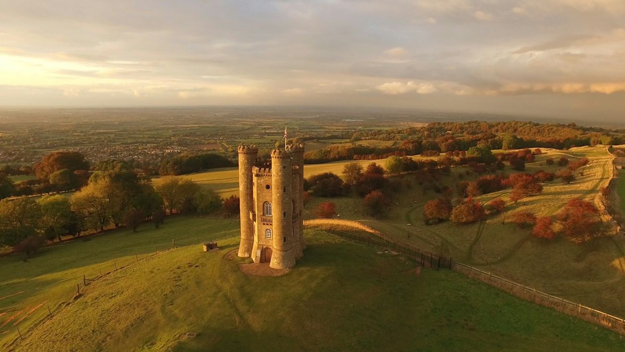
Colin Watts on Unsplash
The Cotswold Way
The Cotswold Way is a 102-mile (164km) National Trail walk from Chipping Campden to Bath along the escarpment, in 15 sections; the official guidebook suggests seven to ten days, and its frequent steep climbs make it hard going.
- Distance
- 164.0 km (101.9 mi)
- Difficulty
- Hard
- Circular
- One way
The route
Starts at The Market Hall in Chipping Campden follows the Cotswold Way for a while Steep sectionLivestock in fields Download GPX
Sights on the way
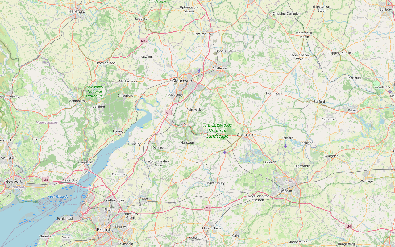
The sights this walk passes, numbered as on the map.
-
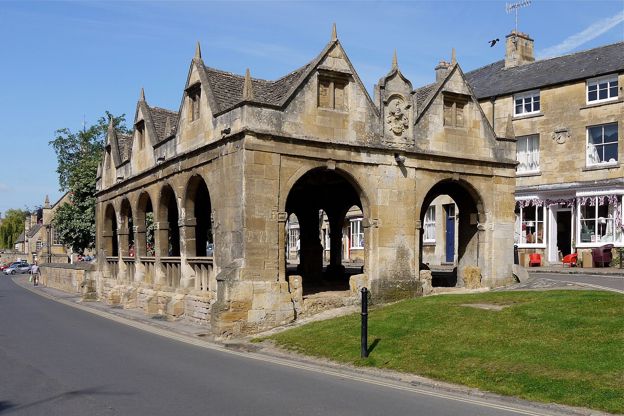
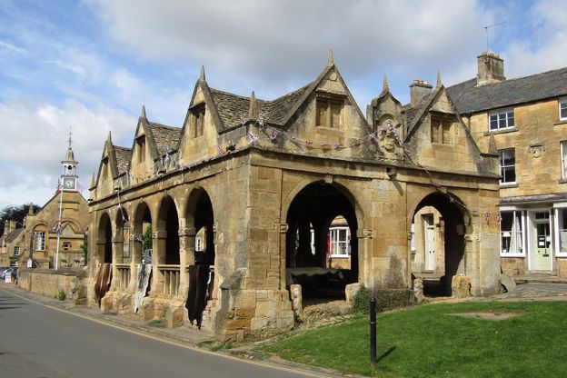
Market Hall, Chipping Campden
Sight · Historic building · Chipping Campden
The open arcade of 1627 in the middle of Chipping Campden's High Street, built by Sir Baptist Hicks as a sheltered market for butter, cheese and poultry, saved from sale to America in the 1940s and now the National Trust's. Grade I; the Cotswold Way starts beside it.
-
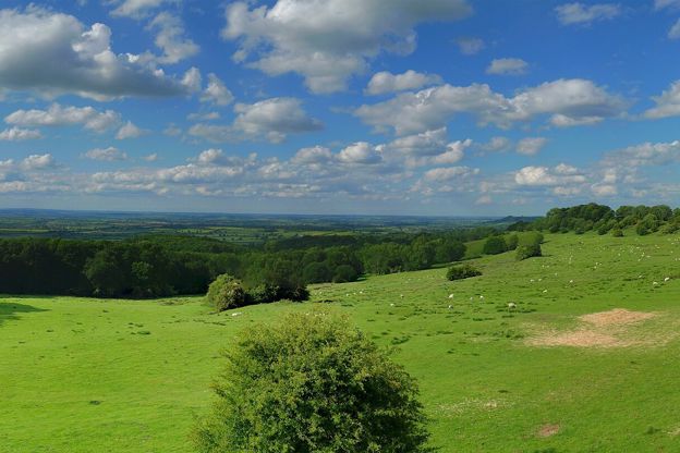
Dover's Hill
Sight · Viewpoint · Chipping Campden
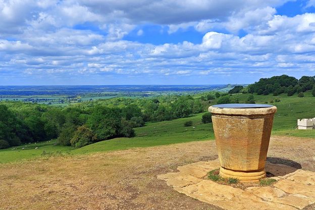
A National Trust hill on the Cotswold edge above Chipping Campden, about 230m up, with a topograph naming the view over the Vale of Evesham and a level path to it. Robert Dover's Cotswold Olimpicks have been held here, on and off, since 1612.
-
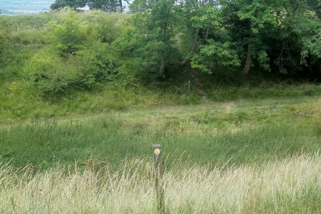
Shenberrow Camp
Sight · Hill fort or barrow · Stanton
Shenberrow Camp is a small Iron Age hill fort on the Cotswold Edge above Stanton, a D-shaped enclosure of about 1.9 hectares inside two banks and ditches, nearly 300m up beside Shenberrow Buildings farm. The Cotswold Way runs through it. A scheduled monument.
-
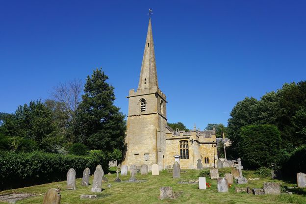
St Michael and All Angels, Stanton
Sight · Church · Stanton
St Michael and All Angels is Stanton's Grade I church, of the twelfth to seventeenth century, with a spired west tower, medieval wall paintings and a rood loft and east window by Sir Ninian Comper. It stands on Church Lane, by the cross and the Cotswold Way.
-
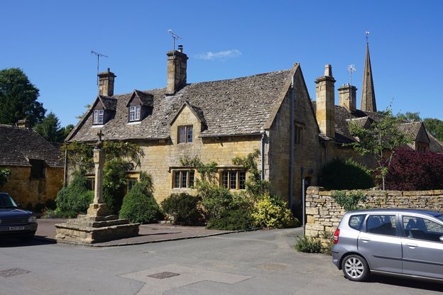
Stanton village cross
Sight · Monument · Stanton
Stanton's village cross stands where the High Street meets Church Lane: medieval steps and socket stone carrying a later shaft topped by a sundial, a ball and a cross. Listed Grade II and a scheduled monument, it is on the Cotswold Way, open at all times.
-
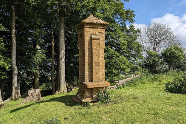
Beckbury Camp, Hailes
Sight · Hill fort or barrow · Winchcombe
An Iron Age hillfort on the Cotswold edge above Hailes, near Winchcombe, its bank still up to 4m high, with the nineteenth-century monument called Cromwell's Seat, where the story goes that Thomas Cromwell watched Hailes Abbey burn. On the Cotswold Way.
-
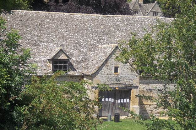
Tithe barn, Postlip
Sight · Historic building · Winchcombe
The tithe barn at Postlip is an eight-bay stone barn, probably of the fifteenth century, below Cleeve Common near Winchcombe, with raised crucks inside, said to have dried the town's tobacco in the 1600s and home every July to the Cotswold Beer Festival.
-
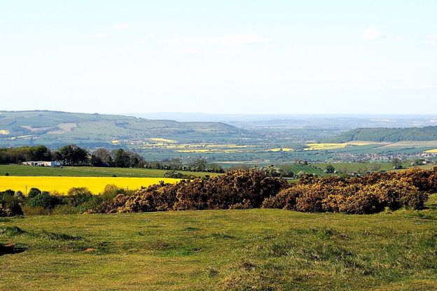
Cleeve Common
Sight · Common or park · The Cotswold Edge
Gloucestershire’s largest common: more than 400 hectares of open limestone grassland on the Cotswold Edge above Cheltenham, with the highest point of the Cotswolds at 330m, an Iron Age hillfort, a Bronze Age cross dyke and views to the Malverns and the Black Mountains.
-
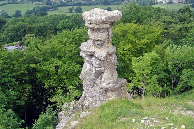
The Devil's Chimney, Leckhampton
Sight · Monument · The Cotswold Edge
The Devil's Chimney is a pillar of limestone standing below the scarp edge of Leckhampton Hill above Cheltenham, most likely left isolated when quarrymen cut an incline to the top and shaped by the weather since. Folklore says the Devil built it. Climbing it is forbidden.
-
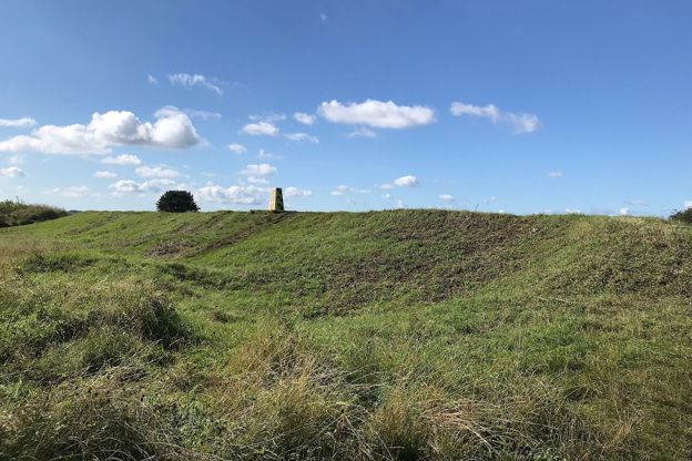
Leckhampton Camp
Sight · Hill fort or barrow · The Cotswold Edge
Leckhampton Camp is the Iron Age hillfort on the summit of Leckhampton Hill above Cheltenham: one rampart and a rock-cut ditch, an inturned entrance with two guard chambers and, to the east, a rare round barrow inside a square enclosure. Scheduled; the trig point is on its bank.
-
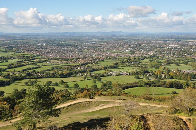
Leckhampton Hill and Charlton Kings Common
Sight · Nature reserve · The Cotswold Edge
Leckhampton Hill and Charlton Kings Common: 60 hectares of old quarries, limestone grassland on the Cotswold Edge above Cheltenham, with an Iron Age hillfort and the Devil's Chimney. Opened to the public in 1929 after the riots of 1902; a National Nature Reserve from 2026.
-
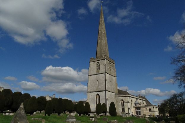
St Mary's Church, Painswick
Sight · Church · Painswick
St Mary's is Painswick's Grade I parish church, of the late fourteenth and fifteenth centuries with a tall stone spire, set in a churchyard of clipped yews and carved table tombs that is on the national Register of Parks and Gardens. Open daily; the clipping is each September.
The walk in detail
The Cotswold Way is a 102-mile (164km) National Trail walk from the Market Hall in Chipping Campden to Bath Abbey, along the Cotswold escarpment in 15 sections. The official guidebook suggests seven to ten days. It is hard going for its length and its steep climbs, with pubs, cafés and rooms in the towns along the way.
It passes Iron Age hill forts, Neolithic long barrows and stately homes, and looks west across the Severn vale for much of its length. Our guide to the Cotswold Edge covers the escarpment around Winchcombe and Cleeve Hill, where the trail reaches its highest ground.
How long the Cotswold Way takes
Most walkers take seven to ten days, the official guidebook's suggestion. That is 10 to 15 miles a day. The sections run from 4.7 to 10.2 miles, and the Trail warns that many walkers are surprised by how often the path climbs, so plan short days where the climbs are steep. Allow longer if you want time in the towns on the way.
Which way to walk
Either way works: the trail is signed in both directions, and the National Trail says there is no right or wrong way. Most guidebooks run north to south, from Chipping Campden to Bath, the views that way are often the more striking, and Bath has more trains and buses for the trip home. At each end is a carved stone disc, one by the Market Hall in Campden, unveiled in 2014, and its partner, by the same carver, Iain Cotton, set in the pavement outside the west doors of Bath Abbey.
Waymarking and the ground underfoot
The trail is well waymarked, with the National Trail acorn or the trail's name on stiles, gates and signposts, yellow arrows on footpaths and blue on bridleways. Carry a map or a guidebook all the same, because phone reception is patchy along the edge. Most of it is footpath across farmland: about 19 per cent is on tracks or bridleways and only about 8 per cent on roads, mostly quiet ones. It is not stile-free.
It can be walked all year. Winter gives the clearest views from the edge, April and May bring bluebells and wild garlic to the woods, and mid to late October the autumn colour.
The fifteen sections
The National Trail divides the Cotswold Way into fifteen sections of 4.7 to 10.2 miles, and we describe each as a walk of its own, with directions stage by stage, a map, a GPX file and how to get back to the start.
From Chipping Campden to Painswick, sections 1 to 8: Chipping Campden to Broadway, Broadway to Wood Stanway, Wood Stanway to Winchcombe, Winchcombe to Cleeve Hill, Cleeve Hill to Dowdeswell, Dowdeswell to Leckhampton Hill, Leckhampton Hill to Birdlip and Birdlip to Painswick.
From Painswick to Bath, sections 9 to 15: Painswick to King's Stanley, King's Stanley to Dursley, Dursley to Wotton-under-Edge, Wotton-under-Edge to Hawkesbury Upton, Hawkesbury Upton to Tormarton, Tormarton to Cold Ashton and Cold Ashton to Bath, which ends at Bath Abbey.
Chipping Campden to Winchcombe: sections 1 to 3
The first three sections run 17.9 miles from Chipping Campden along the northern edge to Winchcombe, past a tower, two hill forts and an abbey.
Section 1, Chipping Campden to Broadway, is 6 miles (9.6km). It climbs to Dover's Hill, home of the Olimpick games, the turning point of our loop from Campden to Dover's Hill, then follows the edge to Broadway Tower and drops into the village. The circuit from Broadway to the tower comes back down that last mile.
Section 2, Broadway to Wood Stanway, is 6.5 miles (10.5km) with 248m of climbing, up to the Iron Age fort of Shenberrow Camp and down into Stanton, then past the Jacobean manor at Stanway. We describe it as a walk of its own, the Cotswold Way from Broadway to Wood Stanway. Broadway, Pye Corner and the Cotswold Way joins it above the village, and the loop from Stanton to Snowshill climbs the same stretch of edge.
Section 3, Wood Stanway to Winchcombe, is 5.4 miles (8.8km), with views across the Vale of Evesham to the Malverns. It passes Beckbury Camp and the ruins of Hailes Abbey with its little church, then follows Puckpit Lane into the town. Our walk from Hailes up to Beckbury Camp takes in the middle of it.
Winchcombe to Painswick: sections 4 to 8
Sections 4 to 8 cover 30 miles from Winchcombe to Painswick, and include both the biggest climb of any section and the highest part of the whole trail.
Section 4, Winchcombe to Cleeve Hill, is 5.6 miles (9km) with 330m of climbing. It crosses the Sudeley estate to Belas Knap, the Neolithic long barrow, drops through Breakheart Plantation by Postlip Hall and climbs again to the golf club house. We have it as the Cotswold Way from Winchcombe to Cleeve Hill, and two loops from the town share it: Winchcombe and Belas Knap, and the longer Winchcombe, Belas Knap and Cleeve Common.
Section 5, Cleeve Hill to Dowdeswell, is 5.5 miles (8.9km) across Cleeve Common, which the National Trail calls the highest part of the entire trail, with views over Cheltenham, then down through Dowdeswell Wood to the reservoir. Our loop over Cleeve Common and Cleeve Cloud starts from the main road at Cleeve Hill.
Section 6, Dowdeswell to Leckhampton Hill, is the shortest at 4.7 miles (7.6km), but climbs 275m: through Lineover Wood to Seven Springs, which some believe to be the source of the Thames, and over Charlton Kings Common to the Devil's Chimney. The loop from Seven Springs and Leckhampton Hill and the Devil's Chimney both follow it.
Section 7, Leckhampton Hill to Birdlip, is 5.6 miles (9km) by Crickley Hill Country Park and the grassland of Barrow Wake. Section 8, Birdlip to Painswick, is 8.6 miles (13.9km) through beech woods, over Cooper's Hill, where the cheese is rolled on the spring bank holiday, and across the ramparts and golf course on Painswick Beacon to the Rococo Garden and the town, which the Trail counts as its midpoint. Our Painswick Beacon loop walks the end of it.

The Cotswolds Info newsletter
Events, new places and the best of the season, about once a month. Unsubscribe at any time.
Painswick to Wotton-under-Edge: sections 9 to 11
Sections 9 to 11 run 22.3 miles along the western edge, above the Stroud valleys and the Severn, to Wotton-under-Edge.
Section 9, Painswick to King's Stanley, is 7.8 miles (12.6km) with 315m of climbing, over Edge Common and Haresfield Beacon, an Iron Age hill fort with views of the Severn, and through Standish Woods, known for bluebells and wood anemones. Near the end you choose between the Stroudwater Navigation and Selsley Common or the way by King's Stanley. Our walk round Haresfield Beacon and Standish Wood is a loop on this section.
Section 10, King's Stanley to Dursley, is 7.2 miles (11.6km), by Middleyard and Pen Wood to the picnic area on Coaley Peak, past a disused quarry that shows the strata of the rock, and over Cam Long Down, with views all round.
Section 11, Dursley to Wotton-under-Edge, is 7.3 miles (11.8km), or 4.8 miles by the shortcut across Stinchcombe Hill from the golf club. It passes North Nibley and the Tyndale Monument, then the walled clump of trees on Wotton Hill planted in 1815 for the Battle of Waterloo. Our ridge walk from Wotton Hill to the Tyndale Monument follows it, and the longer loop by the monument and Coombe Hill adds North Nibley.
Wotton-under-Edge to Bath: sections 12 to 15
The last four sections run 31.9 miles from Wotton-under-Edge to Bath, and finish with the longest section of the trail.
Section 12, Wotton-under-Edge to Hawkesbury Upton, is 7.4 miles (11.9km) with 300m of climbing, by Alderley, the National Trust's Newark Park, the millstream at Lower Kilcott and the Somerset Monument. Wotton-under-Edge and the Cotswold Way uses the trail on Wortley Hill, just south of the town.
Section 13, Hawkesbury Upton to Tormarton, is 7.7 miles (12.4km), past an old drovers' pond, the National Trust's Horton Court, which the Trail calls probably the oldest vicarage in England, and the hill fort above Horton, then through Old Sodbury and Capability Brown's parkland at Dodington. Our stile-free loop from Old Sodbury climbs the trail to the hill fort of Sodbury Camp, and the nearest of our town guides is Chipping Sodbury, 2 miles west.
Section 14, Tormarton to Cold Ashton, is 6.6 miles (10.6km) through Dyrham Park, a William and Mary house in an ancient deer park, and Dyrham Woods. Section 15, Cold Ashton to Bath, is the longest at 10.2 miles (16.5km), with 400m of descent: over the Lansdown battle site, past the Little Down hill fort and Bath Racecourse to Prospect Stile, now a kissing gate, where Bath first comes into view, and down through Weston to the Abbey.
Diversions in 2026
The trail is diverted near Birdlip for at least six months from 3 July 2026, while the A417 is re-routed. In its first stage, of 12 to 14 weeks, the diversion followed the pavement along Leckhampton Hill for about 250m and then a permissive path through National Star. National Highways' leaflet gives the signed temporary route by Ullenwood, Rushwood Kennels and Birdlip Radio Station, adding 4km (2.5 miles), or 50 to 60 minutes on foot. The National Trail says it adds about an hour and passes a large road construction site, with busy roads to cross, so take care. The car park, paths and café at Crickley Hill are not affected. The Trail also lists a permanent diversion at North Nibley, an ongoing one at Tormarton by Beacon Lane Plantation, and a temporary one near Wortley, closed after drought and high winds, which was due to end in September 2026 but was still listed when we checked in October. Check the National Trail's notices before you set out.
Food, drink and places to stay
Pubs, cafés and rooms are in the towns and villages along the way rather than on the open edge, so plan each day's stops; the National Trail's interactive map shows food and drink, water points and visitor facilities. Accommodation fills quickly in peak season, so book early, and there is no right to wild camp: use the campsites on the map, or ask the landowner.
At the start, the Bantam Tea Rooms are on Campden's High Street, and our pages on places to stay in Chipping Campden, Broadway, Winchcombe and Painswick cover the first half of the trail. Our place guides along it name the pubs and cafés in each town.
Getting to the start and home again
The nearest main-line station to the start is Moreton-in-Marsh, from where the 1 and 2 buses run to Chipping Campden; Bath, at the finish, has its own station. The nearest airports are Birmingham and Bristol, and local buses link the towns near the trail, with times on Traveline's planner.
Four firms carry bags between overnight stops: A2B Cotswold Travel, Carryabag, Cotswold Luggage Transfers and Sherpa Van, and many walking holiday companies arrange the whole trip. The Cotswold Voluntary Wardens lead monthly guided walks along the trail in stages, booked and paid for in advance, with no dogs other than assistance dogs.
Dogs, livestock and stiles
Dogs are welcome, and many walkers have done the whole trail with one, but keep them on a lead unless you are told otherwise. Cattle, horses and sheep graze freely, so keep at least 10m from them, and remember that cows and horses protect their young. Pick up after your dog even where there are no bins, and check that your rooms take dogs, since some accommodation and campsites do not.
The trail is not stile-free, and it crosses golf courses at Cleeve Hill, Painswick Beacon, Stinchcombe Hill and Lansdown. For walkers with restricted mobility, an off-road scooter can be hired at Crickley Hill Country Park.
Places on the way
-
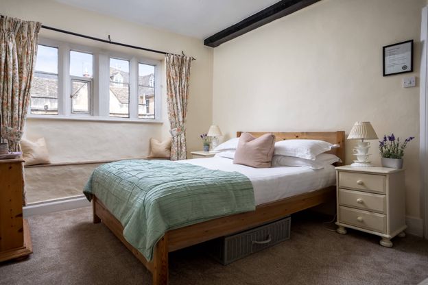
Bantam Tea Rooms
Cafes and tearooms · Chipping Campden
Tea rooms with rooms on the High Street in Chipping Campden, open every day from 9.30am to 5pm.
Verified Oct 2026
Stay near the start
Inns, cottages and hotels within a short drive of where the walk begins, so you can set off early.
-
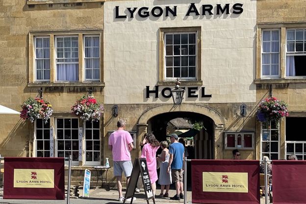
The Lygon Arms, Chipping Campden
Inn · Chipping Campden
A coaching inn with ten rooms on Chipping Campden's High Street, with family rooms, bike storage, free parking at the rear and dogs welcome.
Dog-friendly
Verified Oct 2026
-
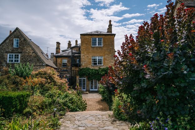
Cotswold House Hotel and Spa
Hotel · Chipping Campden
A Grade II listed Regency town house on Chipping Campden's Upper High Street, now a hotel and spa with the Hidcote restaurant.
Hot tubs · Wedding venues
Verified Nov 2026
-
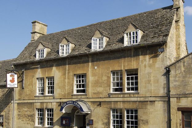
The Noel Arms Hotel
Inn · Chipping Campden
A Grade II listed inn with 27 rooms on Chipping Campden's High Street, with a restaurant, parking, accessible rooms and dogs by arrangement.
Dog-friendly
Verified Oct 2026
More like this
Stories on this walk
-
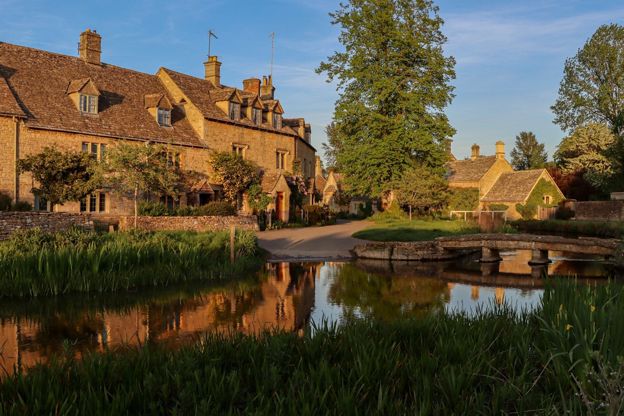
Cotswolds itineraries: one day to a week
Story · Guides · 12 minute read
Cotswolds itineraries from one day to a week: how many days you need, a day by car or by train, two days in the north, three days north to south, five days across two regions, a week with two bases or on the Cotswold Way, and themed weekends for gardens, walks, dogs and winter.
-
The wool churches of the Cotswolds
Story · Guides · 11 minute read
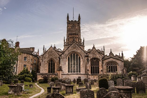
Northleach, Chipping Campden, Cirencester, Fairford, Burford and the other Cotswold churches rebuilt on medieval wool money: how the trade paid for them, what to look for in each, when they open and a route by car or on foot.
-
Walking, cycling and the outdoors in the Cotswolds
Story · Guides · 5 minute read
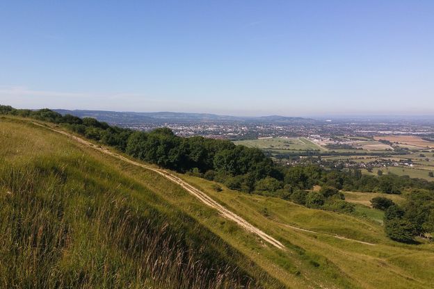
The Cotswold Way and other long walks, the cycle routes that follow the railway and the valleys, and the Cotswold Water Park's lakes: how to get outdoors in the Cotswolds.
More walks to try
-
Chipping Campden and Dover's Hill
Walk · Starts in Chipping Campden · 3 hrs, 30 mins · Circular
A 4.5-mile (7.2km) circular walk from the Market Hall in Chipping Campden, two and a half to three and a half hours, moderate with steep sections. It climbs the Cotswold Way to Dover's Hill, home of the Olimpicks, and drops through Lynches Wood; a 3-mile version skips the climbs.
-
Broadway and Broadway Tower
Walk · Starts in Broadway · 3 hrs · Circular
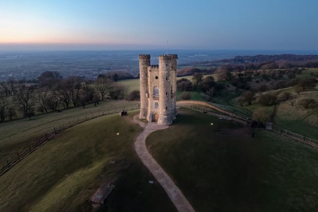
A 4-mile (6.5km) circular walk from the war memorial in Broadway, two and a half to three hours, moderate with steep sections and no stiles. It passes St Eadburgha's, climbs Coneygree Lane to Broadway Tower and comes back down the Cotswold Way.
-
Cotswold Way: Broadway to Wood Stanway
Walk · Starts in Broadway · 3 hrs, 15 mins · Dog-friendly
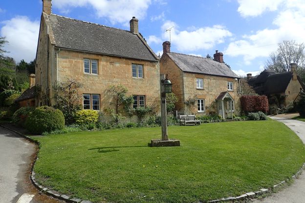
A 6.5-mile (10.5km) one-way walk on the second section of the Cotswold Way, from Broadway's green, moderate and three to three and a half hours: a long climb to Shenberrow, a steep descent into Stanton, then field paths by Stanway's church and gatehouse to Wood Stanway.