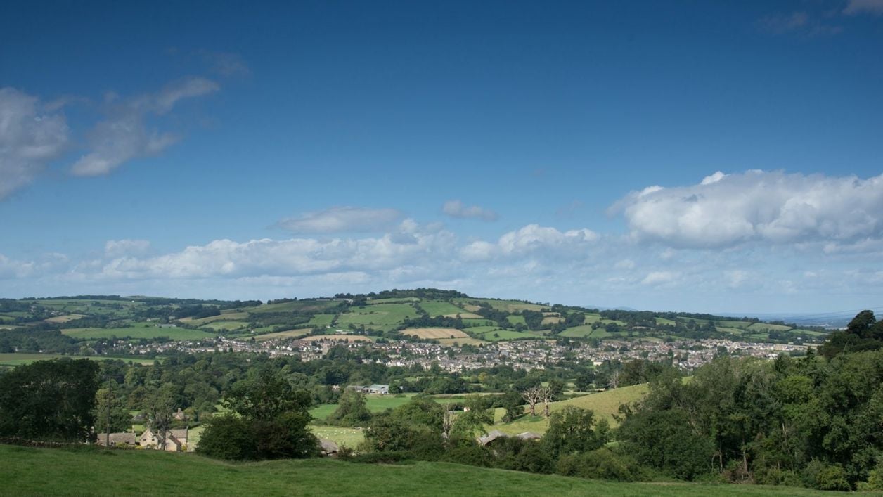
Richard Bell on Unsplash
Cotswold Way: Winchcombe to Cleeve Hill
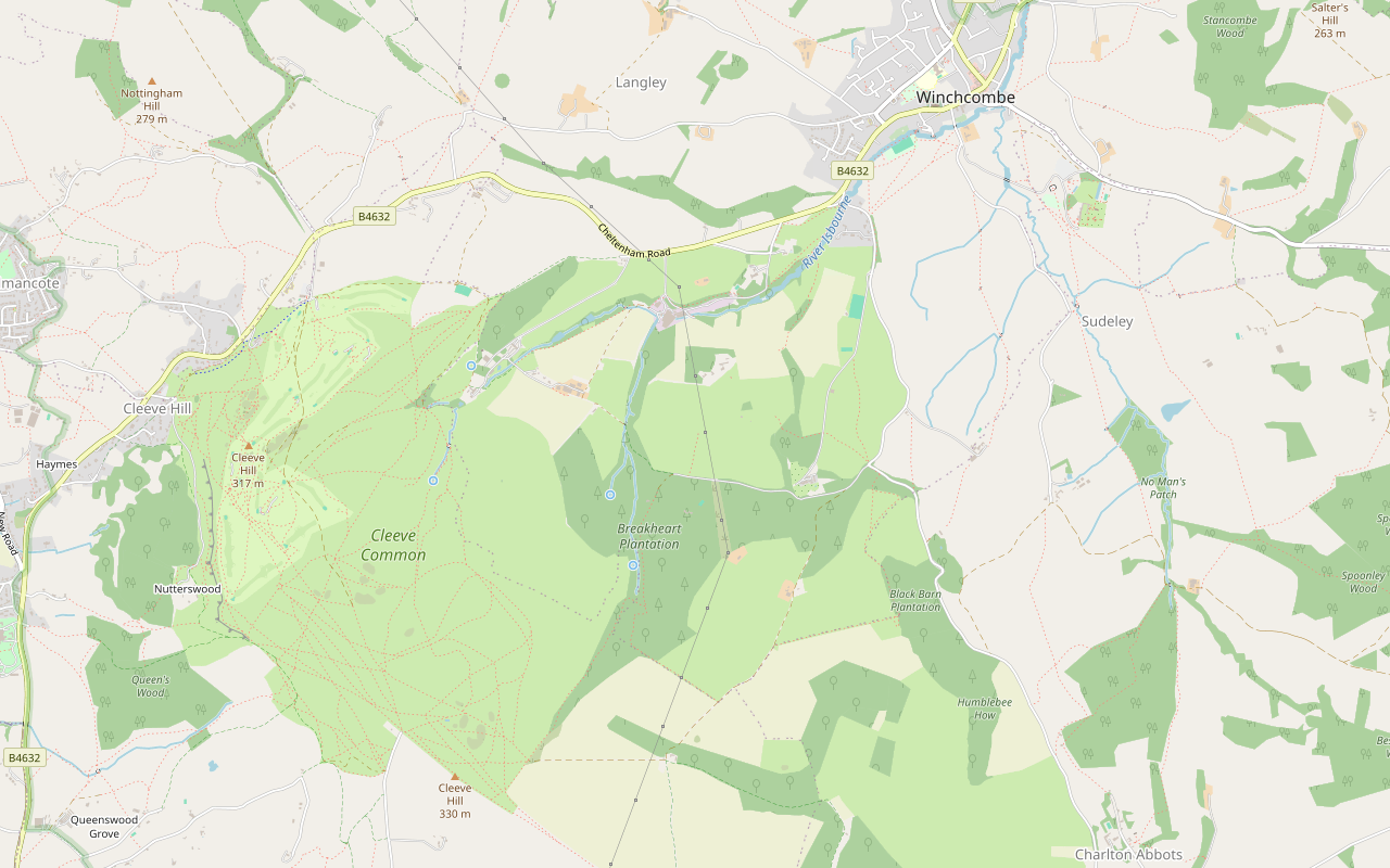
A 5.6-mile (9km) one-way walk on the fourth section of the Cotswold Way, moderate and two and a half to three hours: from Winchcombe by Sudeley up to Belas Knap, down through Breakheart Plantation to Postlip's Norman chapel, then up to the golf club on Cleeve Hill.
- Distance
- 9.2 km (5.7 mi)
- Difficulty
- Moderate
- Time
- 2 hrs, 45 mins
- Ascent
- 356 m
- Circular
- One way
The route
Starts at Abbey Terrace, Winchcombe follows the Cotswold Way for a while Steep sectionMuddy in winterLivestock in fieldsDogs on lead near sheepCafé on route Download GPX
Step by step
-
Step 1: Winchcombe and the Sudeley estate
From Abbey Terrace, walk down Vineyard Street and over Vineyard Bridge, and follow the acorn waymarks south across the fields, along Corndean Lane for a short way, and through the Sudeley estate past the cricket pitch, about 2.3km.
-
Step 2: Up to Belas Knap
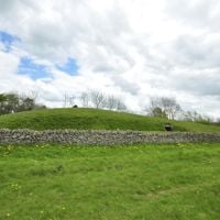
Cross Corndean Lane again and climb steeply for about 1km, past Black Barn Plantation, to Belas Knap long barrow. Look back over Winchcombe before the path turns into the open fields.
- Steep section
- Muddy in winter
-
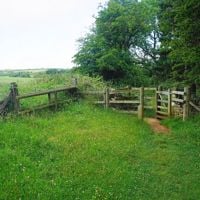
Step 3: Down through Breakheart Plantation
Follow the byway and then the footpaths west along the top for about 1.3km, then drop steeply through Breakheart Plantation and on down the fields, about 130m in all, slippery after rain.
- Steep section
- Muddy in winter
-
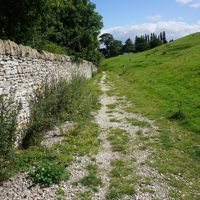
Step 4: Postlip
Follow the bridleway down past Postlip Hall Farm and over the River Isbourne, past the tithe barn, Postlip Hall and St James’ Chapel.
- Dogs on lead
-
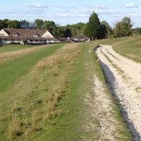
Step 5: Up to Cleeve Hill
Climb on the footpaths and then the restricted byway on to Cleeve Common for about 1.2km, about 100m up, to the quarry car park and the golf clubhouse, where the section ends.
- Steep section
- Café
Sights on the way
The sights this walk passes, numbered as on the map.
-
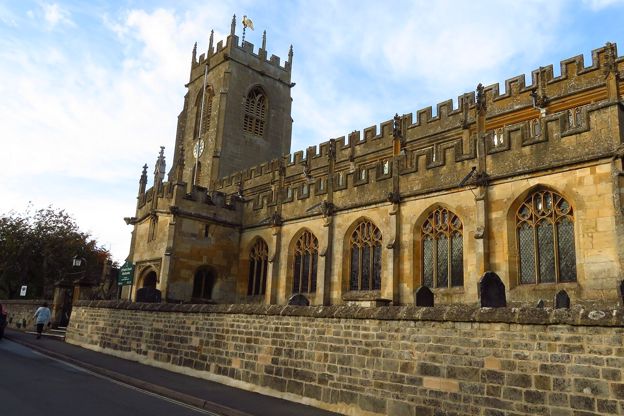
St Peter's Church, Winchcombe
Sight · Church · Winchcombe
St Peter's is Winchcombe's Grade I parish church, built in one campaign in about 1458 to 1468, with some 40 carved grotesques round its walls, a fan-vaulted tower and two stone coffins tied to the St Kenelm story. Usually open daily.
-
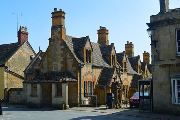
Dent's Terrace, Winchcombe
Sight · Historic building · Winchcombe
A row of ten almshouses of 1865 on Abbey Terrace, Winchcombe, by Sir George Gilbert Scott and J Drayton Wyatt for John and Emma Dent of Sudeley Castle: cream, yellow and pink stone under stepped gables. Grade II.
-

Vineyard Bridge, Winchcombe
Sight · Bridge · Winchcombe
Vineyard Bridge is the single stone arch of 1891 that carries Vineyard Street over the River Isbourne in Winchcombe, the last work in the town of the architect J. Drayton Wyatt and the way to Sudeley Castle. Listed Grade II.
-
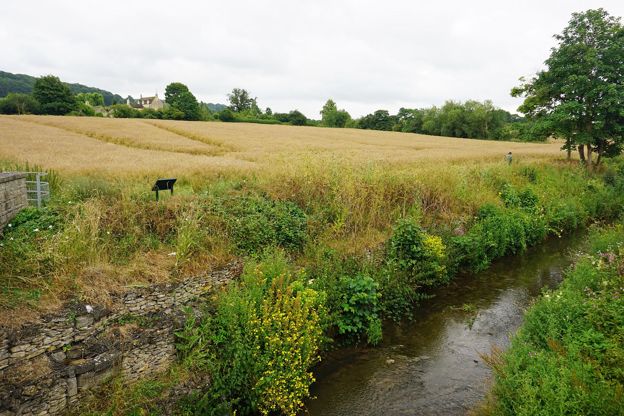
River Isbourne
Sight · River · Winchcombe
The River Isbourne rises at a spring on Cleeve Hill above Winchcombe and runs north past Postlip, Winchcombe, Toddington and Sedgeberrow to join the Avon at Evesham. A waymarked path of some 14 miles, the Isbourne Way, follows it.
-
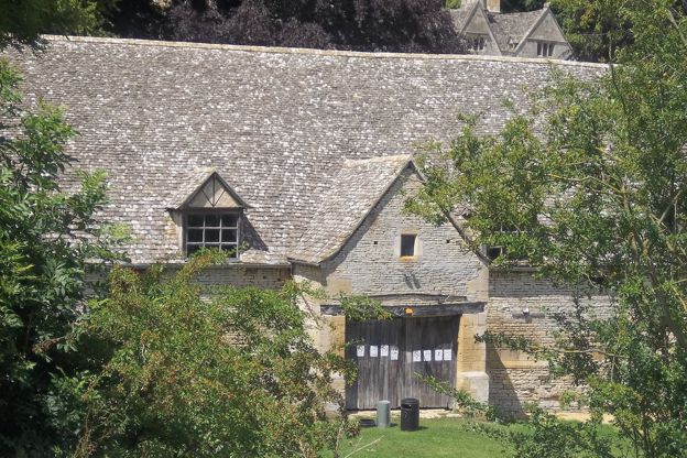
Tithe barn, Postlip
Sight · Historic building · Winchcombe
The tithe barn at Postlip is an eight-bay stone barn, probably of the fifteenth century, below Cleeve Common near Winchcombe, with raised crucks inside, said to have dried the town's tobacco in the 1600s and home every July to the Cotswold Beer Festival.
-
St James' Chapel, Postlip
Sight · Church · Winchcombe
St James' Chapel is a small Norman chapel of about 1140 beside Postlip Hall below Cleeve Common, with a chevron-carved doorway, used as a farm building for centuries and restored for Catholic worship in 1891. Grade I; seen from the Cotswold Way.
The walk in detail
The Cotswold Way from Winchcombe to Cleeve Hill is a 5.6-mile (9km) one-way walk from Winchcombe by the Sudeley estate and the Belas Knap long barrow to the golf club on Cleeve Hill. It is moderate but climbs about 356m in two pulls, takes two and a half to three hours, and ends at the clubhouse restaurant.
It is the fourth of the Cotswold Way's fifteen sections. After Belas Knap it drops to Postlip and its Norman chapel, then climbs again to the edge of Cleeve Common, where the National Trail ends the section. Plan the way back before you start.
Winchcombe and Sudeley
The section starts on Abbey Terrace, near St Peter's, the Grade I church of about 1458 to 1468 with large gargoyles on its tower, one of the churches in our story on the Cotswold wool churches. It goes down Vineyard Street and over Vineyard Bridge, built in 1891 by J. Drayton Wyatt, then across the fields and the Sudeley estate on public footpaths. Sudeley Castle, where Katherine Parr is buried, is in the park; it opens daily from mid-March to the start of November and has a café. The National Landscape's short walk from Winchcombe to Sudeley Castle covers the castle drive.
Belas Knap
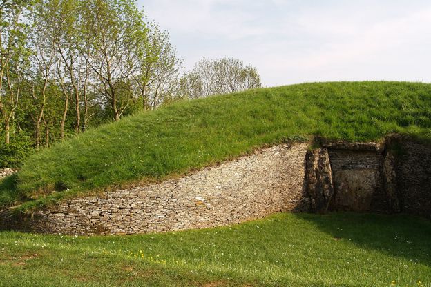
The first climb is the steepest, up from Corndean Lane past Black Barn Plantation to Belas Knap, about 200m above the town. The Neolithic long barrow has a false entrance and side chambers, and was explored between 1863 and 1865 and again in 1928 to 1930; the chambers held about 31 burials. It is free to visit in daylight. Walkers suggest looking back over Winchcombe before the path turns into the open fields at the top. The National Landscape’s Winchcombe and Belas Knap makes a shorter loop of this part.
Breakheart Plantation and Postlip
After a stretch along the top, the path drops steeply through Breakheart Plantation, and walkers warn that the descent, with its switchbacks after the long barrow, is slippery when wet. At the bottom it passes Postlip. St James’ Chapel, about 15m from the bridleway, is a small two-cell Norman church of the twelfth century, now a private Roman Catholic chapel, with a chevron-carved north doorway and a stone bell turret. It is listed Grade I, and the tithe barn at Postlip Hall is a scheduled monument.
Up to Cleeve Hill
The last climb, about 100m, goes up from the River Isbourne on to Cleeve Common. The National Trail calls the common the highest part of the whole trail, and the next section crosses it. This one ends at the golf clubhouse, by the quarry car park. Our walk on Cleeve Common is a short loop from the main road just below.
What walkers report
Walkers describe more than one stiff climb, with the first, up to Belas Knap, the hardest, and exposed in summer, so carry water. The route carries the National Trail's acorn waymarks, but walkers in 2025 and 2026 found many forks and small signs easy to miss, so carry a map. On Cleeve Common cattle graze all year and sheep from late April to November, the Cleeve Common Trust says, and mountain bikes are allowed on its byways and main tracks.
Walkers report nowhere to buy food or drink between Winchcombe and the golf club. Winchcombe has public toilets near the library by Back Lane car park. At the finish the golf club has the only toilets on Cleeve Common, up steps, and its café, Flynn’s on the Hill, welcomes walkers and their dogs. The club says it opens seven days a week for coffee, drinks and cakes, with food from Tuesday to Sunday; ring 01242 672025 for its hours.
The Cotswolds Info newsletter
Events, new places and the best of the season, about once a month. Unsubscribe at any time.
Getting back, and getting there
Stagecoach West's W runs back to Winchcombe about hourly from the main road just below the golf club, Monday to Saturday, with no Sunday service; check the times before you set out. You can also do it the other way round, taking the bus out to Cleeve Hill and walking back, or park at the golf club (£2 for 24 hours) and catch the bus to Winchcombe to start. Without a bus, our loop from Winchcombe over Cleeve Common turns this section into a 9.2-mile round walk.
In Winchcombe, Back Lane car park costs £1.50 all day by RingGo, and the 606 and W buses from Cheltenham arrive roughly hourly, Monday to Saturday. If you are walking the whole trail, the Cleeve Hill Hotel, a bed and breakfast, is on the main road below the common, with a back gate on to it.
To make a weekend of it, our page on places to stay in Winchcombe has the inns and cottages in the town, and the White Hart is a few steps from the start on the High Street.
Places on the way
-
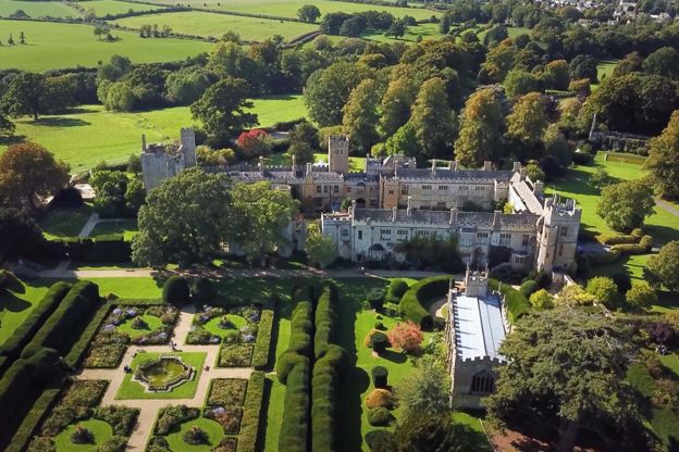
Sudeley Castle and Gardens
Historic houses and heritage · Winchcombe
A castle on the edge of Winchcombe where Katherine Parr, Henry VIII's last queen, is buried, with gardens, a Tudor history and the Dent family's home.
Family-friendly · Walker-friendly
Verified Nov 2026
-
Belas Knap Long Barrow
Historic houses and heritage · Winchcombe
A Neolithic long barrow on the hill above Winchcombe, with a false entrance and side chambers, free to visit and on the Cotswold Way.
Walker-friendly
Verified Oct 2026
-
Cleeve Hill Hotel
B&B · Winchcombe
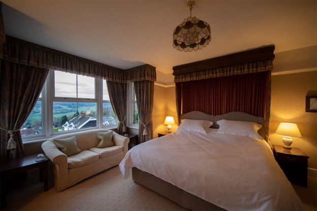
A 12-room bed and breakfast hotel on Cleeve Hill, about three miles south-west of Winchcombe, with views over the Severn Vale and a door onto Cleeve Common and the Cotswold Way.
Walker-friendly · Dog-friendly
Verified Oct 2026
-
The White Hart Inn
Inn · Winchcombe
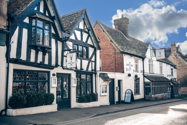
An inn with sixteen rooms on Winchcombe's High Street, with dog-friendly rooms and a restaurant and bar open all day to non-residents.
Dog-friendly · Wedding venues · Walker-friendly
Verified Nov 2026
-
The Lion Inn
Inn · Winchcombe
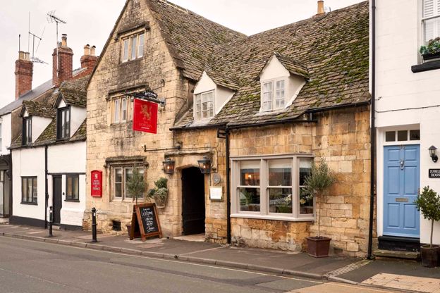
A restored fifteenth-century coaching inn on North Street, Winchcombe, with nine rooms, run by Butcombe.
Dog-friendly · Walker-friendly
Verified Oct 2026
-
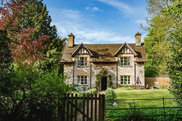
Sudeley Castle Cottages
Self-catering · Winchcombe
Nineteen holiday cottages on the Sudeley Castle estate at Winchcombe, sleeping three to fourteen, some dog-friendly, with free castle entry in season.
Dog-friendly
Verified Nov 2026
Stay near the start
Inns, cottages and hotels within a short drive of where the walk begins, so you can set off early.
Where to stay in Winchcombe-
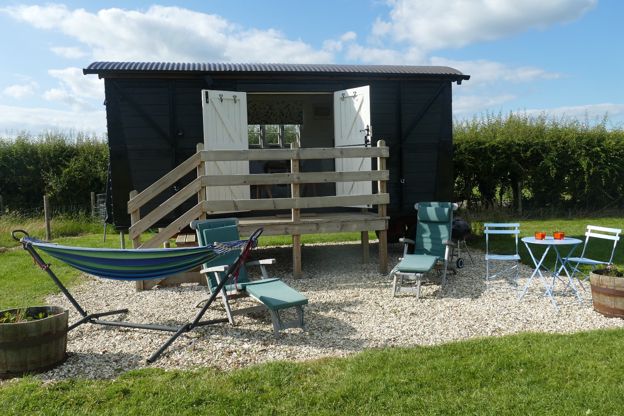
Elms Farm
B&B · Winchcombe
A converted freight wagon and five Caravan and Motorhome Club pitches on a working farm at Gretton, about two miles north-west of Winchcombe.
Verified Oct 2026
-
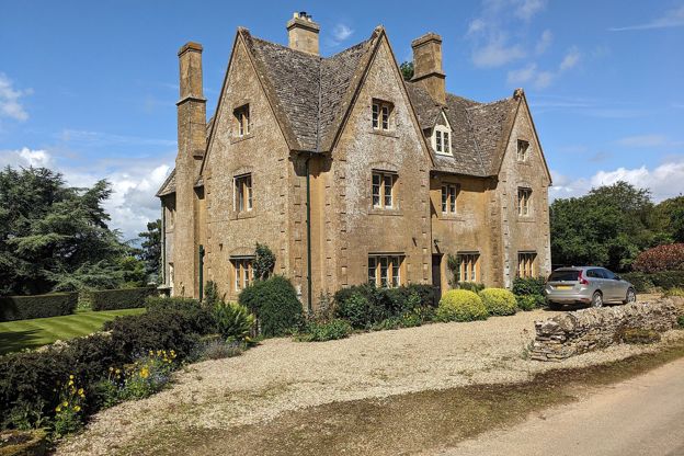
North Farmcote
B&B · Winchcombe
Bed and breakfast in a farmhouse above Winchcombe, built around 1840, its owners say, as a dower house for Lord Sudeley's mother.
Walker-friendly
Verified Oct 2026
-
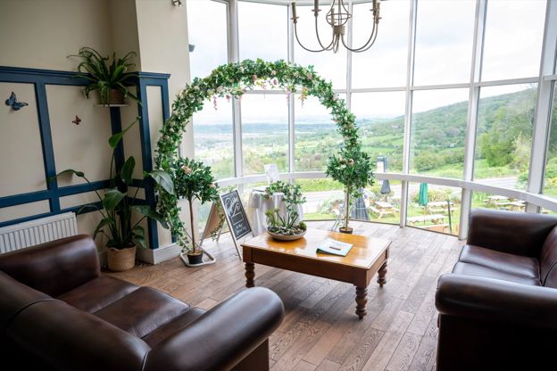
The Rising Sun Hotel
Hotel · Cleeve Hill
A Greene King Inns hotel, pub and restaurant with 23 bedrooms near the top of Cleeve Hill, with views over five counties from its beer garden.
Dog-friendly · Walker-friendly
Verified Nov 2026
More like this
Stories on this walk
-
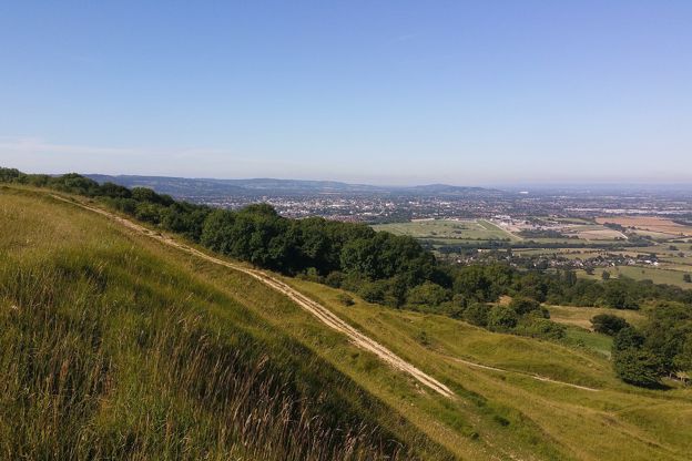
Walking, cycling and the outdoors in the Cotswolds
Story · Guides · 5 minute read
The Cotswold Way and other long walks, the cycle routes that follow the railway and the valleys, and the Cotswold Water Park's lakes: how to get outdoors in the Cotswolds.
More walks to try
-

The Cotswold Way
Walk · Dog-friendly
The Cotswold Way is a 102-mile (164km) National Trail walk from Chipping Campden to Bath along the escarpment, in 15 sections; the official guidebook suggests seven to ten days, and its frequent steep climbs make it hard going.
-
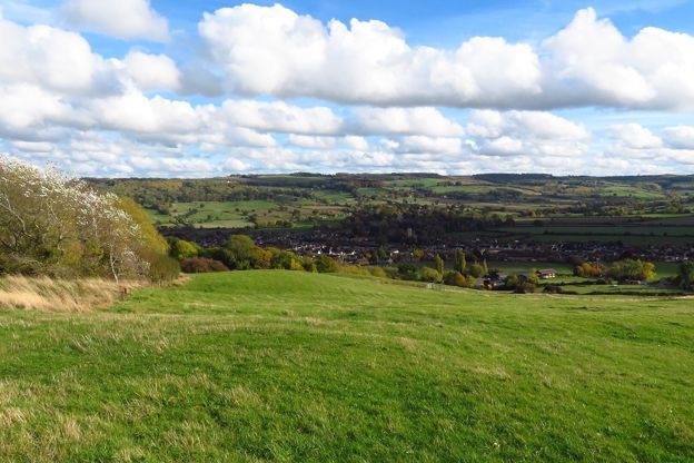
Winchcombe and Belas Knap
Walk · Starts in Winchcombe · 2 hrs, 45 mins · Circular
A 5.5-mile (8.8km) moderate loop of two to two and three quarter hours from Winchcombe, up the Cotswold Way and through the woods to Belas Knap, the Neolithic long barrow, then home on the Winchcombe Way by Wadfield Farm and Sudeley, with two stiles and a narrow road.
-
Cleeve Common and Cleeve Cloud
Walk · Starts in the Cotswold Edge · 1 hr, 45 mins · Circular · Dog-friendly
A 4-mile (6.4km) moderate loop of about an hour and three quarters on the highest ground in the Cotswolds: from the main road at Cleeve Hill past the golf club, across Cleeve Common, back along the scarp by the hill fort and Cleeve Cloud, and down through Thrift Wood.