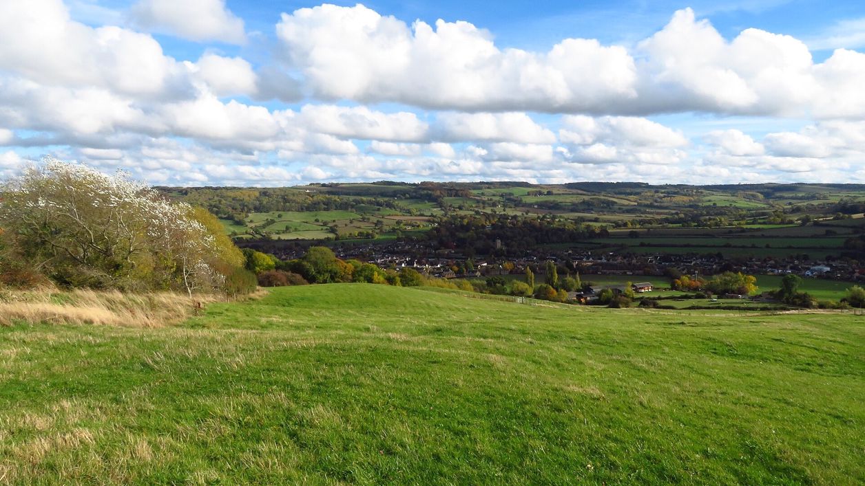
Colin Park, CC BY-SA 2.0, via Wikimedia Commons
Winchcombe and Belas Knap
A 5.5-mile (8.8km) moderate loop of two to two and three quarter hours from Winchcombe, up the Cotswold Way and through the woods to Belas Knap, the Neolithic long barrow, then home on the Winchcombe Way by Wadfield Farm and Sudeley, with two stiles and a narrow road.
- Distance
- 8.8 km (5.5 mi)
- Difficulty
- Moderate
- Time
- 2 hrs, 45 mins
- Circular
- Circular
The route
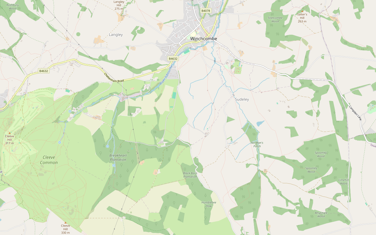
Starts at Back Lane car park, Winchcombe follows the Cotswold Way for a while StilesSteep sectionRoad walking Download GPX
Step by step
-
Step 1: Winchcombe to the junction of lanes
Leave Back Lane car park by the far corner into Cowl Lane, turn right to the High Street, then right along Abbey Terrace until you are opposite Vineyard Street. Cross with care and go down Vineyard Street, over the bridge, and shortly turn right through a gate waymarked Cotswold Way. Follow the Cotswold Way straight across the field to another gate and on for about 450m to Corndean Lane. Turn left along the road for 300m and turn right through a gate waymarked Cotswold Way. Follow the tarmac drive uphill past the cricket pitch and, just after a horse dressage area, go through the gate on your left and follow the Cotswold Way up the hill. At the top of the field, go through the gate and down a short ramp to a T-junction of minor roads.
-
Step 2: Through the woods to Belas Knap
Turn right along the lane. After about 350m, at a Y-junction, turn left and climb steadily along the lane through the woods to Hill Barn Farm. Carry on past the farm along a gravel track for 300m, then turn left onto the Cotswold Way. Go over the low stone wall and through a gate on the left, and follow the Cotswold Way beside a stone wall to another gate, by Belas Knap.
-
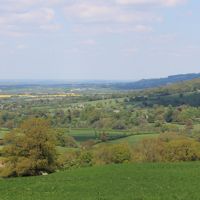
Step 3: Down to the road
Go through the gate and descend to the bottom, where the path turns left along the field boundary beside a wood; the right of way keeps to the edges of the field rather than cutting across. Through a gate, go down a sunken path through the woods to a gate onto the road, signposted Winchcombe Way. Turn right along the narrow road for about 500m, watching for traffic, ignoring a path on the left before the top of the rise, to a track on the left waymarked Winchcombe Way.
-
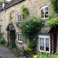
Step 4: The Winchcombe Way home
Turn left down the gravel track past some cottages and bear left down the slope, following the Winchcombe Way signs and ignoring the path to the right just after the cottages. Keep down the track, passing to the right of Wadfield Farm, and along the narrow path between hedges to a stile into a field. Cross the field diagonally to a stile on your right in the hedge, and turn left along the edge of the next field for 100m into another field. Cross it diagonally to a footbridge, the second field diagonally to a gate, and the third field to a lane. Turn left along the Old Brockhampton Road to the entrance to Sudeley Castle, keep left down Vineyard Street over the bridge and up to Abbey Terrace, then turn right and retrace your steps to the car park.
- Stiles
Sights on the way
The sights this walk passes, numbered as on the map.
-
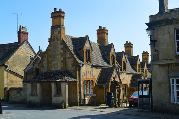
Dent's Terrace, Winchcombe
Sight · Historic building · Winchcombe
A row of ten almshouses of 1865 on Abbey Terrace, Winchcombe, by Sir George Gilbert Scott and J Drayton Wyatt for John and Emma Dent of Sudeley Castle: cream, yellow and pink stone under stepped gables. Grade II.
-
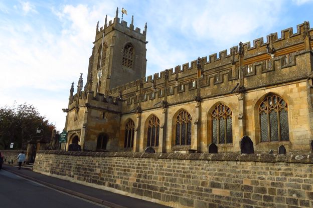
St Peter's Church, Winchcombe
Sight · Church · Winchcombe
St Peter's is Winchcombe's Grade I parish church, built in one campaign in about 1458 to 1468, with some 40 carved grotesques round its walls, a fan-vaulted tower and two stone coffins tied to the St Kenelm story. Usually open daily.
-

Vineyard Bridge, Winchcombe
Sight · Bridge · Winchcombe
Vineyard Bridge is the single stone arch of 1891 that carries Vineyard Street over the River Isbourne in Winchcombe, the last work in the town of the architect J. Drayton Wyatt and the way to Sudeley Castle. Listed Grade II.
-
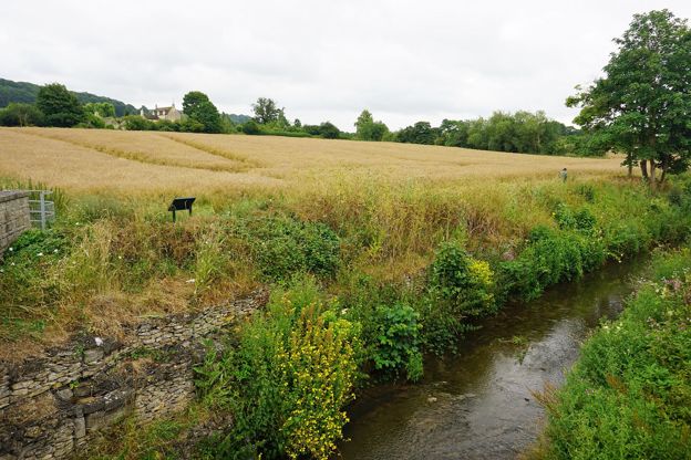
River Isbourne
Sight · River · Winchcombe
The River Isbourne rises at a spring on Cleeve Hill above Winchcombe and runs north past Postlip, Winchcombe, Toddington and Sedgeberrow to join the Avon at Evesham. A waymarked path of some 14 miles, the Isbourne Way, follows it.
The walk in detail
The Winchcombe and Belas Knap walk is a 5.5-mile (8.8km) circular walk from Back Lane car park in Winchcombe to Belas Knap, a Neolithic long barrow south of the town. It is moderate, with two stiles, and takes two to two and three quarter hours. The White Hart and the Lion Inn are in the town at the end.
It is one of the National Landscape's Cotswold Gateway walks. It goes up by the Cotswold Way and a lane through the woods and comes back on the Winchcombe Way by Wadfield Farm and the edge of Sudeley. A variant from the junction of lanes follows the Cotswold Way straight up to the barrow, about half a mile shorter, with a short steep section through a wood.
Vineyard Street and the climb
The walk leaves the town down Vineyard Street and over the River Isbourne, then climbs steadily on the Cotswold Way and a wooded lane. The leaflet says the street was once known as Duck Street: a stump of the town's ducking stool was found when the ground was dug for a new bridge. Vineyard Bridge, at the bottom of the street, is listed Grade II: it was built in 1891, the last work in Winchcombe of the architect J. Drayton Wyatt, with the mason John Oakey, who worked for Emma Dent of Sudeley Castle.
Across the river the Cotswold Way crosses fields to Corndean Lane, then follows a drive uphill past the cricket pitch and climbs a field, with views back over Winchcombe. From the junction of lanes at the top, the leaflet points out the view over the Isbourne valley to the hills north-west of the town. The main route then climbs steadily through woods, where you may see deer, to Hill Barn Farm.
Belas Knap
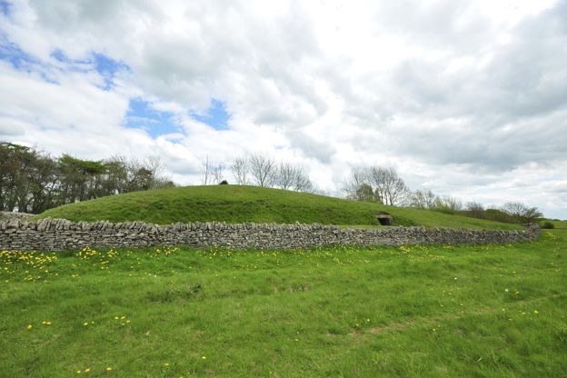
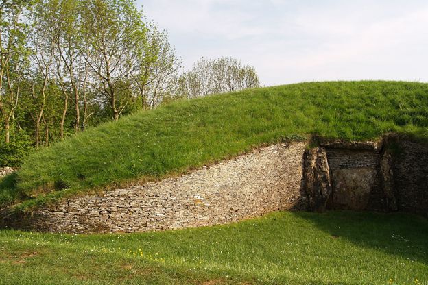
Belas Knap is a chambered long barrow just below the crest of a ridge, with burials dated to between 4000 and 3700 BC. The leaflet gives its mound as about 55m long, 20m across at its widest and three to four metres high, trapezoidal and lying north to south. English Heritage says it was excavated in 1863 and 1865, when the remains of 31 people were found; the leaflet adds a further excavation in 1928, and a restoration by the Ministry of Works between 1929 and 1931, which gave the barrow much of its present shape.
Under the lintel of the false entrance, the leaflet says, the diggers found the remains of five infants and an adult of a round-headed type not usually found in Gloucestershire burials before 2200 BC. When the bones were dated in 2000, all of them fell between 4000 and 3700 BC. There are historical notes on a board at the site. Belas Knap is free to visit and open in daylight all year, and English Heritage asks for dogs to be kept on leads because sheep graze around it.
Wadfield and Sudeley
The way home comes down through the woods and along the Winchcombe Way past Wadfield Farm to the gates of Sudeley Castle. The sunken path through the woods meets a narrow road, then the gravel track of the Winchcombe Way runs past cottages and the farm. Where the path meets the first field, the leaflet points out the view towards Sudeley Castle and St Mary's Church. The fields lead to the Old Brockhampton Road, which comes out at the entrance to Sudeley Castle at the top of Vineyard Street.
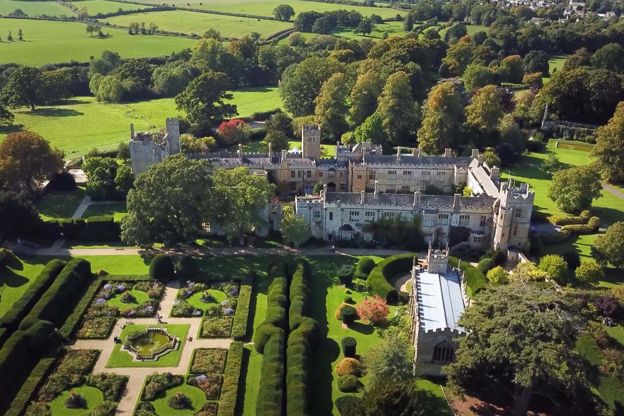
Katherine Parr, the last of Henry VIII's six wives, is buried in St Mary's chapel at Sudeley; she died there on 5 September 1548. The castle, built for Ralph Boteler in the fifteenth century and slighted on Parliament's orders in 1649, was bought by the Dents, Worcester glove makers, in 1837; the castle says it is still home to the Dent-Brocklehurst family. It is listed Grade I and charges for entry; our guide to Cotswold houses and castles has more.
Dent's Terrace
Dent's Terrace, on Abbey Terrace near the end of the walk, is a row of ten almshouses of 1865 built for the Dents of Sudeley. Sir George Gilbert Scott and J. Drayton Wyatt designed it in cream, yellow and pink limestone, with the date and the letter D in the porch gables. Its listing calls the row a good example of the generosity of John Coucher Dent and his wife Emma, then the owners of Sudeley, and records it as externally as built. It is listed Grade II.
The Cotswolds Info newsletter
Events, new places and the best of the season, about once a month. Unsubscribe at any time.
Food, parking and toilets
The places to eat are all in Winchcombe, at the start and finish; there is nothing on the hill. The White Hart Inn on the High Street has a restaurant and a bar open to non-residents, and the Lion Inn, a restored fifteenth-century coaching inn on North Street, welcomes dogs in the pub. Winchcombe Museum, free and run by volunteers in the former Town Hall on the High Street, shows fragments of the Winchcombe meteorite. To stay, the Sudeley Castle cottages are on the estate the walk skirts, and our places to stay in Winchcombe has more.
The walk starts at Back Lane car park, where Tewkesbury Borough Council charges £1.50 for the day (pay by RingGo; Blue Badge holders park free). The National Landscape’s route page for this walk puts the car park behind the library and lists public toilets there.
Paths, stiles, dogs and road
There are two stiles, both on the way home after Wadfield Farm, and a footbridge in the fields below. The route follows about 500m of narrow road between the sunken path and the Winchcombe Way track, so watch for traffic, and there are short stretches of lane on the way up. The leaflet asks you to keep to the edges of the field below Belas Knap, where the right of way runs, rather than cutting across. It says nothing about dogs, but sheep graze round the barrow, where English Heritage asks for leads.
More walks from Winchcombe
For a shorter walk, the 2-mile walk to Sudeley Castle goes through the castle grounds and back by the River Isbourne. For a longer day, the loop by Belas Knap and Cleeve Common goes on from the barrow to the open common. The walk from Hailes to Beckbury Camp starts about 3 miles away by road at Hayles Fruit Farm.
Places on the way
-
Belas Knap Long Barrow
Historic houses and heritage · Winchcombe
A Neolithic long barrow on the hill above Winchcombe, with a false entrance and side chambers, free to visit and on the Cotswold Way.
Walker-friendly
Verified Oct 2026
-
Sudeley Castle and Gardens
Historic houses and heritage · Winchcombe
A castle on the edge of Winchcombe where Katherine Parr, Henry VIII's last queen, is buried, with gardens, a Tudor history and the Dent family's home.
Family-friendly · Walker-friendly
Verified Nov 2026
-
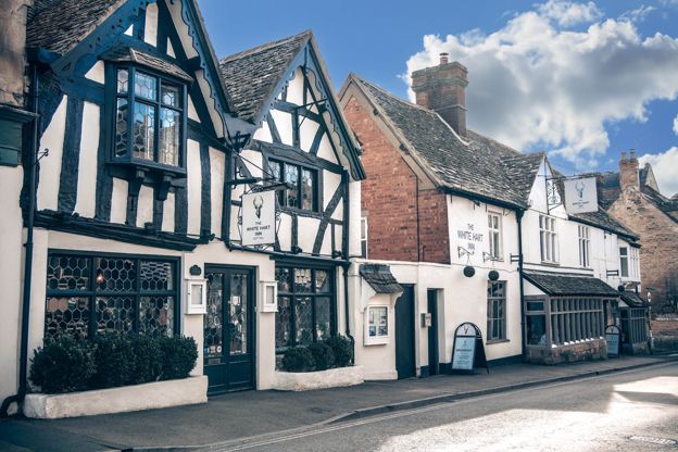
The White Hart Inn
Inn · Winchcombe
An inn with sixteen rooms on Winchcombe's High Street, with dog-friendly rooms and a restaurant and bar open all day to non-residents.
Dog-friendly · Wedding venues · Walker-friendly
Verified Nov 2026
-
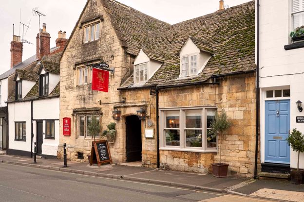
The Lion Inn
Inn · Winchcombe
A restored fifteenth-century coaching inn on North Street, Winchcombe, with nine rooms, run by Butcombe.
Dog-friendly · Walker-friendly
Verified Oct 2026
-
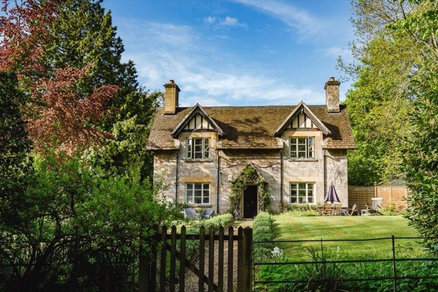
Sudeley Castle Cottages
Self-catering · Winchcombe
Nineteen holiday cottages on the Sudeley Castle estate at Winchcombe, sleeping three to fourteen, some dog-friendly, with free castle entry in season.
Dog-friendly
Verified Nov 2026
-
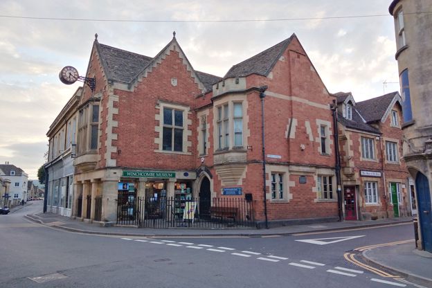
Winchcombe Museum
Museums and galleries · Winchcombe
A free, volunteer-led museum in Winchcombe's former Town Hall, with fragments of the Winchcombe meteorite, a rare pair of fifteenth-century town maces and the town's story from its trades and tanneries to the Arts and Crafts makers.
Rainy days · Car-free
Verified Oct 2026
Stay near the start
Inns, cottages and hotels within a short drive of where the walk begins, so you can set off early.
Where to stay in Winchcombe-
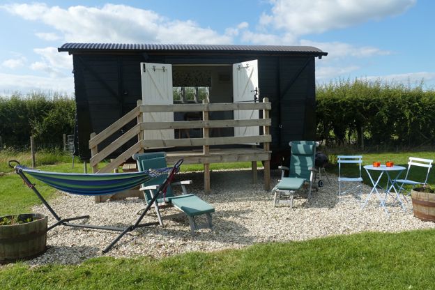
Elms Farm
B&B · Winchcombe
A converted freight wagon and five Caravan and Motorhome Club pitches on a working farm at Gretton, about two miles north-west of Winchcombe.
Verified Oct 2026
-
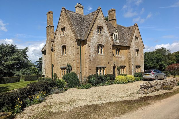
North Farmcote
B&B · Winchcombe
Bed and breakfast in a farmhouse above Winchcombe, built around 1840, its owners say, as a dower house for Lord Sudeley's mother.
Walker-friendly
Verified Oct 2026
-
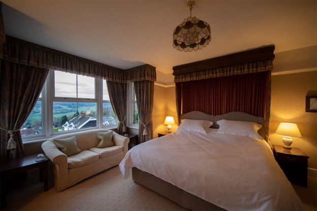
Cleeve Hill Hotel
B&B · Winchcombe
A 12-room bed and breakfast hotel on Cleeve Hill, about three miles south-west of Winchcombe, with views over the Severn Vale and a door onto Cleeve Common and the Cotswold Way.
Walker-friendly · Dog-friendly
Verified Oct 2026
More like this
Stories on this walk
-
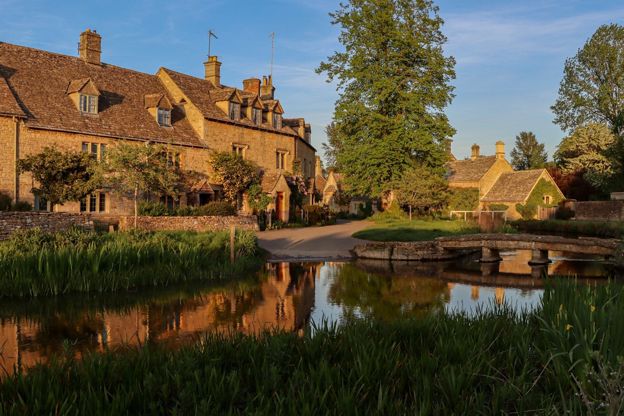
Cotswolds itineraries: one day to a week
Story · Guides · 12 minute read
Cotswolds itineraries from one day to a week: how many days you need, a day by car or by train, two days in the north, three days north to south, five days across two regions, a week with two bases or on the Cotswold Way, and themed weekends for gardens, walks, dogs and winter.
-
Free things to do in the Cotswolds
Story · Guides · 11 minute read
Free things to do in the Cotswolds: open commons and viewpoints, Neolithic tombs and hill forts, ruins, wool churches, free museums in Malmesbury, Stroud, Woodstock and Burford, the Cotswold Way and Blenheim's public footpaths.
-
The best pubs with rooms in the Cotswolds
Story · Guides · 13 minute read
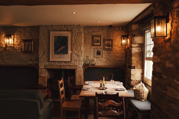
The best pubs with rooms in the Cotswolds, region by region: the Kingham Plough and the King’s Head at Bledington, the Lion at Winchcombe, the Falcon at Painswick and the Red Lion at Lacock, with the rooms, the food, the dog rules and the walk from the door.
More walks to try
-

The Cotswold Way
Walk · Dog-friendly
The Cotswold Way is a 102-mile (164km) National Trail walk from Chipping Campden to Bath along the escarpment, in 15 sections; the official guidebook suggests seven to ten days, and its frequent steep climbs make it hard going.
-
Winchcombe, Belas Knap and Cleeve Common
Walk · Starts in Winchcombe · 4 hrs, 15 mins · Circular · Dog-friendly
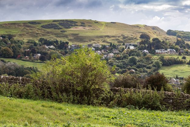
A 9.2-mile (14.8km) moderate loop of four to four and a half hours from Winchcombe: up the Cotswold Way through the Sudeley estate to Belas Knap, west along the byways to the top of Cleeve Common, then down by Postlip's Norman chapel and Breakheart Plantation.
-
Hailes and Beckbury Camp
Walk · Starts in Winchcombe · 2 hrs, 15 mins · Circular
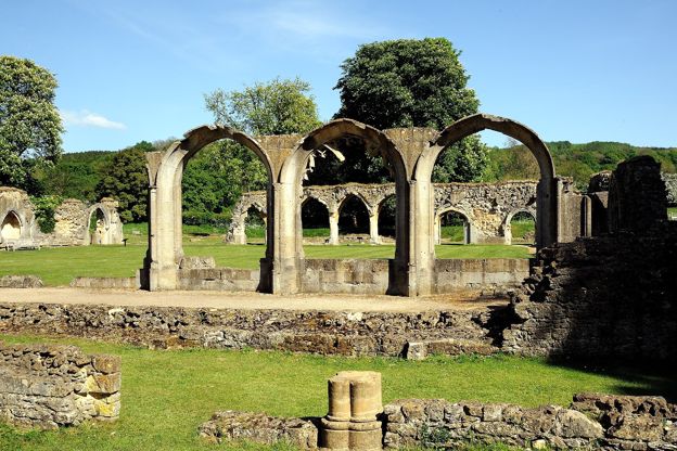
A 3.5-mile (5.6km) circular walk from Hayles Fruit Farm, moderate and about two and a quarter hours: up the monks' track to Beckbury Camp, down the edge of a wood over three stiles towards Wood Stanway, and back past Hailes church and the abbey ruins.