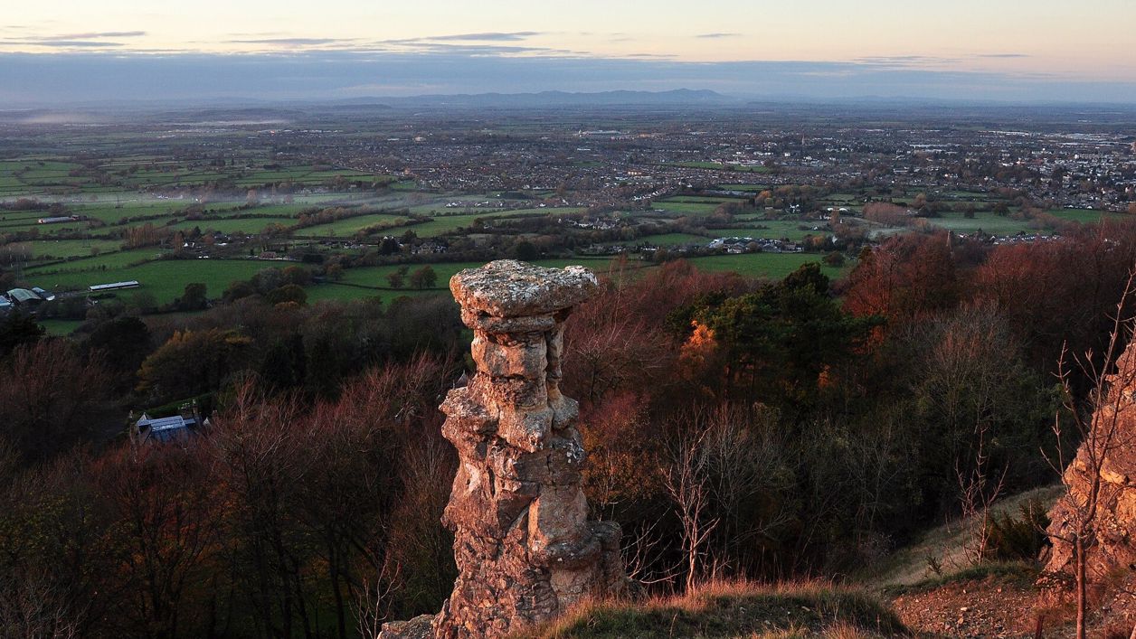
Nilfanion, CC BY-SA 3.0, via Wikimedia Commons
Leckhampton Hill and the Devil's Chimney
A 4-mile (6.3km) circular walk from the Daisy Bank Road car parks above Cheltenham, about two hours and moderate, with one steep climb: round Charlton Kings Common, up onto the escarpment past the hillfort to the Devil's Chimney, and down the old quarry incline.
- Distance
- 6.3 km (3.9 mi)
- Difficulty
- Moderate
- Time
- 2 hrs
- Ascent
- 199 m
- Circular
- Circular
The route
Starts at Daisy Bank car park, Daisy Bank Road, Leckhampton follows the Cotswold Way for a while Steep sectionMuddy in winterLivestock in fields Download GPX
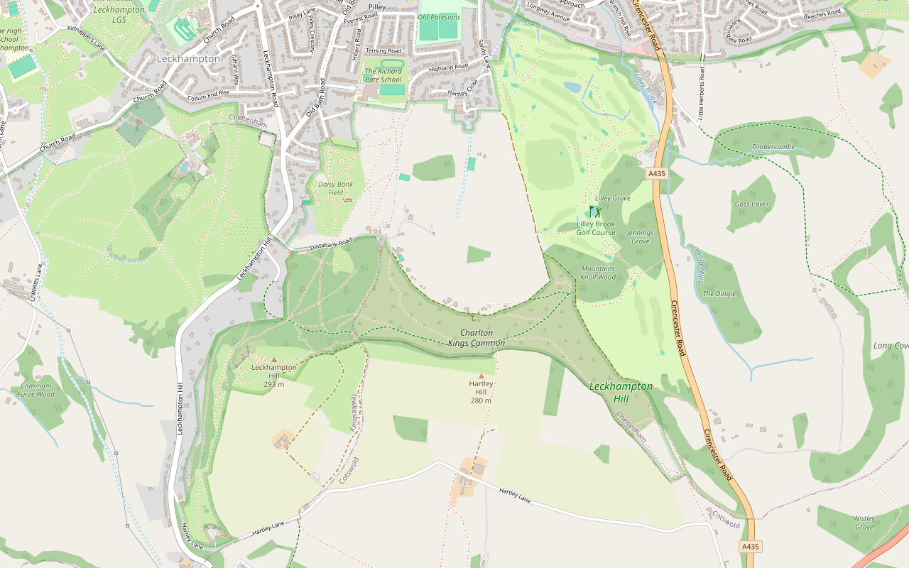
Step by step
-
Step 1: Down the incline to Southfield
From Daisy Bank car park, pass the Bridge car park and follow the Standard Gauge Incline path north, then the footpath east past Southfield Manor.
-
Step 2: Round the foot of the common
Follow the track east along the foot of Charlton Kings Common for about half a mile. AllTrails notes that parts of the walk get muddy after rain.
- Muddy in winter
-
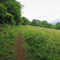
Step 3: Up onto the escarpment
Turn south and climb the footpaths up through the common to the top of the escarpment. The climb is steep in places.
- Steep section
- Dogs on lead
-
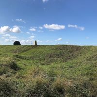
Step 4: Along the top to the hillfort
Follow the bridleway and paths west along the top of the hill, on the Cotswold Way, to the trig point on the rampart of the Iron Age hillfort.
-
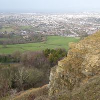
Step 5: The Devil's Chimney and back down
Carry on west to the scarp edge above the Devil's Chimney and Dead Man's Quarry, then follow the path back east to the old limekilns and down the Standard Gauge Incline to Daisy Bank Road. Walkers reported this descent slippery and tricky in the wet in September and October 2026.
- Steep section
- Muddy in winter
Sights on the way
The sights this walk passes, numbered as on the map.
-
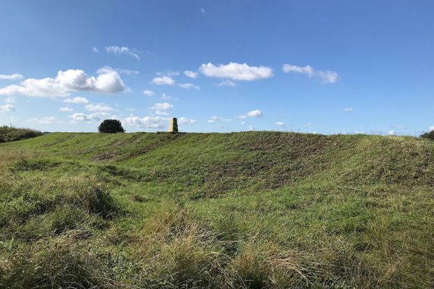
Leckhampton Camp
Sight · Hill fort or barrow · The Cotswold Edge
Leckhampton Camp is the Iron Age hillfort on the summit of Leckhampton Hill above Cheltenham: one rampart and a rock-cut ditch, an inturned entrance with two guard chambers and, to the east, a rare round barrow inside a square enclosure. Scheduled; the trig point is on its bank.
-
Leckhampton Hill and Charlton Kings Common
Sight · Nature reserve · The Cotswold Edge
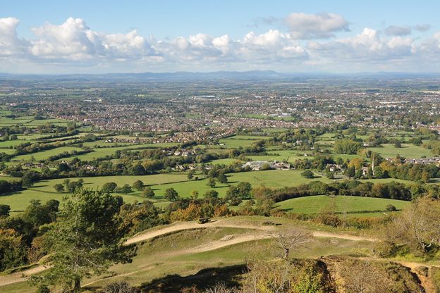
Leckhampton Hill and Charlton Kings Common: 60 hectares of old quarries, limestone grassland on the Cotswold Edge above Cheltenham, with an Iron Age hillfort and the Devil's Chimney. Opened to the public in 1929 after the riots of 1902; a National Nature Reserve from 2026.
-
The Devil's Chimney, Leckhampton
Sight · Monument · The Cotswold Edge
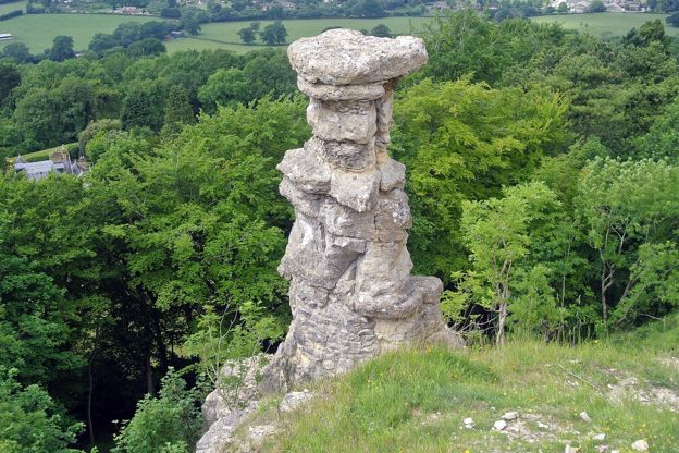
The Devil's Chimney is a pillar of limestone standing below the scarp edge of Leckhampton Hill above Cheltenham, most likely left isolated when quarrymen cut an incline to the top and shaped by the weather since. Folklore says the Devil built it. Climbing it is forbidden.
The walk in detail
The Leckhampton Hill and Devil's Chimney walk is a 4-mile (6.3km) circular walk from Daisy Bank Road above Cheltenham, on the scarp of the Cotswold Edge. It climbs about 199m and takes about two hours, with one long climb and a steep descent on the old quarry incline, past an Iron Age hillfort, the Devil's Chimney and views over Cheltenham.
A hill made by quarrying
Most of the rock faces you see are quarry faces. The Friends of Leckhampton Hill, a local group formed in 2000, say the Romans took stone from here, and that the last recorded quarrying ran for about 150 years, from the late eighteenth century to the mid 1920s. Around 1875 the quarries produced about 8,000 tons a year, and around 1915 about 50 men worked on the hill. The best stone was carved for interiors, some of it in Cheltenham College chapel, but most went for road stone, gravel and lime.
Tramroads, railways and inclines carried the stone down the hill, and many of today's tracks follow them: the main way up from Daisy Bank Road is the Standard Gauge Incline, built for a redevelopment in the 1920s. Part way up, four large limekilns were built in the early 1920s with a government loan meant to ease unemployment after the First World War. The venture failed and closed by 1927; the stonework of the kiln bases survives beside the path.
The Devil's Chimney, the pillar of rock below the scarp edge, is part of the same story. The likeliest explanation, the Friends say, is that cutting an incline to the top left a piece of rock isolated, which then weathered, perhaps with a hand from the quarrymen.
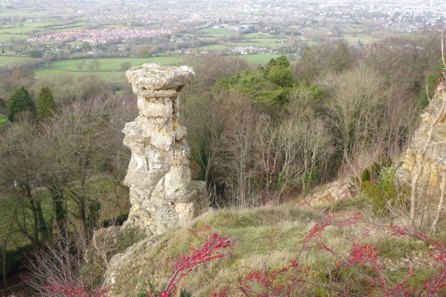
Hillfort, rocks and flowers
On top, Leckhampton Camp is an Iron Age hillfort with a single rampart on its south and east sides; the trig point stands on the east rampart. Nearby is a round barrow inside a square enclosure. Both are scheduled monuments. The quarries expose a section of Jurassic limestone about 70m thick, laid down in a shallow sea 170 to 175 million years ago, which is why the hill is a Site of Special Scientific Interest; our page on where the Cotswolds are notes it shows some of the thickest Jurassic rock in the country.
The limestone grassland grows common rock-rose, wild thyme, autumn gentian and orchids, and 33 species of butterfly have been recorded, including the Duke of Burgundy. Glow-worms light up some summer nights. The hill and common, 67 hectares in all, are now a National Nature Reserve.

The Cotswolds Info newsletter
Events, new places and the best of the season, about once a month. Unsubscribe at any time.
Open to all, by a fight
Cheltenham Town Council, now the borough council, bought the hill in 1927, and it opened to the public in 1929; Charlton Kings Common passed to the borough council in 1965. Most of it is registered common land, and walkers may roam the whole area as well as the public paths and the Cotswold Way. That right was fought for: after the owner, Henry Dale, fenced part of the hill in 1899, crowds tore down the fences in 1902 and razed the quarry foreman's cottage, and in 1906 the Riot Act was read and eight of the crowd were jailed.
What walkers report
Walkers on AllTrails reported the descent slippery and tricky when wet, even in proper boots, in September and October 2026, and AllTrails notes that parts of the walk get muddy after rain. The hill is shared with mountain bikers; the council gives cyclists permissive access to most areas, and the steep downhill trails are in the woods above Daisy Bank Road. Belted Galloway cattle graze the common in autumn and winter, wearing Nofence GPS collars that keep them to set areas; notices on site have a QR code showing where they are.
Parking, dogs and food
Park free at the Daisy Bank or Bridge car park on Daisy Bank Road, walkers report, where the walk starts. There are two more car parks higher up off Hartley Lane, at Salterley Quarry and Brownstones Quarry, and Cheltenham Spa station and the 444 coach from London, in our guide to the Cotswolds without a car, put the hill within reach without one.
Dogs are welcome on the hill, but the Friends of Leckhampton Hill ask for them to be on a short lead, not a long or extending one, near the Belted Galloway cattle that graze the common in autumn and winter; our guide tothe Cotswolds with a dog has more on livestock. None of the walk's sources names a pub or café on the route, so bring water and something to eat, and look for food in Cheltenham below. The nearest places to eat are the Wheatsheaf on Old Bath Road in Leckhampton, below the hill, and StarBistro at National Star in Ullenwood, open on weekdays.
More walks on the escarpment
The Cotswold Way runs along this scarp, so longer walks join up easily. Seven Springs and Leckhampton Hill reaches the hill along the Cotswold Way, which since July 2026 also carries a diversion around the A417 works near Birdlip. The National Landscape's mobility-scooter route on Leckhampton Hill is in our guide to the accessible Cotswolds. Further along the escarpment, Cleeve Common and Cleeve Cloud climbs to the highest ground in the Cotswolds, and Painswick Beacon has Iron Age ramparts of its own.
Places on the way
-
The Wheatsheaf, Leckhampton
Pubs · The Cotswold Edge
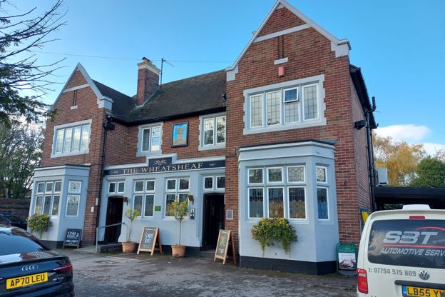
A family-run Wadworth pub on Old Bath Road in Leckhampton, below Leckhampton Hill, which Wadworth lists with a large garden, a heated patio, Sunday roasts and jazz and blues nights.
Dog-friendly · Family-friendly
Verified Nov 2026
-

StarBistro
Cafes and tearooms · The Cotswold Edge
The restaurant at National Star college in Ullenwood, above Cheltenham, where students with disabilities serve breakfast, lunch and afternoon tea on weekdays, on the line of the Cotswold Way's 2026 diversion.
Walker-friendly · Family-friendly
Verified Oct 2026
-
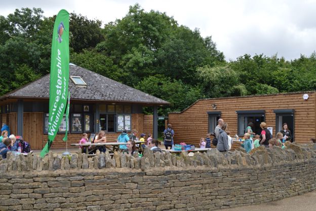
Crickley Hill café
Cafes and tearooms · The Cotswold Edge
Gloucestershire Wildlife Trust's café by the top car park at Crickley Hill Country Park, near Birdlip, on the Cotswold Way: breakfast, lunch and cakes, dogs welcome.
Dog-friendly · Walker-friendly · Family-friendly
Verified Nov 2026
Stay near the start
Inns, cottages and hotels within a short drive of where the walk begins, so you can set off early.
Where to stay in the Cotswold Edge-
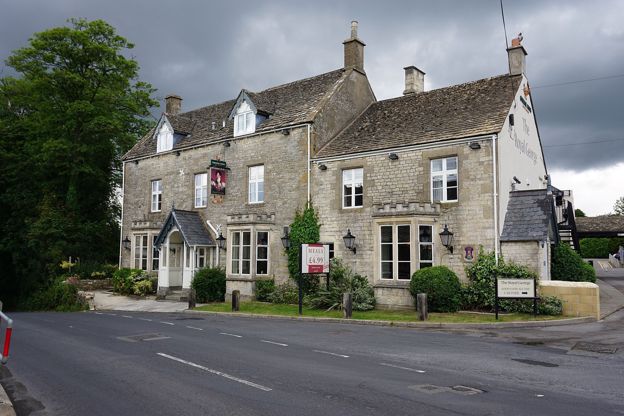
The Royal George Hotel
Pubs · The Cotswold Edge
An eighteenth-century inn in Birdlip, run by Greene King Inns, with a bar and restaurant of pub classics, a large beer garden and 34 bedrooms, where the Cotswold Way sections from Leckhampton Hill and to Painswick meet.
Dog-friendly · Walker-friendly · Family-friendly
Verified Oct 2026
More like this
Stories on this walk
-
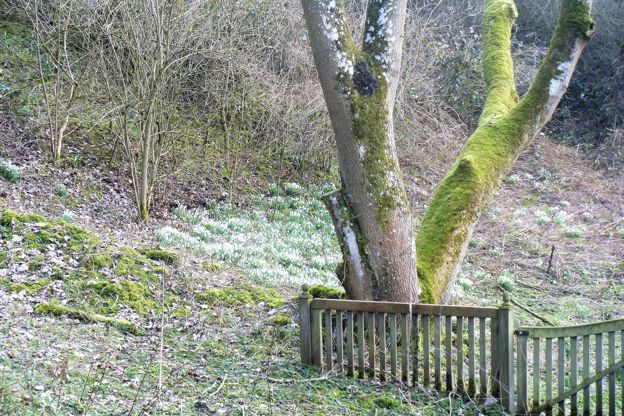
The Cotswolds in February
Story · Guides · 8 minute read
The Cotswolds in February: snowdrop month, with Colesbourne's weekends, Painswick's booked valley and Batsford, the Stroud Wassail, the first lambs, half term's one busy week, what is open, and three walks for the mud.
-
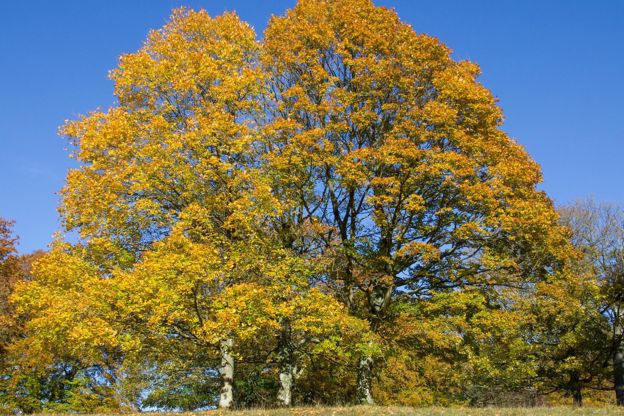
The Cotswolds in November
Story · Guides · 8 minute read
The Cotswolds in November: the wettest month and one of the quietest, the last of the beech colour, the November Meeting at Cheltenham, the light trails and late-night shopping that start Christmas, what stays open in winter, firm walks for wet weather and inns with fires.
-
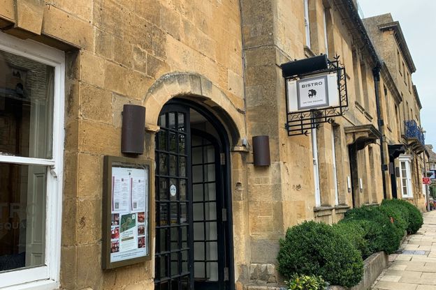
Why Cotswold stone is golden
Story · History · 9 minute read
The Jurassic limestone that built the Cotswolds, the iron that colours it honey in the north and grey in the south, the quarries at Taynton, Barrington, Guiting and Painswick, the stone slate roofs and the dry-stone walls, and where to see each.
More walks to try
-
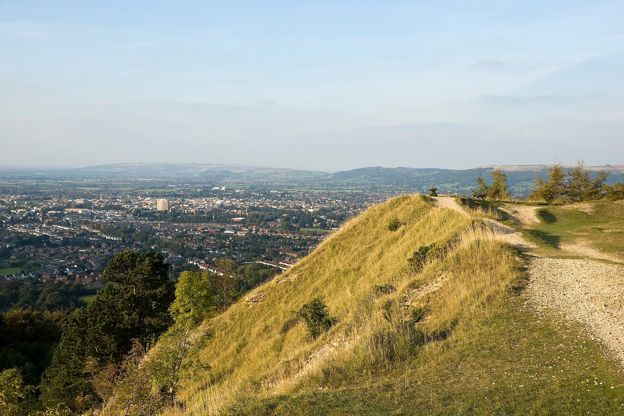
Seven Springs and Leckhampton Hill
Walk · Starts in the Cotswold Edge · 2 hrs, 30 mins · Circular · Dog-friendly
A 5.4-mile (8.7km) circular walk from Seven Springs, about two and a half hours and moderate, with steep slopes: along the Cotswold Way over Charlton Kings Common to the hillfort on Leckhampton Hill and the Devil's Chimney, and back along the foot of the common.
-

The Cotswold Way
Walk · Dog-friendly
The Cotswold Way is a 102-mile (164km) National Trail walk from Chipping Campden to Bath along the escarpment, in 15 sections; the official guidebook suggests seven to ten days, and its frequent steep climbs make it hard going.
-
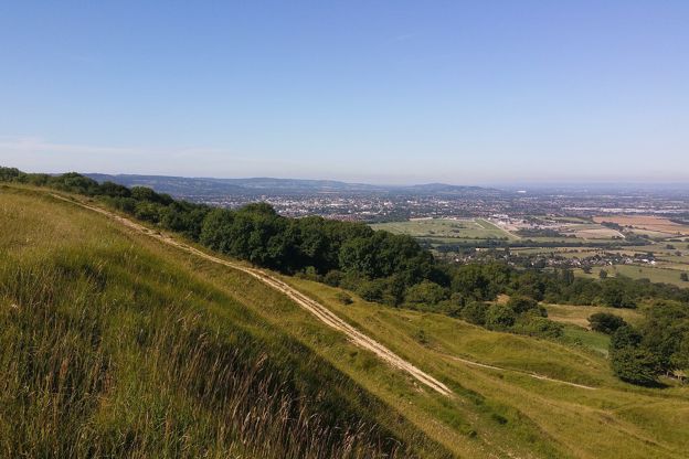
Cleeve Common and Cleeve Cloud
Walk · Starts in the Cotswold Edge · 1 hr, 45 mins · Circular · Dog-friendly
A 4-mile (6.4km) moderate loop of about an hour and three quarters on the highest ground in the Cotswolds: from the main road at Cleeve Hill past the golf club, across Cleeve Common, back along the scarp by the hill fort and Cleeve Cloud, and down through Thrift Wood.