Why Cotswold stone is golden
Every Cotswold village is built of the hill it stands on, which is why no two are quite the same colour. Here is where the stone came from, what turns it gold, and the places to see the quarries, the roofs and the walls.
· 9 minute read
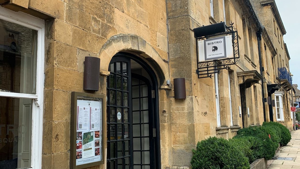
Cotswold stone is golden because of iron. It is a limestone laid down on the floor of a warm, shallow sea in the Jurassic period, and the more iron oxide it carries, the warmer it weathers: honey and gold around Chipping Campden and Stanway in the north, cream and silver-grey around Painswick and Minchinhampton in the south-west. Each village was built from the quarries on its own hill, so each has a slightly different tone, and the same stone gave the region its roofs and the walls round its fields. Our guide about the Cotswolds gives the short answer. This is the longer story, and where to see it.
A sea floor of tiny eggs
The rock is oolitic limestone, from the Greek for egg stone, because it is made of countless rounded grains like fish roe. The British Geological Survey describes them as grains of calcium carbonate that formed in warm tropical seas, and says these limestones cap the Cotswold Hills, reaching 150m thick in places with the mudstones between them.
The Cotswolds National Landscape Board's account of the landscape divides the rocks into three. At the bottom are the clays and shales of the Lias, which slump into the soft ground at the foot of the escarpment. Above them comes the Inferior Oolite, which forms the edge of the hills in the north, and on top the Great Oolite, which makes up most of the long dip slope running down towards Oxford. Between the two limestones lies a thin band of clay called fuller's earth, which the cloth makers used to clean and felt their wool.
The band of oolite runs right across England from Lyme Bay in Dorset to the North Sea coast, and the Cotswolds are one of its best-known stretches. The Board says the thickest sections of Jurassic rock in the country are at Leckhampton Hill and Cleeve Common, and both are Sites of Special Scientific Interest.
Why the north is honey and the south grey
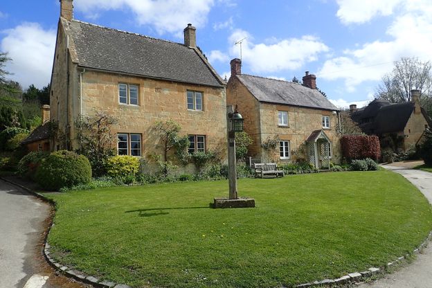
The colour depends on how much iron oxide the stone holds, and the Board describes the range as running 'from silvery and creamy white, through subtleties of grey, to a golden ochre'. The Inferior Oolite of the high wold weathers to gold and grey, mottled with white and yellow lichens, and its best building stone, Yellow Guiting stone, weathers to a rich gold. It is still quarried at Coscombe above Stanway, at Bourton Hill and at Westington, and Stanway's church, manor and tithe barn are built of the same golden stone.
The Great Oolite is cream when it is cut and weathers through buff to brown, but differently from place to place. In Painswick, the Board notes, buildings have a silvery quality, and in Minchinhampton the stone has a cold grey character. Bath, at the far southern end, is the exception that proves the rule is local: its Great Oolite freestone has matured to a warm honey colour.
East of the Evenlode the iron shows most strongly. There the Marlstone Rock, often called ironstone, has been mined for iron ore, and the Board says it gives buildings a warm brown colour varied by dark olive and purple stones. These are its Ironstone villages, and they contrast strongly with the limestone villages to the south and west.
The quarries that built Oxford and London
The finest stone came from the Windrush valley near Burford, and it travelled. The Board records that Oxford University was quarrying Great Oolite near Burford from 1260, and that the quarries at Taynton supplied the tower of Merton chapel about 1310, Blenheim Palace between 1705 and 1722 and the Bodleian Library's extension in 1939. St Lawrence's at Lechlade was rebuilt in Taynton stone in the 1470s, and the parish says the same freestone was shipped from Lechlade down the Thames for St Paul's Cathedral.
A few miles upstream, the Barringtons sent stone to New College, Oxford, in 1396 and 1397, to St George's Chapel at Windsor and the Divinity School in the fifteenth century, to Hampton Court and Christ Church in the sixteenth and the Sheldonian Theatre in the seventeenth, as the Victoria County History lists them. The masons who ran the trade were the Strongs. Timothy Strong moved to Little Barrington early in the seventeenth century, his son Valentine worked there from 1632 until his death in 1662, and Thomas Strong took stone from his pits there for the rebuilding of London after the Great Fire of 1666. The Windrush carried it away. In the nineteenth century the stone was mined underground, and the last quarries had closed by 1961.
Burford had its own master mason in Christopher Kempster, who worked for Wren at St Paul's and died in 1715. His memorial is in St John the Baptist. The road between the two Barringtons crosses the river by Strong's Causeway, which tradition, as the county history records it, credits to Thomas Strong at the end of the seventeenth century.
Guiting, Painswick and Leckhampton
Every part of the hills had its quarries, and the county history and the Board between them name the big ones. At Painswick, Catsbrain Quarry on the hill was recorded from the fifteenth century and worked by Burdock and Sons until 1950, then closed in 1968; the county history credits the Bryan family of masons, Joseph, who died in 1730, and his sons, with the quality of the town's stonework, notably its churchyard monuments. Catsbrain and other old workings still scar the slopes of Painswick Beacon, and our walk over the Beacon climbs the hill.
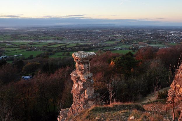
Leckhampton Hill above Cheltenham supplied the Lower Freestone that built much of the town, including the Royal Crescent and the Montpellier Rotunda. The Friends of Leckhampton Hill date the last recorded quarrying there from the late eighteenth century to the mid 1920s, and the quarrymen left the Devil's Chimney, a pillar of rock that the Board thinks the quarrymen left standing as a kind of monument. Our Leckhampton Hill walk goes past it.
Stone slates and how they were split
Cotswold roofs are limestone too. Stone slates come from thin, fissile beds near the base of the Great Oolite, and the Board describes how they were made: the stone was dug in autumn and spread on the ground so that the winter frost would get into the thin films of water inside it, and in spring a tap of a mallet split it into slates. At Stonesfield, near Woodstock, almost the whole village helped spread the stone. Naunton had slate quarries in the nineteenth century too, and the Chipping Campden History Society names Naunton and Whittington as places the tile-stone was dug in quantity.
The society explains the shape of a Cotswold roof. The slates are graded, the biggest at the eaves and the smallest at the ridge, because water gathers at the bottom, the big slates throw it clear of the walls and the light ones keep the weight off the middle of the span. A single slate can weigh up to 20kg. The pitch is steep, about 50 to 55 degrees, to shed rain and stop snow blowing in, and the slaters gave the sizes local names like short pricks and long bachelors. Most cottages were thatched until stone slates became common from the seventeenth century, and the Board notes that late Victorian demand was so strong that old slates were stripped from barns and cottages to reuse.

The Cotswolds Info newsletter
Events, new places and the best of the season, about once a month. Unsubscribe at any time.
Dry-stone walls and the wallers
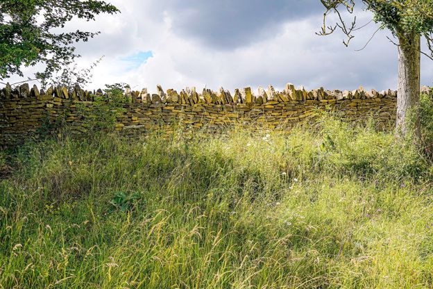
The fields are walled with the same stone. The Board counts at least 4,000 miles (6,400km) of dry-stone wall in the Cotswolds, built without mortar from thin beds of oolite, and most of what you see dates from the eighteenth and nineteenth centuries, when the open fields and downs were enclosed for livestock.
A Cotswold wall tapers, its width under the top half that of its base. Long through stones bind the two faces together, small stones called hearting fill the middle, and each stone is set with its long edge into the wall and tilted slightly so that water runs out rather than freezing inside. The top is usually finished with cock and hen coping, thin stones set on edge across the wall. The Board's leaflet points out bee boles, stiles and holes for sheep built into the walls, and the mosses, lichens, snails and nesting birds that live in them.
In the second half of the twentieth century many walls fell out of use as livestock numbers fell and fields went over to crops, and fewer people had the skills to mend them. The Dry Stone Walling Association (opens in a new tab), a charity, runs beginner courses through its local branches, four-day courses and a Craft Certification Scheme. The easiest wall to admire is the restored one beside the Cotswold Way below Broadway Tower, which our walk from Broadway follows for a mile on the way down.
How the stone shaped the buildings
The Board dates the first flowering of the Cotswold style to the century after the Dissolution of the Monasteries, when merchants and clothiers bought abbey lands and built manor houses, often from the stones of the abbeys themselves. The style held so firmly that cottages built by improving landlords in the late eighteenth and early nineteenth centuries, of local stone by local men, are often hard to tell from ones two centuries older.
The stone also explains the oddities. At Filkins, near Lechlade, gardens are fenced with waist-high slabs of Forest Marble set on end like gravestones, an unusual local habit. In the Stroud valleys some nineteenth-century mill terraces were built of brick and slate brought in by the new canals and railways, and they look it.
Where to see it
For gold, go north: Stanway and Stanton below the escarpment, and Chipping Campden's High Street, whose Market Hall of 1627 is roofed in stone slates. For the quarries that built Oxford, drive the Windrush from Burford through the Barringtons. For silver and grey, go to Painswick, then south to Minchinhampton, where the Market House of 1698 stands on stone pillars. Leckhampton Hill shows the rock itself in its old quarry faces.
Mentioned in this story
The places, sights and walks in this story, each with a page of its own: what it is, when to go and how to get there.
-

Broadway Tower
Historic houses and heritage · Broadway
-
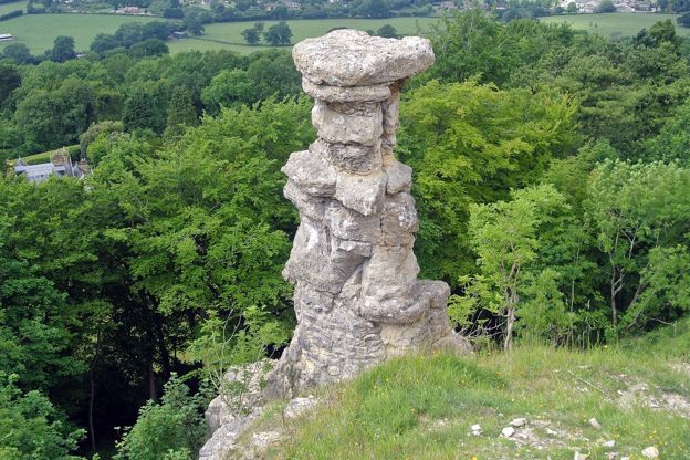
The Devil's Chimney, Leckhampton
Sight · Monument · The Cotswold Edge
-
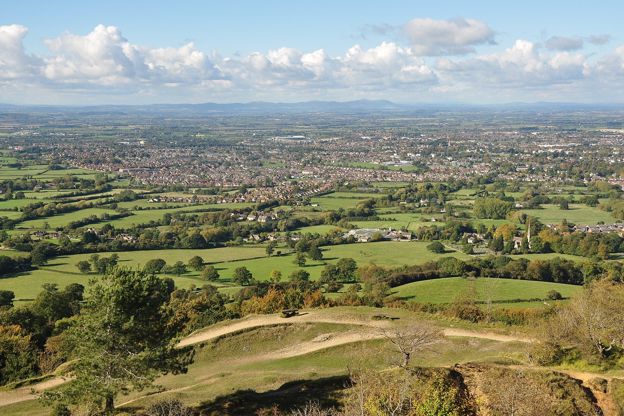
Leckhampton Hill and Charlton Kings Common
Sight · Nature reserve · The Cotswold Edge
-
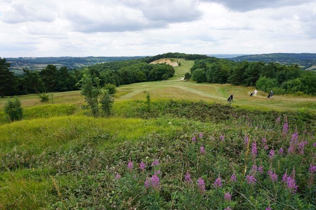
Painswick Beacon
Sight · Hill fort or barrow · Painswick
-
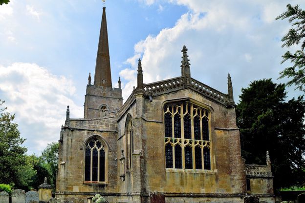
St Lawrence's Church, Lechlade
Sight · Church · Lechlade-on-Thames
-
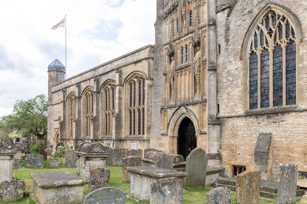
St John the Baptist, Burford
Sight · Church · Burford
-
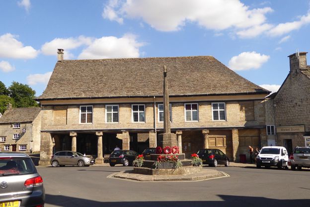
Market House, Minchinhampton
Sight · Historic building · Minchinhampton
-
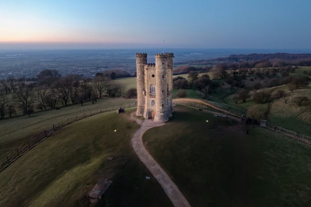
Broadway and Broadway Tower
Walk · Starts in Broadway · 3 hrs · Circular
Places to stay near the Barringtons and Windrush
-
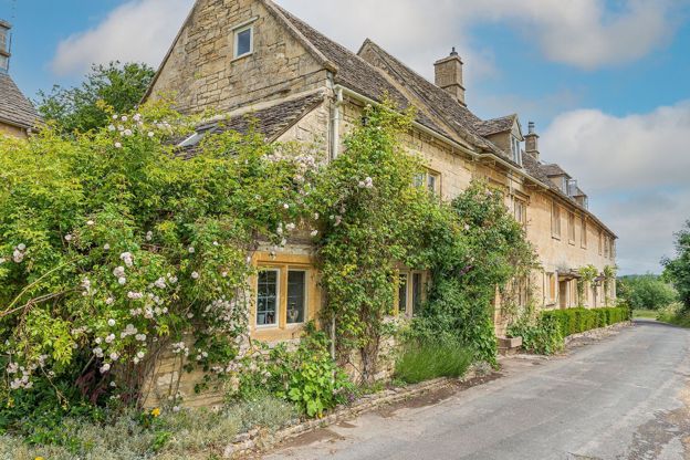
Greenview Cottage
Self-catering · The Barringtons and Windrush
An eighteenth-century stone cottage on the green at Little Barrington, let for up to seven in four bedrooms, with an inglenook and wood burner and one dog welcome.
Dog-friendly · Family-friendly · Walker-friendly
Verified Oct 2026
-
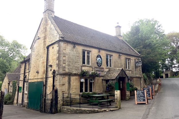
The Fox Inn, Great Barrington
Pubs · The Barringtons and Windrush
An eighteenth-century Donnington Brewery inn beside the River Windrush at Great Barrington, near Burford, with a riverside restaurant and garden, a log burner, seasonal food all day at weekends and seven bedrooms.
Verified Oct 2026
-
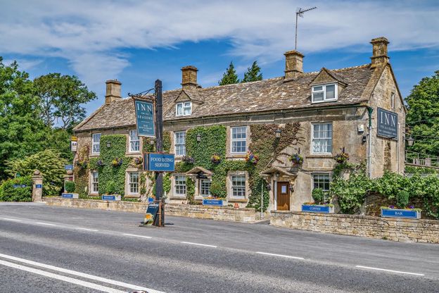
The Inn for All Seasons
Inn · Burford
A country inn at the Barringtons, about three miles west of Burford, begun in the 1500s and a coaching inn from the 1700s, with twelve rooms and dogs welcome.
Dog-friendly
Verified Nov 2026
Read next
-
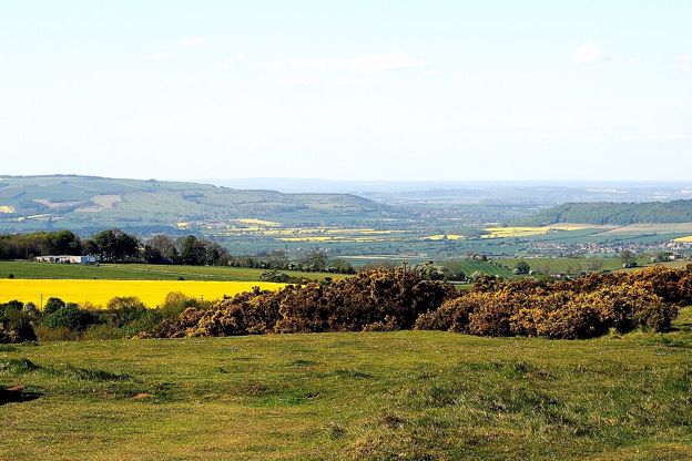
Where are the Cotswolds?
Story · Guides · 11 minute read
The Cotswolds are a range of limestone hills in south-central England, a National Landscape of 787 square miles across six counties, most of it in Gloucestershire. Here is where they are, what the boundary includes, and what makes the stone golden.
-
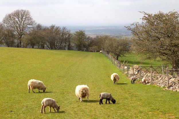
The Cotswold wool trade
Story · History · 9 minute read
How the Cotswold sheep made the hills rich: the medieval export of raw wool through the Staple at Calais, the woolmen of Campden, Northleach and Fairford, the cloth mills of the Stroud valleys, the decline, and where to see it all today.
-
The wool churches of the Cotswolds
Story · Guides · 11 minute read
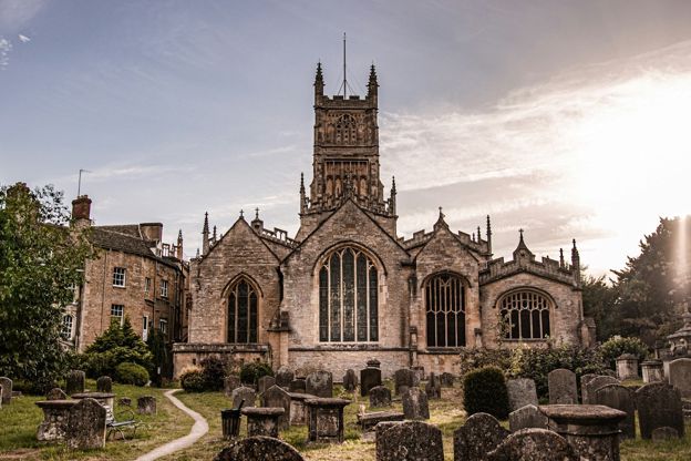
Northleach, Chipping Campden, Cirencester, Fairford, Burford and the other Cotswold churches rebuilt on medieval wool money: how the trade paid for them, what to look for in each, when they open and a route by car or on foot.