Tim Heaton, CC BY-SA 2.0, via Wikimedia Commons
Wotton, the Tyndale Monument and Coombe Hill
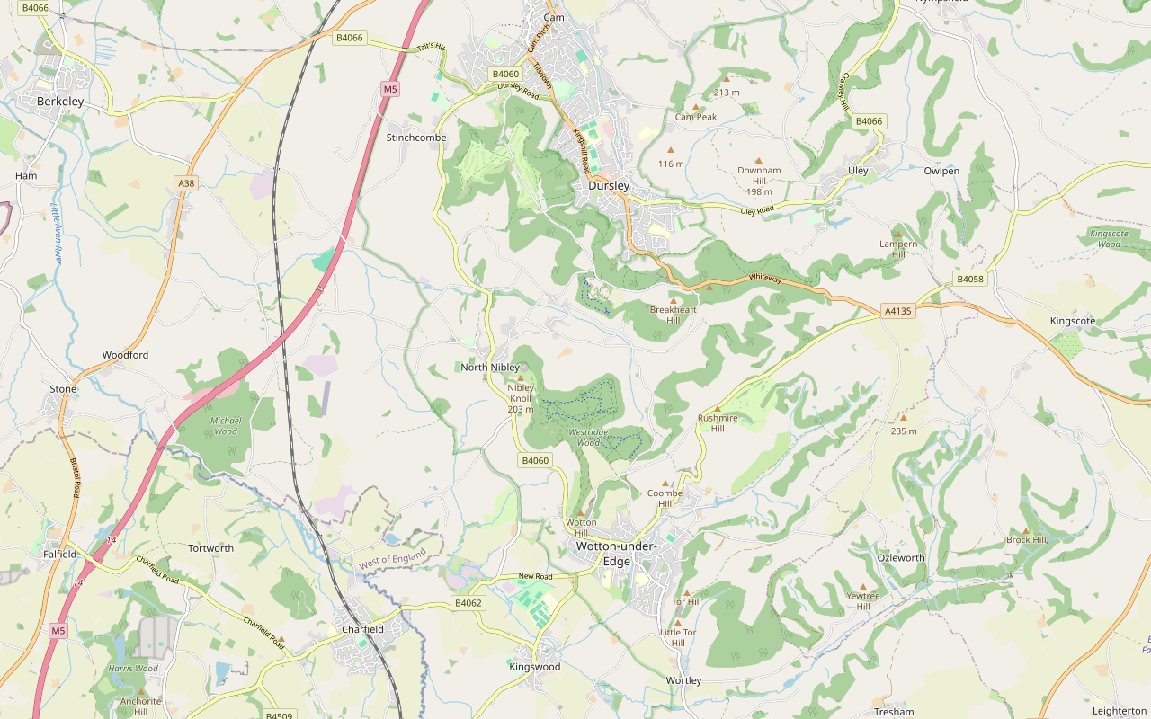
An 8.5-mile (13.5km) moderate loop of four to four and a half hours from Wotton-under-Edge, with three big climbs: to the Tyndale Monument, down to North Nibley, north towards Stinchcombe Hill, round by Hermitage Wood and Waterley Bottom, and back over Coombe Hill.
- Distance
- 13.5 km (8.4 mi)
- Difficulty
- Moderate
- Time
- 4 hrs, 15 mins
- Ascent
- 409 m
- Circular
- Circular
The route
Starts at Gloucester Street, Wotton-under-Edge, by the Civic Centre follows the Cotswold Way for a while Steep sectionMuddy in winterRoad walkingLivestock in fieldsDogs on lead near sheep Download GPX
Step by step
-
Step 1: Wotton to Westridge Wood
From Gloucester Street walk up Tabernacle Pitch and Tabernacle Road, then follow the restricted byway CWE 12 to Old London Road. Take footpath CWE 94 and then bridleway CWE 95, a broad track north into Westridge Wood.
-
Step 2: Brackenbury Ditches and the monument
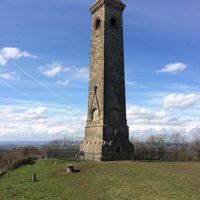
Bear left onto bridleway CNN 30, then follow footpaths CNN 66 and CNN 34 west past Brackenbury Ditches. Rejoin CNN 30 and take footpaths CNN 63 and CNN 64 across the grass of Nibley Knoll to the Tyndale Monument.
-
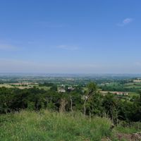
Step 3: Down to North Nibley and north
Drop down Wood Lane, a steep bridleway, to the road at North Nibley, and follow The Street past the Black Horse. Turn up Lower House Lane, a restricted byway, then take footpaths CNN 4, CST 49 and CST 48 north across the fields and up the bridleways through the woods to The Broadway below Stinchcombe Hill.
-
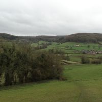
Step 4: Hermitage Wood and Waterley Bottom
Follow the bridleway east along the edge, past Hermitage Wood, then the paths south through Millend Wood. Footpath CNN 10 brings you down to the lane at Waterley Bottom by the New Inn, closed for now. Follow the quiet lanes south for about a mile.
-
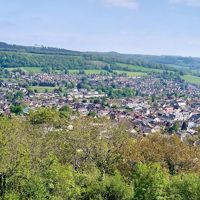
Step 5: Over Coombe Hill
Take Sheep Path Lane, a restricted byway, and bridleway CWE 31 up onto Coombe Hill, then the grassy permissive path over the top. Footpaths CWE 15, 91 and 13 lead down across Adey's Lane to Tabernacle Pitch and back into Gloucester Street.
Sights on the way
The sights this walk passes, numbered as on the map.
-
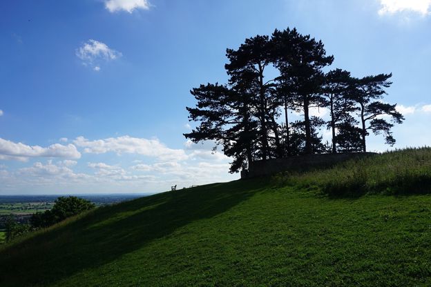
Jubilee Clump, Wotton Hill
Sight · Viewpoint · Wotton-under-Edge
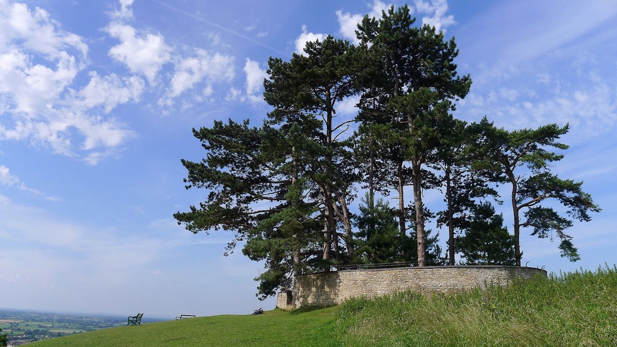
Jubilee Clump is the walled ring of trees on Wotton Hill above Wotton-under-Edge, replanted in 1888 for Queen Victoria's Golden Jubilee on a spot said to have been first planted after Waterloo: a landmark and viewpoint on the Cotswold Way. Free.
-
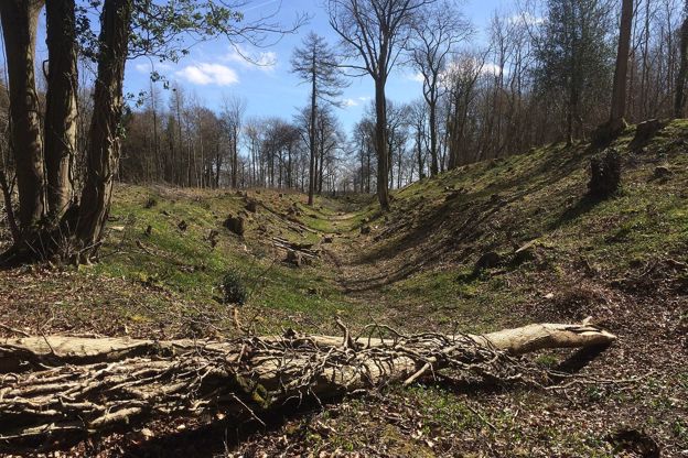
Brackenbury Ditches hill fort
Sight · Hill fort or barrow · Wotton-under-Edge
Brackenbury Ditches is an Iron Age hill fort in Westridge Wood on a spur of the Cotswold Edge above North Nibley, with a great inner rampart 3m high and a ditch 14m wide, unexcavated when surveyed in 1976 and now among the trees. Beside public footpaths through the wood.
-
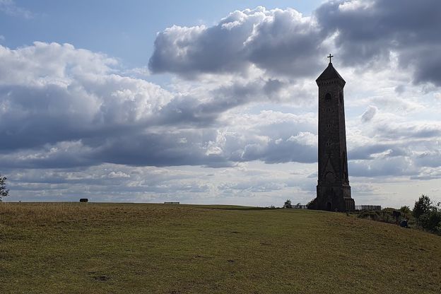
Tyndale Monument, North Nibley
Sight · Monument · Wotton-under-Edge
The Tyndale Monument is the tower on Nibley Knoll above North Nibley, built in 1866 by S. S. Teulon in memory of William Tyndale, translator of the first printed English New Testament. Grade II*; usually open to climb, free, with a key nearby if locked.
The walk in detail
The Wotton, Tyndale Monument and Coombe Hill walk is an 8.5-mile (13.5km) circular walk from Gloucester Street in Wotton-under-Edge. It is moderate, with about 410m of climbing in three ascents, and takes four to four and a half hours. It passes the Tyndale Monument, and carry food: both pubs on the way, the Black Horse at North Nibley and the New Inn at Waterley Bottom, may be closed.
The three climbs are to Nibley Knoll, to the edge below Stinchcombe Hill and over Coombe Hill, on the hills of the Cotswold Edge, with gentler walking in between. The first third follows the Cotswold Way, whose stage 11, from Dursley to Wotton, passes North Nibley and the Tyndale Monument.
Leaving Wotton
The walk leaves Gloucester Street by Tabernacle Pitch, past a chapel of 1850, and climbs to Old London Road. The Tabernacle Chapel has twin turrets and lancet windows. Its listing records it as a museum, its seating removed for a replica of the Roman pavement from Woodchester Park. Wotton Auction Rooms now hold their sales in the chapel and its Sunday school buildings. At the end the route passes the Rowland Hill almshouses of 1815, now called Streamsfield, with two blind pointed arches high on the front, one carrying the inscription and date.
Westridge Wood and the Tyndale Monument
The first climb ends at the Tyndale Monument on Nibley Knoll, reached by a broad bridleway north through Westridge Wood from Old London Road past the earthworks of Brackenbury Ditches hillfort. The monument is 34m high by its charity's measure, with 121 steps inside, built in 1866 by S S Teulon for the second Earl of Ducie and listed Grade II*. Its tablet says William Tyndale was born near here and was martyred at Vilvorde in 1536. The Tyndale Trail, about 28 miles between his sculpture in Bristol and the monument, was ready to walk from 31 January 2026 for the 500th anniversary of his New Testament. Our guide to walking in the Cotswolds lists it with the other long-distance paths, and our piece on famous Cotswold people has more on Tyndale.
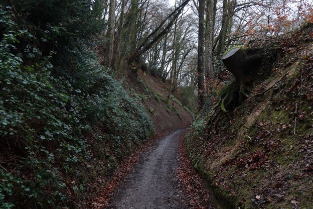
Wood Lane drops steeply from the knoll into North Nibley, where the route passes the Black Horse on The Street. The National Trail notes a permanent diversion of the Cotswold Way at North Nibley, so follow its signs where they differ from older maps.
Hermitage Wood, Waterley Bottom and Coombe Hill
The second half climbs to the edge below Stinchcombe Hill, comes back south past the New Inn at Waterley Bottom, and finishes over Coombe Hill. North of North Nibley, field paths and bridleways climb through the woods to the edge, where the route turns east past Hermitage Wood and comes south through Millend Wood to the New Inn. A mile of quiet lanes leads to the last climb, up Sheep Path Lane onto Coombe Hill, one of the three peaks of the National Landscape's walk from Wotton, with Wotton Hill and Tor Hill. From the top a grassy path drops back into the town.

The Cotswolds Info newsletter
Events, new places and the best of the season, about once a month. Unsubscribe at any time.
What walkers report
Walkers on AllTrails describe steep climbs and descents with easier walking between, much of it shaded in woodland and sunken lanes. AllTrails puts about a third of the route on natural paths and a quarter on lanes and roads. Some stretches are high and exposed to the wind. Walkers take care on the slopes when it is wet, and find it muddy in winter and in places in autumn. In August 2026 one walker found paths overgrown with nettles and brambles, while another that month found them clear.
There are many paths in these woods, and several walkers had to keep checking the map to stay on this line. Expect quiet road walking on narrow lanes and long stretches with dogs on leads. One walker in March 2025 made a detour round some curious bulls. Take water for yourself and a dog, as there is none on the way.
Food, parking and getting there
Stroud District Council lists no charge for Wotton's car parks at The Chipping and Potters Pond, and walkers have also parked in residential streets midweek. There are free public toilets on Ropewalk. The route passes two pubs but neither can be counted on: the Black Horse at North Nibley has lost its website and may have closed, and the New Inn at Waterley Bottom says it has gone into hibernation, so carry food and water. Back in town, the Royal Oak on Haw Street is about 170m off the route and opens from midday, Tuesday to Sunday.
From Monday to Saturday, the Stagecoach 60 comes from Dursley bus station about every two hours, the Cotswold Green 40 from Stroud and Nailsworth, and the Eurocoaches Y8 from Yate station. There are no Sunday buses.
Shorter walks from Wotton
For the ridge without the climbs, Wotton Hill and the Tyndale Monument is an easy 3.5-mile loop from Old London Road. Wotton-under-Edge and the Cotswold Way heads south-east by Wortley, and over the valleys to the east, the walk from Kingscote reaches Ozleworth.
Places on the way
-

The Royal Oak, Wotton-under-Edge
Pubs · Wotton-under-Edge
A neighbourhood pub and kitchen on Haw Street, Wotton-under-Edge, serving pub classics from South West producers, open Tuesday to Sunday from midday.
Family-friendly
Verified Oct 2026
Stay near the start
Inns, cottages and hotels within a short drive of where the walk begins, so you can set off early.
Where to stay in Wotton-under-Edge-
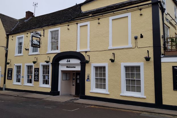
The Swan Hotel
Hotel · Wotton-under-Edge
A Grade II listed coaching inn on Market Street in the middle of Wotton-under-Edge, with 18 en-suite rooms, a restaurant and bar, and dogs welcome.
Dog-friendly · Walker-friendly
Verified Nov 2026
-
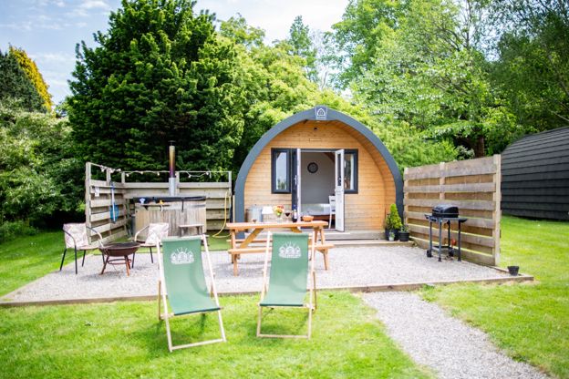
Hunts Court Huts
Glamping · North Nibley
Two glamping pods and a shepherd's hut for two, each with its own wood-fired hot tub, on a working farm at Forthay, North Nibley, by the Cotswold Way.
Hot tubs · Walker-friendly
Verified Oct 2026
-
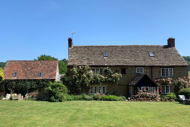
Forthay Bed and Breakfast
B&B · North Nibley
A late seventeenth-century farmhouse B&B with four rooms for two in the hamlet of Forthay, below the Tyndale Monument at North Nibley, on the Cotswold Way.
Dog-friendly · Walker-friendly
Verified Nov 2026
More like this
More walks to try
-

The Cotswold Way
Walk · Dog-friendly
The Cotswold Way is a 102-mile (164km) National Trail walk from Chipping Campden to Bath along the escarpment, in 15 sections; the official guidebook suggests seven to ten days, and its frequent steep climbs make it hard going.
-
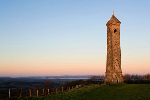
Wotton Hill and the Tyndale Monument
Walk · Starts in Wotton-under-Edge · 1 hr, 15 mins · Circular · Dog-friendly
A 3.5-mile (5.8km) easy ridge walk of an hour to an hour and a half from Old London Road above Wotton-under-Edge: out to the walled Jubilee Clump on Wotton Hill, through Westridge Wood past Brackenbury Ditches to the Tyndale Monument on Nibley Knoll, and back through the woods.
-
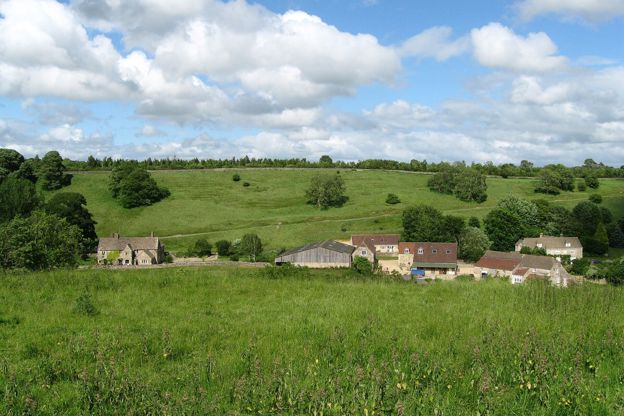
Kingscote, Ozleworth and Lasborough
Walk · Starts in the Cotswold Edge · 3 hrs, 15 mins · Circular
A 7.5-mile (11.9km) circular walk from the Hunters Hall Inn at Kingscote, moderate and three to three and a half hours: across the fields to Bagpath, down to Ozleworth's six-sided church tower, along the wooded floor of Ozleworth Bottom, and back by Lasborough Park.