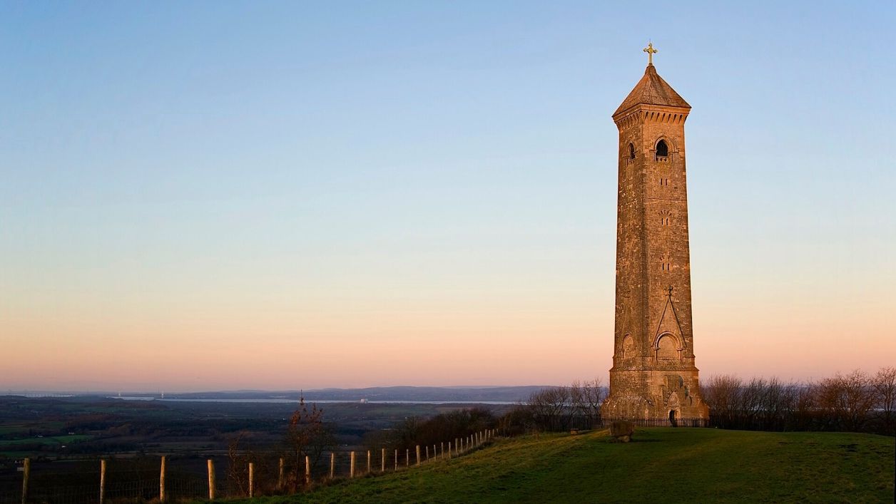
Saffron Blaze, CC BY-SA 3.0, via Wikimedia Commons
Wotton Hill and the Tyndale Monument
A 3.5-mile (5.8km) easy ridge walk of an hour to an hour and a half from Old London Road above Wotton-under-Edge: out to the walled Jubilee Clump on Wotton Hill, through Westridge Wood past Brackenbury Ditches to the Tyndale Monument on Nibley Knoll, and back through the woods.
- Distance
- 5.8 km (3.6 mi)
- Difficulty
- Easy
- Time
- 1 hr, 15 mins
- Ascent
- 63 m
- Circular
- Circular
The route
Starts at Old London Road, above Wotton-under-Edge follows the Cotswold Way for a while Muddy in winter Download GPX
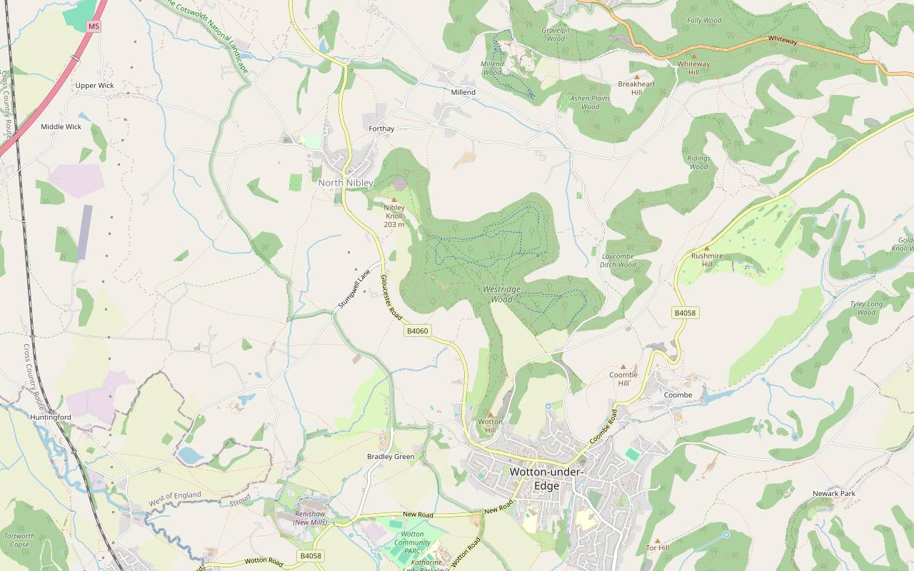
Step by step
-
Step 1: Out to Wotton Hill
From Old London Road, take bridleway CWE 95 a few metres and turn onto footpath CWE 9, which runs south along the edge of the wood to the open top of Wotton Hill and the trees of Jubilee Clump.
-
Step 2: Into Westridge Wood
Turn back north on the permissive paths below the clump and rejoin bridleway CWE 95, a broad track north into Westridge Wood. Bear left onto bridleway CNN 30, then the tracks of footpaths CNN 66 and CNN 34 west to the information board at Brackenbury Ditches.
-
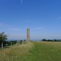
Step 3: To the Tyndale Monument
Follow bridleway CNN 30 north-west and footpaths CNN 63 and CNN 64 across the grass to the Tyndale Monument on Nibley Knoll.
-
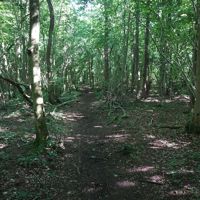
Step 4: Back through the woods
From the monument take the bridleway round the edge of Nibley Quarry and back south-east on bridleway CNN 30, then bridleway CNN 65 east through the wood. Rejoin CWE 95 and follow it south back to Old London Road.
Sights on the way
The sights this walk passes, numbered as on the map.
-
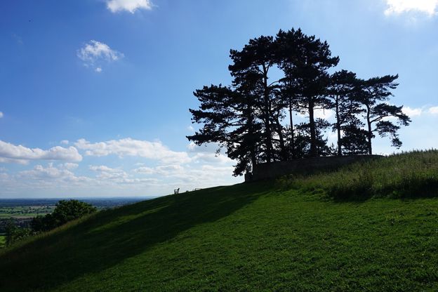
Jubilee Clump, Wotton Hill
Sight · Viewpoint · Wotton-under-Edge
Jubilee Clump is the walled ring of trees on Wotton Hill above Wotton-under-Edge, replanted in 1888 for Queen Victoria's Golden Jubilee on a spot said to have been first planted after Waterloo: a landmark and viewpoint on the Cotswold Way. Free.
-
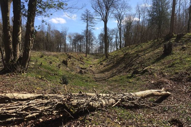
Brackenbury Ditches hill fort
Sight · Hill fort or barrow · Wotton-under-Edge
Brackenbury Ditches is an Iron Age hill fort in Westridge Wood on a spur of the Cotswold Edge above North Nibley, with a great inner rampart 3m high and a ditch 14m wide, unexcavated when surveyed in 1976 and now among the trees. Beside public footpaths through the wood.
-
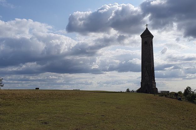
Tyndale Monument, North Nibley
Sight · Monument · Wotton-under-Edge
The Tyndale Monument is the tower on Nibley Knoll above North Nibley, built in 1866 by S. S. Teulon in memory of William Tyndale, translator of the first printed English New Testament. Grade II*; usually open to climb, free, with a key nearby if locked.
The walk in detail
The Wotton Hill and Tyndale Monument walk is a 3.5-mile (5.8km) ridge loop from Old London Road above Wotton-under-Edge to the Tyndale Monument on Nibley Knoll and back. It is easy, with only about 60m of ups and downs, and takes an hour to an hour and a half. The nearest pub is the Royal Oak in town.
Once you are on the ridge it stays level, on broad woodland tracks and grass. Much of it follows the Cotswold Way, whose stage 11, from Dursley to Wotton, passes North Nibley, the Tyndale Monument and Wotton Hill's Waterloo enclosure.
Wotton Hill and Jubilee Clump
The walk starts with the open grass of Wotton Hill, a short stretch south along the edge of the wood to the trees of Jubilee Clump. The National Trail describes it as a walled enclosure of trees planted in 1815 for the Battle of Waterloo; the Historic England listing records that the first trees were cut down in 1856 and the clump was replanted inside its wall in 1888, after Queen Victoria's Golden Jubilee. Walkers like the benches along the top, set where the views are best, and the Cotswold Way runs over the hill on its way between North Nibley and the town, so you share the path with long-distance walkers here.
Westridge Wood and Brackenbury Ditches
The middle of the walk runs north through Westridge Wood, mostly on bridleways and broad tracks, past a hillfort. Halfway along it passes an information board and the banks of Brackenbury Ditches, hidden in the trees. Historic England schedules it as Brackenbury camp, a slight univallate hillfort with outworks, and the National Trail gives its main rampart as up to 3m high above the steep natural slopes. The path then comes out onto the grass of Nibley Knoll.
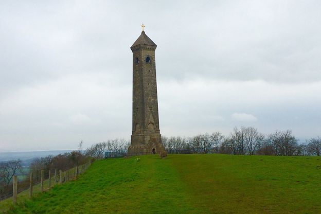
The Tyndale Monument
The Tyndale Monument, the walk's turning point, is a tower 34m high by its charity's measure on Nibley Knoll, built in 1866 by S S Teulon for the second Earl of Ducie and listed Grade II*. Its tablet says that William Tyndale was born near here and was martyred at Vilvorde in 1536. The 500th anniversary of his New Testament in 2026 brought a new long-distance path, the Tyndale Trail, which runs about 28 miles between Bristol and the monument and was ready to walk from 31 January 2026, and our guide to walking in the Cotswolds lists it with the other long-distance paths. Our piece on famous Cotswold people has more on Tyndale.
A spiral stair of 121 steps climbs to the top. The National Trail says the monument is usually open; if it is locked, a key can be had from a cottage in North Nibley named on the notice board. It is free, and the Tyndale Monument Charity relies on donations to keep it safe. The way back passes the edge of Nibley Quarry and returns through the woods on a lower bridleway.

The Cotswolds Info newsletter
Events, new places and the best of the season, about once a month. Unsubscribe at any time.
What walkers report
Walkers on AllTrails call it an easy ridge walk with wide paths, but report loose stones and mud on the ridge paths, slippery after rain. AllTrails' surface data puts most of it on natural ground, with about a fifth on grass. Carry the map: there are many paths in the wood, and this line keeps to the bridleways and footpaths described here. On fine weekends it is busy, with plenty of dogs off the lead, so keep yours close if it does not mix.
Parking and food
The walk starts by a small parking area beside Old London Road, which walkers report and which is mapped as free roadside parking. Wotton-under-Edge, a short walk down the hill, has council car parks at The Chipping and Potters Pond, for which Stroud District Council lists no charge, and free public toilets on Ropewalk, open 7am to 7pm. There is nothing to eat on the ridge. In town, the Royal Oak on Haw Street, a neighbourhood pub and kitchen, opens from midday, Tuesday to Sunday, and is closed on Mondays.
Longer walks from Wotton
For a full day, the 8.5-mile loop from Wotton to the Tyndale Monument and Coombe Hill continues down to North Nibley and round by Hermitage Wood. Wotton-under-Edge and the Cotswold Way heads south-east instead, by Wortley and its woods. Over the valleys to the east, the walk from Kingscote reaches Ozleworth's six-sided church tower. Our guide to the Cotswold Edge follows the escarpment end to end.
Places on the way
-

The Royal Oak, Wotton-under-Edge
Pubs · Wotton-under-Edge
A neighbourhood pub and kitchen on Haw Street, Wotton-under-Edge, serving pub classics from South West producers, open Tuesday to Sunday from midday.
Family-friendly
Verified Oct 2026
Stay near the start
Inns, cottages and hotels within a short drive of where the walk begins, so you can set off early.
Where to stay in Wotton-under-Edge-
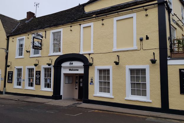
The Swan Hotel
Hotel · Wotton-under-Edge
A Grade II listed coaching inn on Market Street in the middle of Wotton-under-Edge, with 18 en-suite rooms, a restaurant and bar, and dogs welcome.
Dog-friendly · Walker-friendly
Verified Nov 2026
-
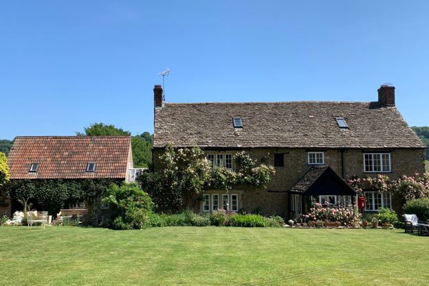
Forthay Bed and Breakfast
B&B · North Nibley
A late seventeenth-century farmhouse B&B with four rooms for two in the hamlet of Forthay, below the Tyndale Monument at North Nibley, on the Cotswold Way.
Dog-friendly · Walker-friendly
Verified Nov 2026
-
Hunts Court Huts
Glamping · North Nibley
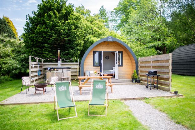
Two glamping pods and a shepherd's hut for two, each with its own wood-fired hot tub, on a working farm at Forthay, North Nibley, by the Cotswold Way.
Hot tubs · Walker-friendly
Verified Oct 2026
More like this
Stories on this walk
-
Famous people with Cotswold connections
Story · History · 10 minute read
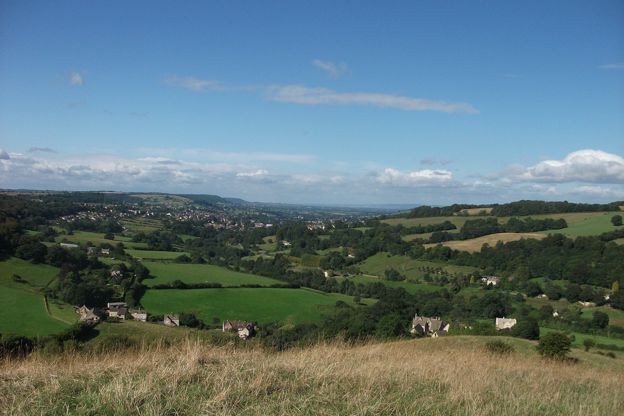
The writers, composers, scientists, queens and prime ministers whose lives are tied to Cotswold places, from Tyndale and Katherine Parr to Laurie Lee, Holst and Edward Thomas, and where to find their traces.
-
The Cotswolds in September
Story · Guides · 8 minute read
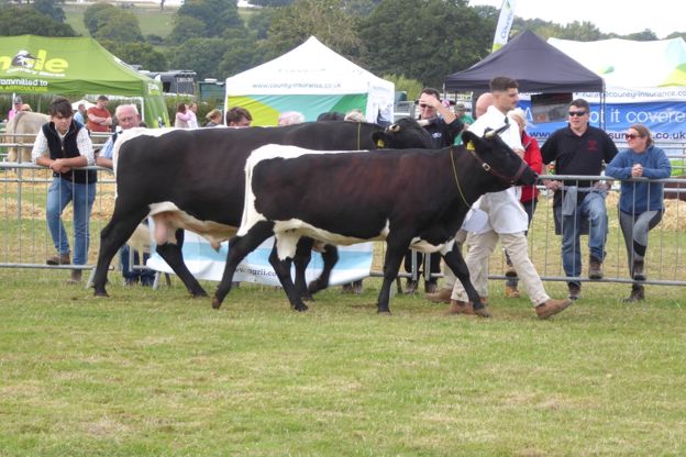
The Cotswolds in September: the schools back and the villages quiet on weekdays, the Moreton Show, Heritage Open Days, the Blenheim horse trials and Painswick's clipping, the last weeks of the summer gardens, walks on the edge and where to stay for them.
More walks to try
-

The Cotswold Way
Walk · Dog-friendly
The Cotswold Way is a 102-mile (164km) National Trail walk from Chipping Campden to Bath along the escarpment, in 15 sections; the official guidebook suggests seven to ten days, and its frequent steep climbs make it hard going.
-
Wotton, the Tyndale Monument and Coombe Hill
Walk · Starts in Wotton-under-Edge · 4 hrs, 15 mins · Circular
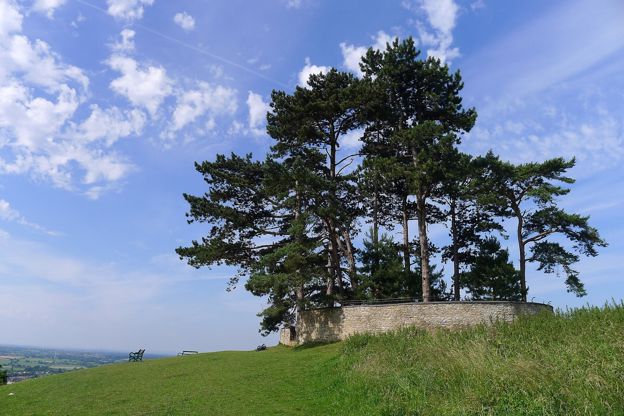
An 8.5-mile (13.5km) moderate loop of four to four and a half hours from Wotton-under-Edge, with three big climbs: to the Tyndale Monument, down to North Nibley, north towards Stinchcombe Hill, round by Hermitage Wood and Waterley Bottom, and back over Coombe Hill.
-
Kingscote, Ozleworth and Lasborough
Walk · Starts in the Cotswold Edge · 3 hrs, 15 mins · Circular
A 7.5-mile (11.9km) circular walk from the Hunters Hall Inn at Kingscote, moderate and three to three and a half hours: across the fields to Bagpath, down to Ozleworth's six-sided church tower, along the wooded floor of Ozleworth Bottom, and back by Lasborough Park.