Celuici, CC BY-SA 3.0, via Wikimedia Commons
Cotswold Way: King's Stanley to Dursley
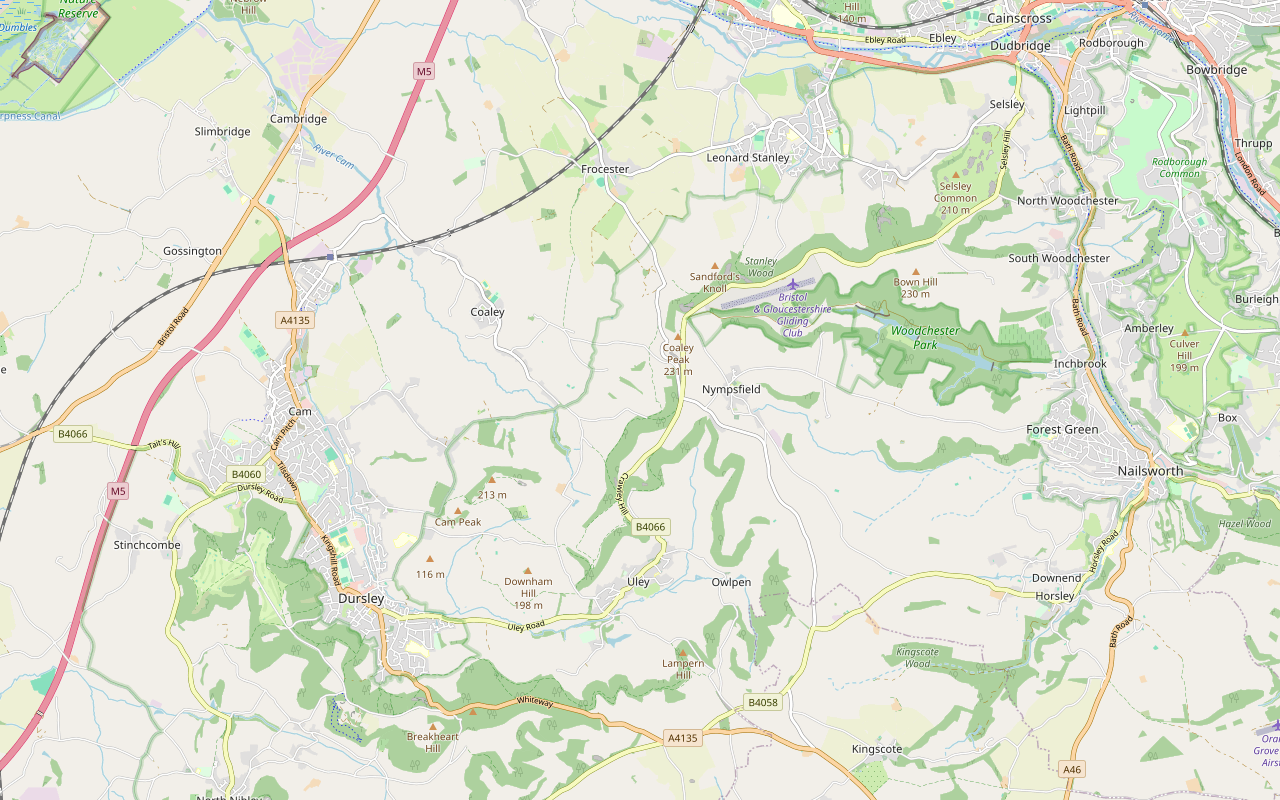
A 6.7-mile (10.8km) one-way walk on the tenth section of the Cotswold Way, moderate and about four and a quarter hours: from Middleyard up through Stanley Wood to Coaley Peak, along the edge past two long barrows, over Cam Long Down and down into Dursley.
- Distance
- 10.8 km (6.7 mi)
- Difficulty
- Moderate
- Time
- 4 hrs, 15 mins
- Ascent
- 331 m
- Circular
- One way
The route
Starts at Coombe Lane, Middleyard, by King's Stanley follows the Cotswold Way for a while Steep sectionMuddy in winterLivestock in fieldsDogs on lead near sheepStiles Download GPX
Step by step
-
Step 1: Middleyard up through Stanley Wood
From Broad Street at Middleyard, by the Coombe Lane bus stop, follow Coombe Lane and then the footpath south-west, cross Penn Lane at about 300m and take the short bridleway beyond it. Then follow the footpath up into Stanley Wood. It climbs steadily for about 2.5km through the trees, over one stile, to the top of the edge, where the Selsley Common option of the trail comes in.
- Steep section
- Muddy in winter
- Stiles
-
Step 2: Along the edge to Coaley Peak
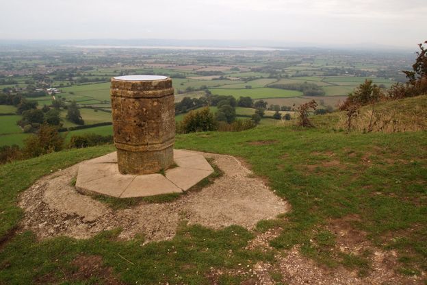
Follow the footpaths south-west along the top of the wood for about 1km, with Woodchester Park in the valley to your left, to the information board by Nympsfield Long Barrow and the Coaley Peak picnic site. Go through the gate on to the grassland and past the toposcope at about 4.2km, and through a second gate.
-
Step 3: Frocester Hill and Coaley Wood
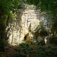
Follow the path across the grass to the Frocester Hill road and cross it with care, then walk a few metres beside the B4066 before taking the bridleway into Coaley Wood. Follow the footpath along the edge through the wood for about 1.2km, passing the disused quarry with its rock layers exposed; Uley Long Barrow is about 100m off the path to the left, by the B4066.
- Muddy in winter
-
Step 4: Over Cam Long Down
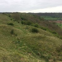
Leave the wood through a gate by a viewpoint and continue along the footpath to a stile at about 6.9km. Cross the lane, go through the gate and over the stile beyond, and follow the field paths over two more stiles. Take the bridleway up on to Cam Long Down. The climb is short and steep. Walk along the top and drop down the far end through a kissing gate to Farfield lane at about 8.9km.
- Steep section
- Stiles
-
Step 5: Farfield into Dursley
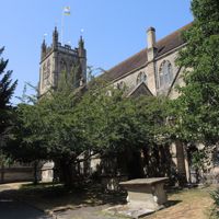
Cross the lane and follow the footpath south across the fields beside a stream, through three kissing gates and over a stile, then through another kissing gate on to a track. Follow it to Chestal, cross Bymacks Lane, and walk along Long Street past the car park to Silver Street. Cross with care to the Market House in the town centre, where the section ends.
- Muddy in winter
Sights on the way
The sights this walk passes, numbered as on the map.
-
Woodchester Park
Sight · Common or park · Nailsworth
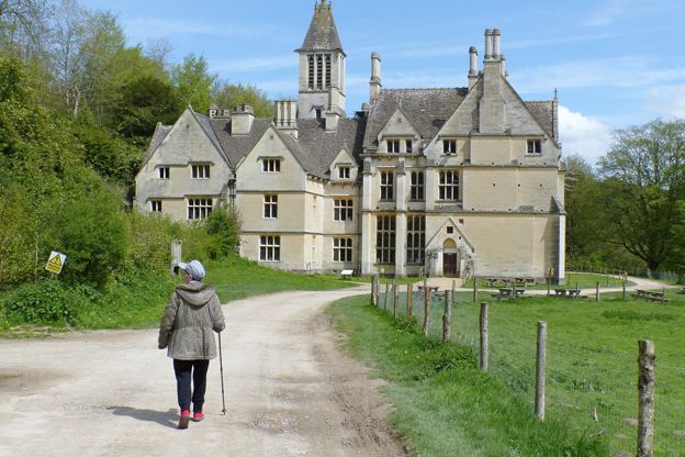
A steep wooded valley west of Nailsworth, National Trust since 1994: a deer park walled by the Huntleys after a grant of 1564, with five lakes of the early nineteenth century, a boathouse of about 1820 and the unfinished Woodchester Mansion at its head.
The walk in detail
The Cotswold Way from King's Stanley to Dursley is a one-way walk of 6.7 miles (10.8km) from Middleyard, on the edge of King's Stanley, up to Coaley Peak, over the steep little hill of Cam Long Down and down to the Market House in Dursley. It is moderate, climbs about 330m and takes about four and a quarter hours, with pubs and cafés in Dursley at the end.
It is the tenth of the fifteen sections of the Cotswold Way, and the National Trail gives it as 7.2 miles (11.6km). The line we follow is about 0.8km shorter because it starts at Middleyard, where the previous section's line ends, rather than in the middle of King's Stanley, a village in the valley south-west of Stroud.
What the walk is like
Most of the climbing comes at the start: a long, steady pull of about 130m up through Stanley Wood, which the National Trail calls Pen Wood, to the top of the edge. From there the path runs level through beech woods and out on to the open grassland at Coaley Peak, then back into woodland for the quarry and Coaley Wood. Cam Long Down is the second effort, short and steep, and from its far end it is field paths and lanes into the town.
There are about six stiles on the line, most of them between Coaley Wood and Cam Long Down, and a road crossing at Frocester Hill with a few metres beside the B4066. The woods are muddy after rain.
Coaley Peak and the long barrows
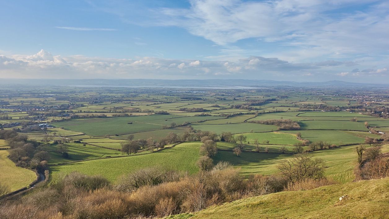
Coaley Peak is a picnic site and viewpoint at the top of Frocester Hill, with picnic tables, a free car park and a toposcope, and Gloucestershire Wildlife Trust looks after the grassland as a nature reserve, open all year, grazed by sheep, with orchids among its wild flowers. Beside it is Nympsfield Long Barrow, a Neolithic tomb in English Heritage's care, open free in daylight, where excavations found the remains of at least 13 people.
Uley Long Barrow, better known as Hetty Pegler's Tump, lies about 100m from the line by the B4066. English Heritage says the mound is 37m long and can be entered in daylight, free; bring a torch, keep dogs on leads, and use the lay-by for one or two cars on the road. Uley is in the valley just south-east, below Uley Bury, a large Iron Age hill fort with a public footpath round its ramparts.
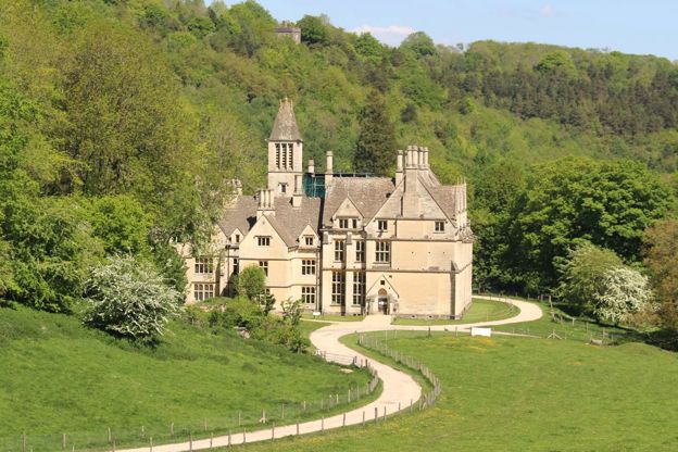
Below the path to the south-east is Woodchester Park, the National Trust's wooded valley. Woodchester Mansion, the unfinished Victorian house in the valley, opens on Fridays, Saturdays, Sundays and bank holidays from Good Friday to the start of November (its 2026 season ends on 1 November), with a minibus, when volunteers are available, from the National Trust's Buckholt car park off the B4066 near Coaley Peak.
Cam Long Down and Dursley
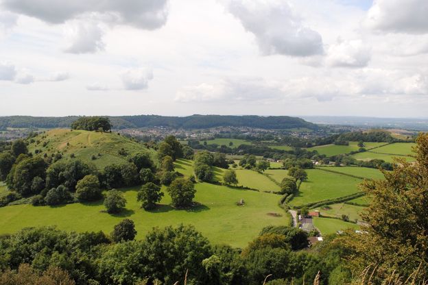
Cam Long Down is an outlier of the escarpment, a narrow ridge standing on its own above Uley and Dursley. The National Trail calls the climb steep and the reward views all round; the descent off the far end to Farfield is steep too. From there the path crosses fields into the town and finishes at the Market House of 1738.
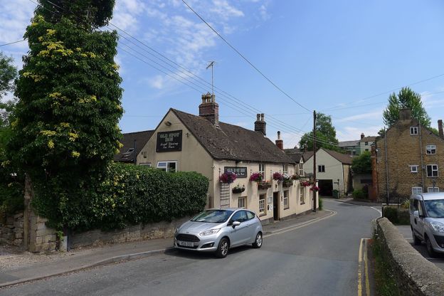
Dursley grew round R A Lister's engineering works from the 1860s, and our guide to Dursley has its car parks, the heritage centre and the town's walks. The Old Spot, at the foot of Stinchcombe Hill on the Cotswold Way itself, was CAMRA's National Pub of the Year for 2007 to 2008 by its own account, and the next section climbs straight out again on to Stinchcombe Hill.

The Cotswolds Info newsletter
Events, new places and the best of the season, about once a month. Unsubscribe at any time.
Getting back to the start
Take the Stagecoach 65 from Dursley to Stroud's Merrywalks bus station, about half an hour by way of Uley, Nympsfield and Selsley, then the 62 to Middleyard, about 10 minutes. Both run about hourly from Monday to Saturday and every two hours on Sunday, when the 65 leaves Dursley at about 11am, 1pm, 3pm and 5pm (bustimes.org, October 2026), so check the times before a Sunday walk. Cam and Dursley station, on the line between Gloucester and Bristol, is on Box Road near Cam, about 3 miles from the town by road.
Where to eat and sleep
There is nowhere to buy food on the way, so carry it; the picnic tables at Coaley Peak are the obvious stop. Dursley has pubs and cafés round the Market House. For a bed near the start, Stonehouse Court is a manor house hotel about 2 miles away, and the Bell Inn at Selsley has two bedrooms, the Dovecot and the Valley, and takes dogs in them for a £20 supplement, on the 65 bus route.
When to go
Late spring and summer, for the orchids and wild flowers on the grassland at Coaley Peak, or a clear winter day for the views across the Severn. The woods and the fields below Cam Long Down are muddy after rain, especially in winter.
Places on the way
-
The Old Spot Inn, Dursley
Pubs · Dursley
A traditional pub at the foot of Stinchcombe Hill in Dursley, on the Cotswold Way, a CAMRA National Pub of the Year, with cask ales, a garden and lunch every day.
Walker-friendly
Verified Nov 2026
-
Uley Bury
Historic houses and heritage · Uley
One of the largest Iron Age hillforts in the Cotswolds, a plateau of about 23 hectares above Uley ringed by terraced ramparts, free to walk round on the rampart path with views to Cam Long Down and the Severn.
Walker-friendly
Verified Oct 2026
-
Woodchester Mansion
Historic houses and heritage · Minchinhampton
An unfinished Grade I house near Nympsfield, reached by minibus or a walk down a track, open Friday to Sunday from April to early November.
Family-friendly · Walker-friendly
Verified Nov 2026
-
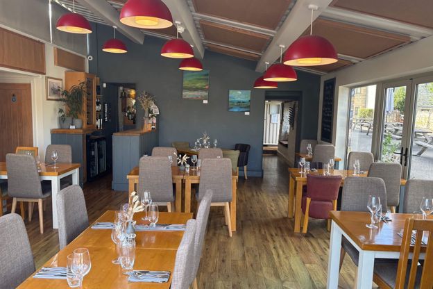
The Bell Inn, Selsley
Inn · Stroud
A chef-owned 17th-century inn, listed Grade II, with two bedrooms at Selsley, two miles from Stroud, with two AA Rosettes and dogs welcome throughout.
Dog-friendly
Verified Nov 2026
-
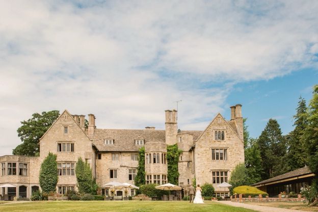
Stonehouse Court
Hotel · Stroud
A seventeenth-century manor house hotel in six acres at Stonehouse, near Stroud, with 44 rooms, a brasserie using its own kitchen garden, and weddings.
Wedding venues
Verified Nov 2026
Stay near the start
Inns, cottages and hotels within a short drive of where the walk begins, so you can set off early.
Where to stay in Stroud-
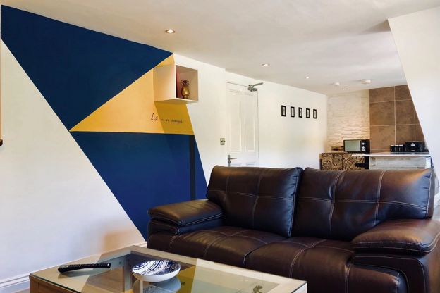
Old Fleece apartments
Self-catering · Nailsworth
Three self-catering apartments behind the Old Fleece pub at Rooksmoor, between Nailsworth and Stroud, with an EV charging point and the garden.
EV charging
Verified Nov 2026
-
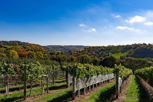
Woodchester Valley Vineyard stays
Self-catering · Nailsworth
Three barn suites for two, a two-bedroom farmhouse and a six-bedroom house among the vines at Woodchester Valley Vineyard, near Nailsworth.
Dog-friendly
Verified Nov 2026
-
The Clothiers Arms
Inn · Stroud
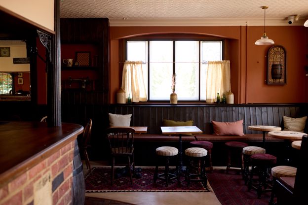
A pub with seven rooms at the bottom of Rodborough Hill in Stroud, a pub since 1891, with a beer garden, an adventure play area next door and a family suite.
Family-friendly · Car-free
Verified Nov 2026
More like this
More walks to try
-
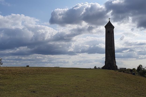
Cotswold Way: Dursley to Wotton-under-Edge
Walk · Starts in Dursley · 4 hrs, 30 mins · Dog-friendly
A 7.5-mile (12km) one-way walk on the eleventh section of the Cotswold Way, moderate and about four and a half hours: from Dursley round the rim of Stinchcombe Hill, down to North Nibley, up to the Tyndale Monument and along the ridge to Wotton-under-Edge.
-

The Cotswold Way
Walk · Dog-friendly
The Cotswold Way is a 102-mile (164km) National Trail walk from Chipping Campden to Bath along the escarpment, in 15 sections; the official guidebook suggests seven to ten days, and its frequent steep climbs make it hard going.
-
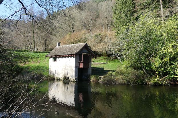
Woodchester Park and the boathouse
Walk · Starts in Nailsworth · 2 hrs · Circular
A 3.75-mile (6km) circular walk without stiles from the National Trust car park at Woodchester Park, moderate and about two hours: down past the unfinished Victorian mansion, along the valley to Middle Pond, back by the boathouse on Old Pond and steadily up through the woods.