Helen Steed, CC BY-SA 2.0, via Wikimedia Commons
Cotswold Way: Dursley to Wotton-under-Edge
A 7.5-mile (12km) one-way walk on the eleventh section of the Cotswold Way, moderate and about four and a half hours: from Dursley round the rim of Stinchcombe Hill, down to North Nibley, up to the Tyndale Monument and along the ridge to Wotton-under-Edge.
- Distance
- 12.0 km (7.5 mi)
- Difficulty
- Moderate
- Time
- 4 hrs, 30 mins
- Ascent
- 337 m
- Circular
- One way
The route
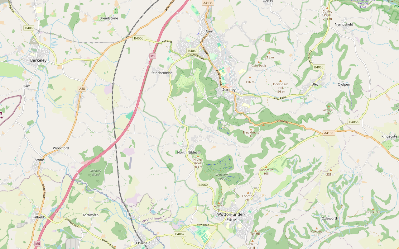
Starts at The Market House, Dursley follows the Cotswold Way for a while Steep sectionMuddy in winterLivestock in fieldsDogs on lead near sheepStilesRoad walking Download GPX
Step by step
-
Step 1: Dursley up to Stinchcombe Hill
From the Market House walk along Parsonage Street, cross Castle Street with care, and follow May Lane past the bus station, the May Lane car park and the Old Spot to Hill Road. Climb Hill Road for about 200m to The Broadway, cross it, and go through the kissing gate. The footpath climbs steeply through Cockshoot Wood, over two stiles, about 100m up in 600m, to the top.
- Steep section
- Stiles
-
Step 2: Round the rim of Stinchcombe Hill
Follow the bridleways west along the northern edge of the hill through Westfield Wood and Sheep Path Woods. Cross the lane and the golf club's drive at about 2.6km and keep to the waymarked path round the rim of the golf course, past a viewpoint, the topograph and Drakestone Point at about 3.9km, then on round the southern edge and down through the woods. Watch for golf balls and keep off the fairways.
The National Trail's shortcut leaves the rim near the golf clubhouse and crosses the neck of the hill, making the section 4.8 miles in all. It is waymarked on the ground but is not on our map.
-
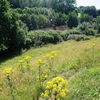
Step 3: Down to North Nibley
Leave the hill on the bridleway and the footpath south across the fields, through three kissing gates, to Park Lane. Cross it, and follow the footpaths through three more kissing gates to a lane. Walk down the lane over the Doverle Brook and cross the B4060 with care at about 6.8km. Follow Lower House Lane, a restricted byway, past the Jubilee Field into North Nibley, then The Street past the village hall to the B4060 by the Black Horse bus stop.
- Muddy in winter
-
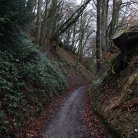
Step 4: Wood Lane to the Tyndale Monument
Cross the B4060 to Wood Lane, up a few steps, and climb the bridleway. It is a steep climb, about 70m up in 600m. Near the top bear right on the footpath by Nibley Quarry, go through the gate, and cross the grass of Nibley Knoll to the Tyndale Monument. Follow the National Trail's signs here: landslips in 2013 made the old path up the slope north of the monument unsafe, and the trail lists a permanent diversion at North Nibley, so the signs may differ from older maps.
- Steep section
-
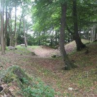
Step 5: Westridge Wood and Brackenbury Ditches
From the monument follow the bridleway south-east through a gate into Westridge Wood, then the broad track past the information board at Brackenbury Ditches at about 9.6km. Keep on south along the bridleway, a wide track through the trees, for about 1km to the open ground by Old London Road.
-
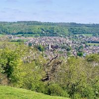
Step 6: Wotton Hill and down into the town
Take the footpath south over the grass of Wotton Hill, through a kissing gate, to Jubilee Clump, the walled ring of trees. Go through the kissing gate beyond and down the path and a gate to Bradley Road. Cross Bradley Road and Gloucester Street with care, and walk down Bradley Street for about 400m into the town centre, where the section ends at High Street, by the Jubilee Clock on Long Street.
Sights on the way
The sights this walk passes, numbered as on the map.
-
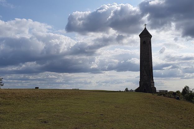
Tyndale Monument, North Nibley
Sight · Monument · Wotton-under-Edge
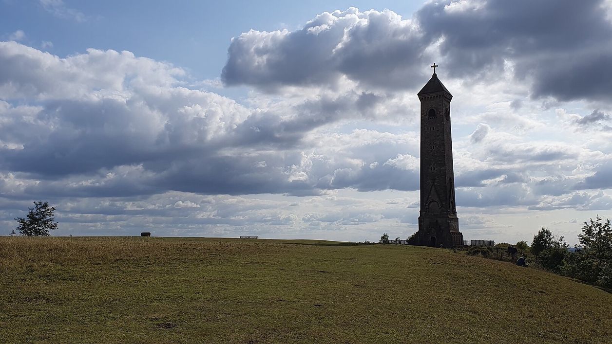
The Tyndale Monument is the tower on Nibley Knoll above North Nibley, built in 1866 by S. S. Teulon in memory of William Tyndale, translator of the first printed English New Testament. Grade II*; usually open to climb, free, with a key nearby if locked.
-
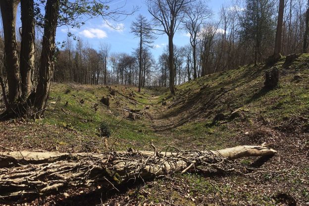
Brackenbury Ditches hill fort
Sight · Hill fort or barrow · Wotton-under-Edge
Brackenbury Ditches is an Iron Age hill fort in Westridge Wood on a spur of the Cotswold Edge above North Nibley, with a great inner rampart 3m high and a ditch 14m wide, unexcavated when surveyed in 1976 and now among the trees. Beside public footpaths through the wood.
-
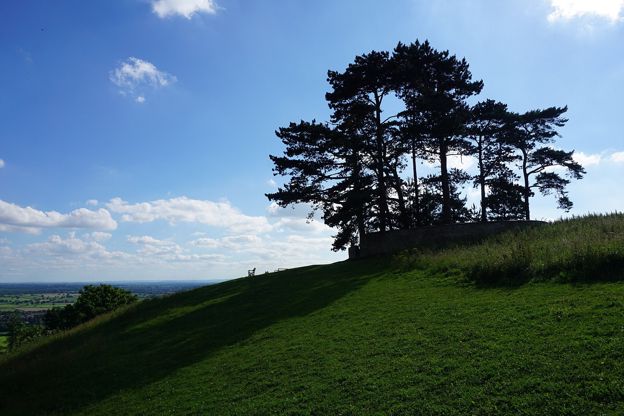
Jubilee Clump, Wotton Hill
Sight · Viewpoint · Wotton-under-Edge
Jubilee Clump is the walled ring of trees on Wotton Hill above Wotton-under-Edge, replanted in 1888 for Queen Victoria's Golden Jubilee on a spot said to have been first planted after Waterloo: a landmark and viewpoint on the Cotswold Way. Free.
The walk in detail
The Cotswold Way from Dursley to Wotton-under-Edge is a one-way walk of 7.5 miles (12km) from the Market House in Dursley, round the rim of Stinchcombe Hill, through North Nibley and past the Tyndale Monument to the town centre in Wotton-under-Edge. It is moderate, climbs about 340m in three steep pulls, and takes about four and a half hours.
It is the eleventh of the fifteen sections of the Cotswold Way. The National Trail gives it as 7.3 miles (11.8km), or 4.8 miles (7.8km) if you take the shortcut across the neck of Stinchcombe Hill from the golf club instead of the long way round its edge. The Trail says the best views are on the longer route, and that is the one we map.
What the walk is like
Three climbs shape the day: straight out of Dursley up through Cockshoot Wood on to Stinchcombe Hill, then after the long descent to North Nibley, the steep track of Wood Lane to the Tyndale Monument, and a gentler rise along the ridge to Wotton Hill. In between are woodland bridleways, a golf course and field paths. There are two stiles, both near the start, and a good many kissing gates, and several crossings of the B4060, a busy road.
Stinchcombe Hill
Stinchcombe Hill is the flat-topped promontory west of Dursley. Sir Stanley Tubbs gave it in trust to the people of the district, a stone seat on the hill remembers him, and much of the top is leased to the golf club, so keep to the paths. Drakestone Point on the southern rim looks to the Tyndale Monument and the Severn bridges. The Cotswolds National Landscape's stile-free Sir Stanley Tubbs walk, 3.25 miles from the public car park on the hill, follows much of the same edge.
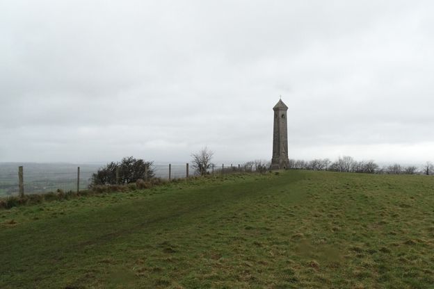
North Nibley and the Tyndale Monument
North Nibley is the village under the monument, and the field where the last private battle in England was fought, in 1470, lies on its western side. The Black Horse Inn by the bus stop is listed Grade II, but its website has gone and it may have closed, so do not count on it.
The Tyndale Monument on Nibley Knoll was built in 1866 by S. S. Teulon in memory of William Tyndale, whose New Testament of 1526 was the first printed in English, and who was born near here according to its tablet. It is 34m high by its charity's measure, listed Grade II*, and free to climb, though the charity relies on donations; if the door is locked the notice board gives the cottage that keeps the key. The Tyndale Trail, about 28 miles between Bristol and the monument, was ready to walk from 31 January 2026 for the 500th anniversary of his New Testament.
Westridge Wood and Wotton Hill
South of the monument the trail runs through Westridge Wood past Brackenbury Ditches, an Iron Age hill fort whose ramparts are hidden in the trees, marked by an information board beside the track. It comes out on the grass of Wotton Hill at Jubilee Clump, said to have been first planted after Waterloo; its trees were cut down in 1856 and replanted inside a wall in 1888, after Queen Victoria's Golden Jubilee. Our ridge walk from Wotton Hill to the Tyndale Monument makes a 3.5-mile loop of this stretch, and the longer loop by Coombe Hill adds North Nibley.

The Cotswolds Info newsletter
Events, new places and the best of the season, about once a month. Unsubscribe at any time.
Getting back to the start
The Stagecoach 60 runs from Wotton-under-Edge to Dursley by North Nibley, about every two hours from Monday to Saturday, and takes about 25 minutes. There is no Sunday bus, so on a Sunday you need two cars or a taxi. The 60 also stops outside the Black Horse at North Nibley, which lets you split the walk.
Where to eat and sleep
Dursley has pubs and cafés at the start, among them the Old Spot by the May Lane car park, on the trail itself, and there is nothing to buy between Dursley and Wotton. In Wotton, the Royal Oak on Haw Street, which reopened under new operators in autumn 2025, opens from midday Tuesday to Sunday, and our guide to Wotton-under-Edge has the town's free car parks, almshouses and church.
When to go
Any dry day from spring to autumn; Stinchcombe Hill's views are best on a clear winter morning. Wood Lane and the fields by North Nibley are muddy after rain, and walkers on AllTrails who walk the loop from Wotton Hill to the monument report loose stones and mud on the ridge paths through Westridge Wood after rain.
Places on the way
-
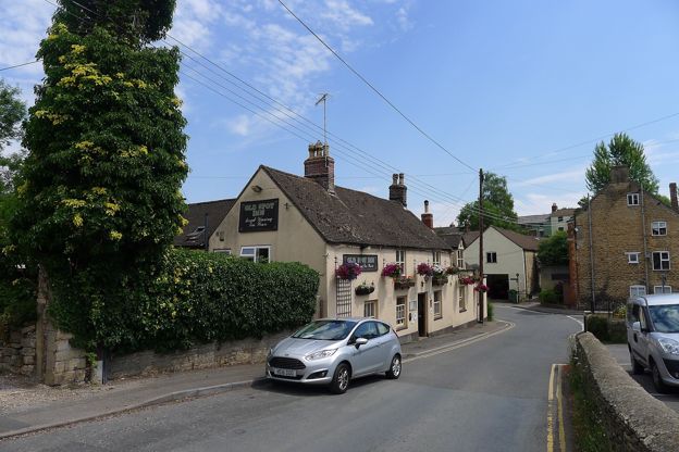
The Old Spot Inn, Dursley
Pubs · Dursley
A traditional pub at the foot of Stinchcombe Hill in Dursley, on the Cotswold Way, a CAMRA National Pub of the Year, with cask ales, a garden and lunch every day.
Walker-friendly
Verified Nov 2026
-

The Royal Oak, Wotton-under-Edge
Pubs · Wotton-under-Edge
A neighbourhood pub and kitchen on Haw Street, Wotton-under-Edge, serving pub classics from South West producers, open Tuesday to Sunday from midday.
Family-friendly
Verified Oct 2026
Stay near the start
Inns, cottages and hotels within a short drive of where the walk begins, so you can set off early.
Where to stay in Dursley-
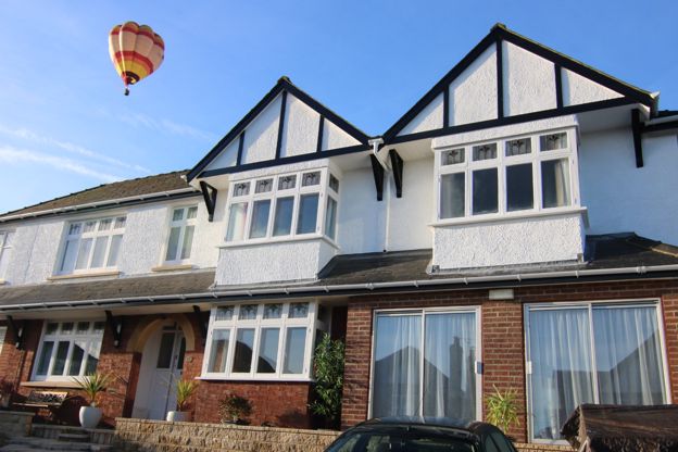
Woodland House
B&B · Dursley
A seven-room B&B in a quiet cul-de-sac six minutes' walk from Dursley, with a hot tub, a sauna, a guest kitchen and parking for seven cars.
Walker-friendly · Hot tubs · Family-friendly
Verified Nov 2026
-
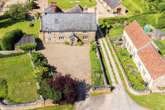
Downhouse Farm Holidays
Self-catering · Dursley
A Grade II listed farmhouse for ten and a converted granary barn for four on a working family farm at Springhill, about a mile from Dursley; dogs welcome.
Dog-friendly · Family-friendly · Walker-friendly
Verified Nov 2026
-
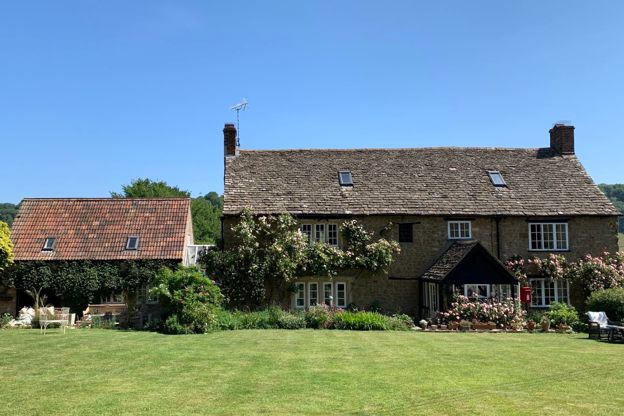
Forthay Bed and Breakfast
B&B · North Nibley
A late seventeenth-century farmhouse B&B with four rooms for two in the hamlet of Forthay, below the Tyndale Monument at North Nibley, on the Cotswold Way.
Dog-friendly · Walker-friendly
Verified Nov 2026
More like this
More walks to try
-
Cotswold Way: King's Stanley to Dursley
Walk · Starts in Stroud · 4 hrs, 15 mins · Dog-friendly
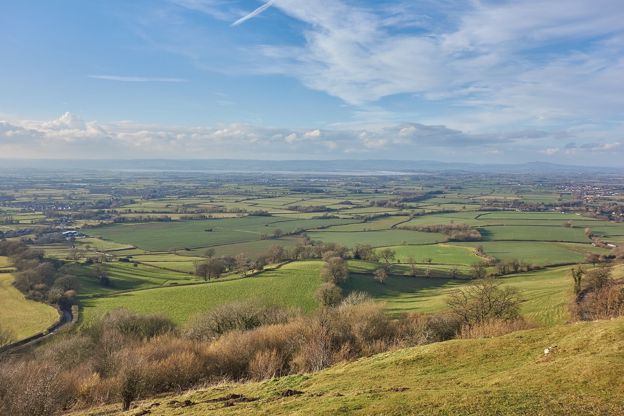
A 6.7-mile (10.8km) one-way walk on the tenth section of the Cotswold Way, moderate and about four and a quarter hours: from Middleyard up through Stanley Wood to Coaley Peak, along the edge past two long barrows, over Cam Long Down and down into Dursley.
-
Cotswold Way: Wotton-under-Edge to Hawkesbury Upton
Walk · Starts in Wotton-under-Edge · 4 hrs, 45 mins · Dog-friendly
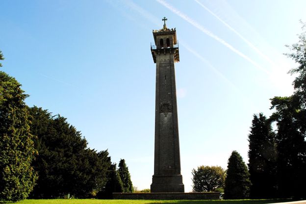
A 7.8-mile (12.6km) one-way walk on the twelfth section of the Cotswold Way, moderate and about four and three quarter hours: from Wotton-under-Edge up past Newark Park, along Wortley Hill, through Alderley and Lower Kilcott to the Somerset Monument and Hawkesbury Upton.
-
Wotton Hill and the Tyndale Monument
Walk · Starts in Wotton-under-Edge · 1 hr, 15 mins · Circular · Dog-friendly
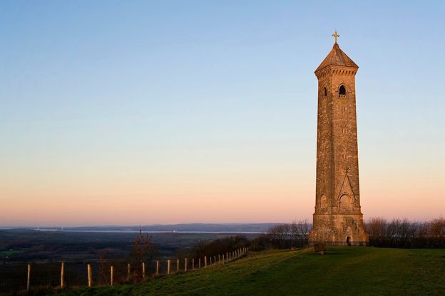
A 3.5-mile (5.8km) easy ridge walk of an hour to an hour and a half from Old London Road above Wotton-under-Edge: out to the walled Jubilee Clump on Wotton Hill, through Westridge Wood past Brackenbury Ditches to the Tyndale Monument on Nibley Knoll, and back through the woods.