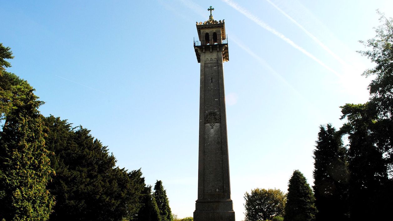
Ray Bird, CC BY-SA 2.0, via Wikimedia Commons
Cotswold Way: Wotton-under-Edge to Hawkesbury Upton
A 7.8-mile (12.6km) one-way walk on the twelfth section of the Cotswold Way, moderate and about four and three quarter hours: from Wotton-under-Edge up past Newark Park, along Wortley Hill, through Alderley and Lower Kilcott to the Somerset Monument and Hawkesbury Upton.
- Distance
- 12.6 km (7.8 mi)
- Difficulty
- Moderate
- Time
- 4 hrs, 45 mins
- Ascent
- 339 m
- Circular
- One way
The route
Starts at The Jubilee Clock, Long Street, Wotton-under-Edge follows the Cotswold Way for a while Steep sectionMuddy in winterLivestock in fieldsDogs on lead near sheepStilesRoad walking Download GPX
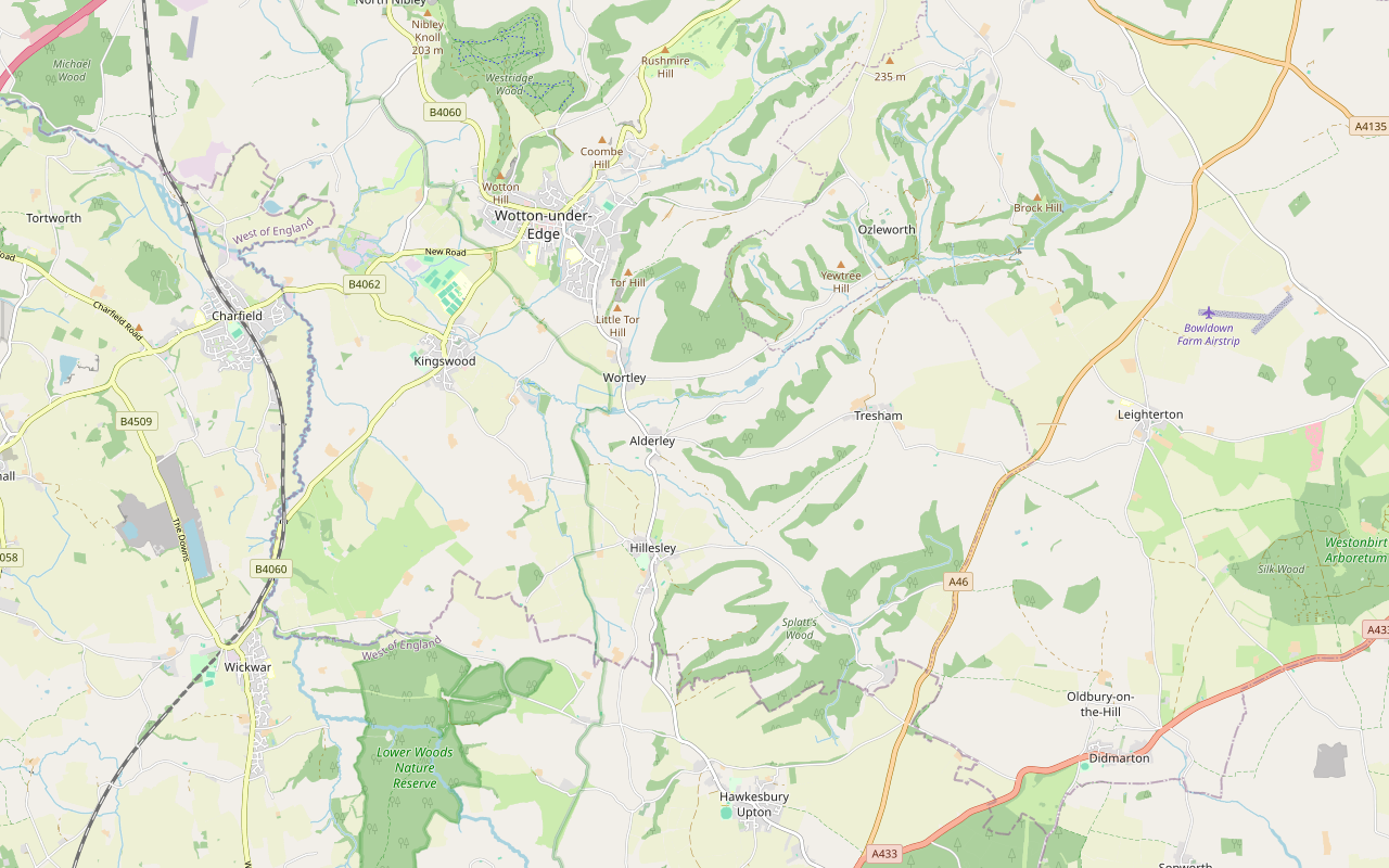
Step by step
-
Step 1: Through Wotton to Coombe
From the Jubilee Clock walk along Long Street and turn down Church Street past the Hugh Perry Almshouses. Cross School Road by the war memorial and follow The Cloud past Potters Pond car park and the Ancient Ram Inn, then go through the gate into the churchyard of St Mary's. Cross Culverhay and Coombe Road (the B4058) with care by the Bearpackers almshouses and walk along Valley Road for about 200m.
Take the footpath beside Dyer's Brook, through two gates, cross Holywell Road, and go through the kissing gate and over the stile. Follow the path along the brook through Holywell Leaze for about 300m to Coombe Lane.
- Stiles
-
Step 2: Up to Blackquarries Hill
Turn right along Coombe Lane for about 150m, then climb the bridleway on the left, a steep flight of steps and a sunken path, to the lane on Blackquarries Hill. Follow the lane uphill for about 900m; there is no pavement, so keep to the side and listen for traffic. The climb from Coombe is about 130m.
- Steep section
-
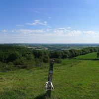
Step 3: Past Newark Park and along Wortley Hill
At the top leave the lane for the bridleway track on the right. Newark Park's entrance is to your left after about 100m, and an information board points to Blackquarries Hill Long Barrow. Go through the gates and follow the footpath along the top of the scarp through the woods for about 2km, then drop steeply down the field paths and through two gates to Hillmill Lane at Wortley.
- Steep section
- Muddy in winter
-
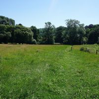
Step 4: Wortley to Alderley
Cross Hillmill Lane and follow the footpath across the fields for about 400m, through a kissing gate, to Kennerwell Lane. Follow this sunken bridleway through the trees, over the Ozleworth Brook and through two gates, to Winterspring Lane. Cross it and walk along the lane into Alderley, past St Kenelm's Church, and cross Alderley Road.
-
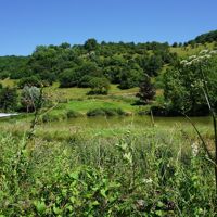
Step 5: The valley to Lower Kilcott
Follow the restricted byway south-east out of Alderley along the valley, a track through six gates for about 1.5km, then a short track to Kilcott Road. Walk along this quiet lane beside the millstream for about 1.1km, past two gates, to the hamlet of Lower Kilcott.
- Muddy in winter
-
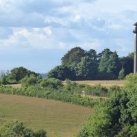
Step 6: Up to the Somerset Monument and Hawkesbury Upton
At Lower Kilcott take the bridleway on the right, which climbs about 70m through Splatt's Wood, then follow the footpath and the track along the edge of Hennel Wood for about 1km. Go through the gate and along the path to the road by the Somerset Monument. Follow the road into Hawkesbury Upton for about 400m, crossing Starveall Lane, past the pond and the bus stop, and turn down Bath Lane. The section ends about 300m along it, past the gate.
- Steep section
Sights on the way
The sights this walk passes, numbered as on the map.
-
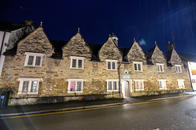
Hugh Perry Almshouses, Wotton-under-Edge
Sight · Historic building · Wotton-under-Edge
The Hugh Perry Almshouses on Church Street in Wotton-under-Edge were built in 1638 from the bequest of a London alderman from the town, and extended for Thomas Dawes's charity from 1723, round a courtyard with a small chapel. Grade II; still homes.
-
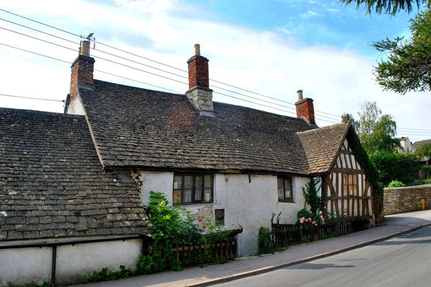
The Ancient Ram Inn, Wotton-under-Edge
Sight · Historic building · Wotton-under-Edge
The Ancient Ram Inn is a late medieval house at Potters Pond in Wotton-under-Edge, by the church, with a jettied timber-framed gable. Often dated to 1145, its timbers were felled in 1495 to 1496. Grade II*; private, with booked paranormal events.
-
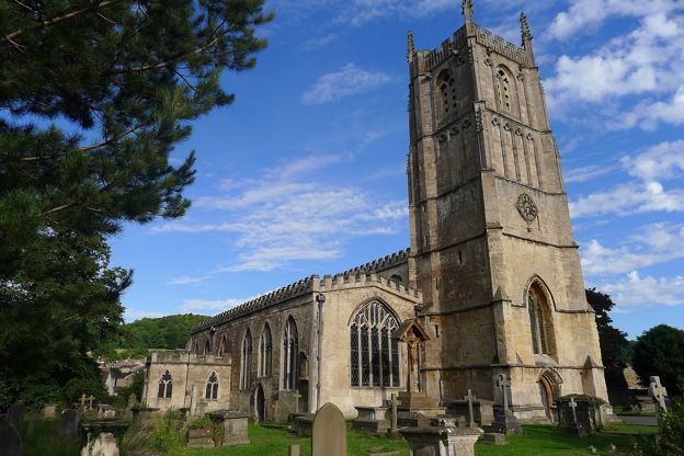
St Mary's Church, Wotton-under-Edge
Sight · Church · Wotton-under-Edge
St Mary's is Wotton-under-Edge's Grade I parish church, with late thirteenth-century arcades, a six-stage fourteenth-century tower, the brasses of Thomas, Lord Berkeley and his wife, and an organ bought in 1800. Open daily.
-
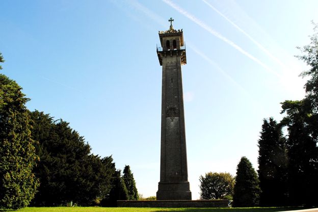
Somerset Monument, Hawkesbury Upton
Sight · Monument · The South Cotswolds
The Somerset Monument is a tower about 30m high on the Cotswold Edge at Hawkesbury Upton, built in 1846 by Lewis Vulliamy in memory of General Lord Robert Edward Somerset, of Waterloo. On the Cotswold Way, seen from outside; Grade II* and on the Heritage at Risk register.
The walk in detail
The Cotswold Way from Wotton-under-Edge to Hawkesbury Upton is a one-way walk of 7.8 miles (12.6km) from the Jubilee Clock in Wotton-under-Edge, up past Newark Park and along Wortley Hill, down through Alderley and the valley to Lower Kilcott, then up to the Somerset Monument and Hawkesbury Upton. It is moderate, climbs about 340m and takes about four and three quarter hours.
It is the twelfth of the fifteen sections of the Cotswold Way. The National Trail gives it as 7.4 miles (11.9km); the line we follow is about 0.7km longer, partly because it runs on along Bath Lane beyond the village pond, where the next section begins.
What the walk is like
Two climbs bracket the day: up from Coombe by steps and a steep lane to the top of the scarp near Newark Park, and up from Lower Kilcott through Splatt's Wood to the Somerset Monument. In between the trail runs along the wooded edge of Wortley Hill, drops to the Ozleworth Brook, and follows a quiet valley that the National Trail notes for its medieval ridge and furrow. There are about 2km on lanes, including the climb up Blackquarries Hill and the stretch beside the millstream at Lower Kilcott.
In September 2026 the National Trail closed a stretch near Wortley in an emergency, after drought and high winds, with a diversion due to run until the end of that month. At the end of October its trail information page still listed a temporary diversion at Wortley, so check its notices for that stretch before you go.
Wotton's almshouses and church
The first kilometre is a walk through the old town. The Hugh Perry Almshouses on Church Street were built in 1638 round a courtyard with a small chapel, and are still homes. Beyond them the Ancient Ram Inn is a late medieval house whose timbers were felled in 1495 and 1496, private and listed Grade II*, and St Mary's is the town's Grade I church, open daily, with the brasses of Thomas Berkeley and his wife.
Newark Park and the valley
Newark Park, a few minutes off the trail at the top of the first climb, is the National Trust's Tudor hunting lodge, built about 1550 by Sir Nicholas Poyntz and given to the Trust in 1949. It has a winter closure, so check the Trust's site for its days. Our loop from Wotton by Wortley Hill uses this stretch of the trail and has a detour into the park.
Alderley is a small village round St Kenelm's Church, at the bottom of the sunken lane the National Trail singles out for this section. From there to Lower Kilcott the trail keeps to the valley floor, and the last 1km follows the lane beside a clear millstream.
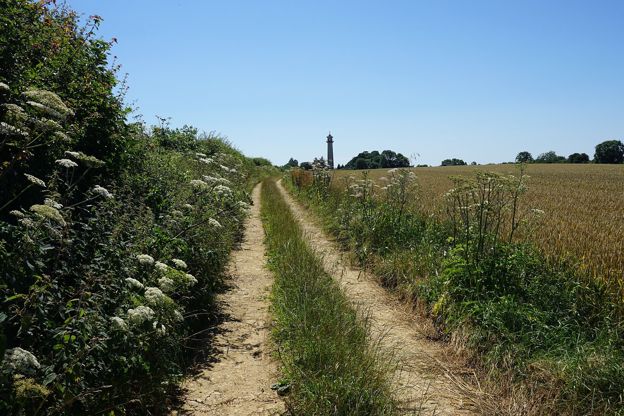
The Somerset Monument and Hawkesbury Upton
The Somerset Monument is a tower about 30m high, built in 1846 by Lewis Vulliamy in memory of General Lord Robert Edward Henry Somerset, a son of the fifth Duke of Beaufort who fought at Waterloo. It is listed Grade II* and seen from outside only. Hawkesbury Upton is the village just south of it, in the South Cotswolds, with a pond by the road that the National Trail calls an ancient drovers' pond.

The Cotswolds Info newsletter
Events, new places and the best of the season, about once a month. Unsubscribe at any time.
Where to eat and sleep
Wotton has the most choice: the Royal Oak on Haw Street opens from midday Tuesday to Sunday, and the town has cafés and other pubs. We found nowhere to eat on the way. In Hawkesbury Upton the Beaufort Arms on the High Street, a Grade II listed pub said to date from 1602, opens every day from noon and serves food every lunchtime from noon to 2.30pm and from 6pm to 9pm Monday to Saturday; dogs are welcome in the public bar but not the lounge or dining room. For rooms, the National Trail's accommodation pages list places in and around the village.
Getting back to the start
This is one of the easiest sections to do by bus. The Eurocoaches Y8 runs from Hawkesbury Upton pond to Wotton-under-Edge in about 12 minutes, seven or eight times a day on weekdays and every two hours on Saturdays. There is no Sunday bus. Park in Wotton, walk to Hawkesbury Upton, and ride back.
When to go
Spring, for the woods on Wortley Hill and the valley at its greenest; the lanes make it a reasonable choice in winter too, though the field paths by Wortley and the valley track are muddy after rain.
Places on the way
-

The Royal Oak, Wotton-under-Edge
Pubs · Wotton-under-Edge
A neighbourhood pub and kitchen on Haw Street, Wotton-under-Edge, serving pub classics from South West producers, open Tuesday to Sunday from midday.
Family-friendly
Verified Oct 2026
-
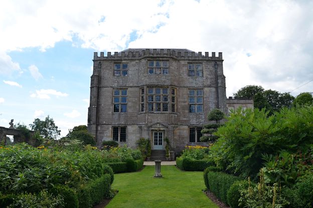
Newark Park
Historic houses and heritage · Wotton-under-Edge
A Tudor hunting lodge of about 1550 on the edge of a valley above Ozleworth, near Wotton-under-Edge, restored by the American architect Bob Parsons and now the National Trust's, with a three-level garden, 700 acres and wide views.
Dog-friendly · Family-friendly · Walker-friendly
Verified Oct 2026
Stay near the start
Inns, cottages and hotels within a short drive of where the walk begins, so you can set off early.
Where to stay in Wotton-under-Edge-
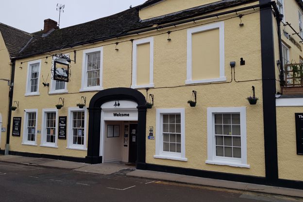
The Swan Hotel
Hotel · Wotton-under-Edge
A Grade II listed coaching inn on Market Street in the middle of Wotton-under-Edge, with 18 en-suite rooms, a restaurant and bar, and dogs welcome.
Dog-friendly · Walker-friendly
Verified Nov 2026
-
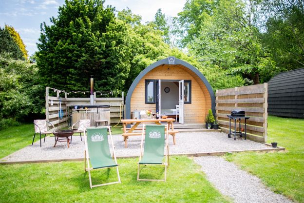
Hunts Court Huts
Glamping · North Nibley
Two glamping pods and a shepherd's hut for two, each with its own wood-fired hot tub, on a working farm at Forthay, North Nibley, by the Cotswold Way.
Hot tubs · Walker-friendly
Verified Oct 2026
-
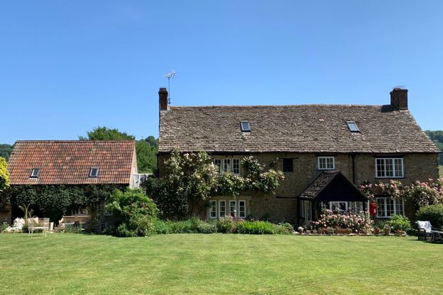
Forthay Bed and Breakfast
B&B · North Nibley
A late seventeenth-century farmhouse B&B with four rooms for two in the hamlet of Forthay, below the Tyndale Monument at North Nibley, on the Cotswold Way.
Dog-friendly · Walker-friendly
Verified Nov 2026
More like this
More walks to try
-
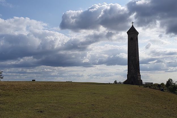
Cotswold Way: Dursley to Wotton-under-Edge
Walk · Starts in Dursley · 4 hrs, 30 mins · Dog-friendly
A 7.5-mile (12km) one-way walk on the eleventh section of the Cotswold Way, moderate and about four and a half hours: from Dursley round the rim of Stinchcombe Hill, down to North Nibley, up to the Tyndale Monument and along the ridge to Wotton-under-Edge.
-
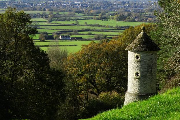
Cotswold Way: Hawkesbury Upton to Tormarton
Walk · Starts in the South Cotswolds · 4 hrs, 15 mins · Dog-friendly
A 7.2-mile (11.6km) one-way walk on the thirteenth section of the Cotswold Way, moderate and about four and a quarter hours: from Hawkesbury Upton down Bath Lane, over two Iron Age hill forts, through Old Sodbury and across Dodington Park to Tormarton.
-
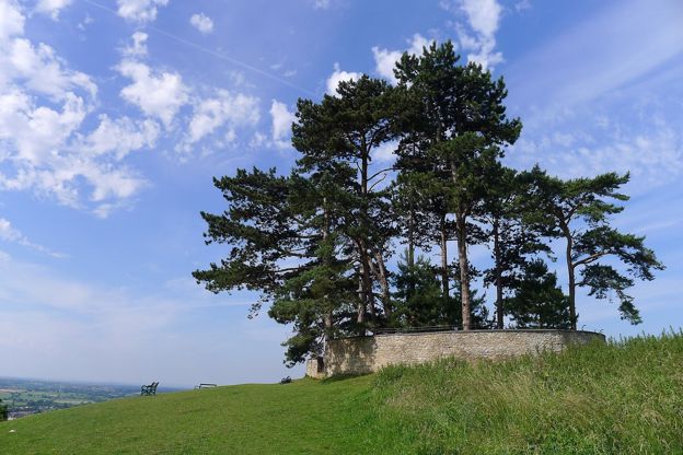
Wotton, the Tyndale Monument and Coombe Hill
Walk · Starts in Wotton-under-Edge · 4 hrs, 15 mins · Circular
An 8.5-mile (13.5km) moderate loop of four to four and a half hours from Wotton-under-Edge, with three big climbs: to the Tyndale Monument, down to North Nibley, north towards Stinchcombe Hill, round by Hermitage Wood and Waterley Bottom, and back over Coombe Hill.