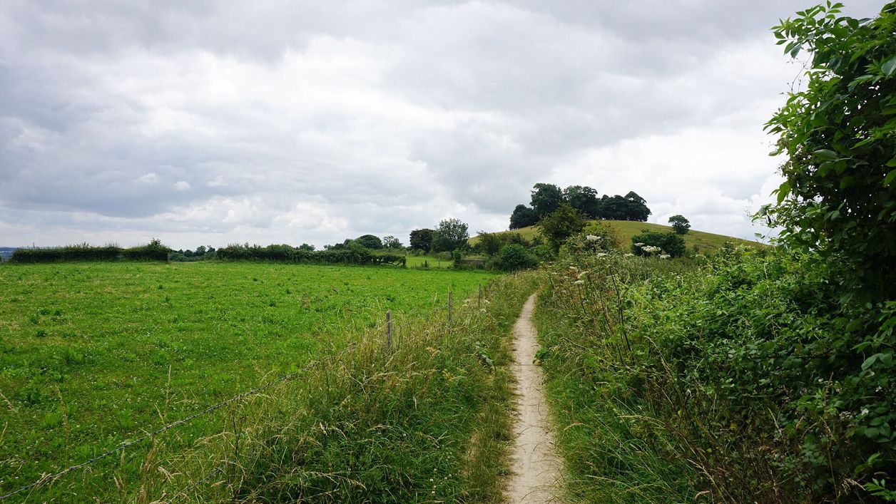
Bill Boaden, CC BY-SA 2.0, via Wikimedia Commons
Cotswold Way: Cold Ashton to Bath
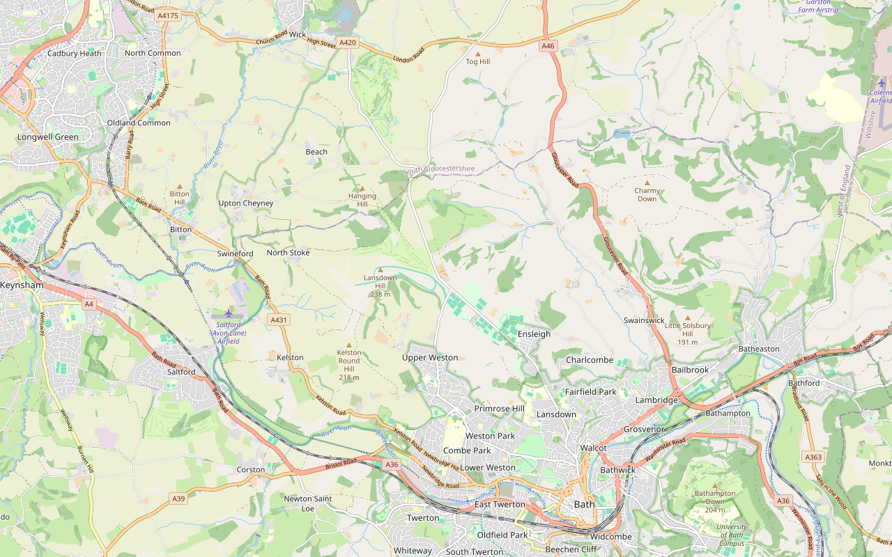
A 10.2-mile (16.5km) one-way walk on the last section of the Cotswold Way, hard and about six hours: from Cold Ashton down to Lower Hamswell, up to the Lansdown battlefield, along the top past Bath Racecourse, and down through Weston to the stone disc at Bath Abbey.
- Distance
- 16.5 km (10.3 mi)
- Difficulty
- Hard
- Time
- 6 hrs
- Ascent
- 225 m
- Circular
- One way
The route
Starts at Hyde's Lane, Cold Ashton follows the Cotswold Way for a while Steep sectionMuddy in winterLivestock in fieldsDogs on lead near sheepStilesRoad walking Download GPX
Step by step
-
Step 1: Cold Ashton down to Lower Hamswell
From Hyde's Lane in Cold Ashton walk west for about 450m and cross the A46 with great care. Follow Greenway Lane, a lane and then a track, for about 1.3km, over a stile and past Hill Farm, through a gate and a kissing gate over a stream. Take the footpath down the fields through two gates and over a stile to Hall Lane at Lower Hamswell, about 110m below the start.
- Stiles
- Steep section
-
Step 2: Up to the Lansdown battlefield
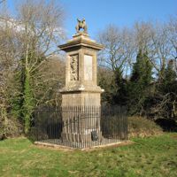
Follow the track over two cattle grids, cross the stream, and take the footpath up the fields through a kissing gate and over a stile. The climb is steep, about 130m in 1.7km. Go through two kissing gates, follow the bridleway through a gate and the footpath over two stiles to Sir Bevil Grenville's Monument, then cross Lansdown Road with care at about 4.7km.
- Steep section
- Stiles
- Dogs on lead
-
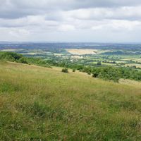
Step 3: Along the top past Hanging Hill and the golf course
Follow the track and the footpath through two kissing gates and along the edge of Beech Wood, over a stile and through a gate to Hanging Hill. Continue along the edge through two kissing gates and two gates, then follow the bridleway tracks past Lansdown Golf Club and the ring of sculptures by its sixth green. Watch for golf balls. Go through a kissing gate, past Pipley Wood, over a stile and through a gate on to a byway at about 7.5km.
- Stiles
-
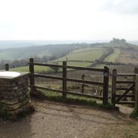
Step 4: Little Down and Prospect Stile
Leave the byway for the footpath south, which runs for about 1.2km along the edge of the plateau through three kissing gates, by the spur of Little Down with its hill fort, and past Bath Racecourse. At about 9.1km reach Prospect Stile, now a kissing gate, where Bath first comes into view in the valley below.
-
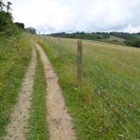
Step 5: Down by Kelston Round Hill to Weston
Go through two kissing gates and follow the bridleway south-east along the slope for about 1.7km, through gates, over a stile below Kelston Round Hill and through a kissing gate, then over another stile to Deanhill Lane. Cross it, go over the stile and down the field paths through two gates and two kissing gates past the school to Weston Recreation Ground and Penn Hill Road. The descent from Prospect Stile is steep in places, about 170m in 3.5km.
- Steep section
- Stiles
- Muddy in winter
-

Step 6: Weston to Bath Abbey
Follow Penn Hill Road and the High Street in Weston, then the path along Church Street by All Saints' Church and up Church Road. Take the paths and steps through Homemead Park and over Primrose Hill, through several gates and kissing gates, and up the steps to Summerhill Road and Sion Hill. Cross the High Common on the footpath, cross Weston Road with care, and follow the lanes past Royal Victoria Park to Marlborough Buildings.
Walk along Gravel Walk and Brock Street past the end of the Royal Crescent, round The Circus and down Gay Street, crossing George Street, to Queen Square. Follow Wood Street, Quiet Street and New Bond Street, crossing Milsom Street, then Burton Street, Union Street and Stall Street to the Abbey Churchyard. The trail ends at the carved stone disc in the pavement outside the west doors of Bath Abbey.
The walk in detail
The Cotswold Way from Cold Ashton to Bath is the last section of the trail, a one-way walk of 10.2 miles (16.5km) from Cold Ashton down into the valley at Lower Hamswell, up to the Lansdown battlefield, along the top past Bath Racecourse and down through Weston to Bath Abbey. It is hard for its length: the National Trail gives it about 225m of climbing and 400m of descent, and it takes about six hours. Bath has everything at the end.
It is the fifteenth of the fifteen sections of the Cotswold Way, and the longest; the National Trail's 10.2 miles (16.5km) matches our line. The last 4km are city streets, from Weston through Georgian Bath to the Abbey. The fourteenth section, from Tormarton, ends where this one starts, in Cold Ashton.
What the walk is like
The first 5km are the hardest: a long descent into the quiet valley at Lower Hamswell and a steep climb out of it to the battlefield on Lansdown. Then the trail runs level along the plateau for about 4km, past a golf course, Little Down and the racecourse, to Prospect Stile. From there it is downhill, steeply at first, through fields to Weston and then on pavements into the city. There are about ten stiles, mostly before the golf course and below Kelston Round Hill, and one crossing of the A46 near the start.
The Lansdown battlefield
The Battle of Lansdown was fought on the hill on 5 July 1643, when the royalist army fought its way up the steep slopes to Sir William Waller's parliamentarian position on the brow; English Heritage says the royalists held the field by nightfall and Waller withdrew, and Historic England registers the battlefield. Sir Bevil Grenville's Monument, beside the trail, remembers the royalist commander, fatally wounded leading his Cornish infantry. His grandson, Lord Lansdown, put it up in 1720. It is listed Grade II* and scheduled, English Heritage looks after it, and it is free to visit in daylight.
Further on, the National Trail points out a circle of sculptures by David Michael Mores beside the sixth green of Lansdown Golf Club. Little Down, the spur south of the trail before the racecourse, carries a hill fort, which the National Trail also points out: Historic England schedules it, and its single rampart and ditch run along the east side, above the Avon valley.
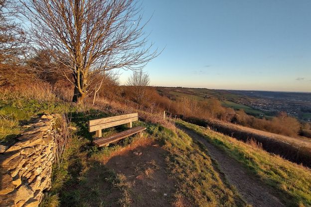
Prospect Stile and the walk into Bath
Prospect Stile, now a kissing gate, is where the National Trail says the first views of Bath open up below. The path drops past Kelston Round Hill to Weston, an old village now part of the city, then climbs over Primrose Hill and Sion Hill and comes down past Royal Victoria Park to the Royal Crescent and The Circus. From Queen Square it threads the shopping streets to the Abbey Churchyard.
The trail ends at a carved stone disc set into the pavement outside the west doors of Bath Abbey, the twin of the one at the start of the trail in Chipping Campden, 102 miles away, where the first section begins. The Abbey opens Monday to Friday from 10am to 5.30pm, Saturday from 10am to 6pm and Sunday from 1pm to 3.30pm, with last entry 30 minutes before closing (2026).

The Cotswolds Info newsletter
Events, new places and the best of the season, about once a month. Unsubscribe at any time.
Where to eat and sleep
Cold Ashton has no pub open, though the Catherine Wheel in Marshfield, about 2 miles east, has rooms for the night before, and Dyrham Park, the National Trust house on the previous section, is about 2 miles north. There is nothing on the way until Weston, so carry food and water for the first 12km. In Bath every kind of café, pub and hotel is within a few minutes of the Abbey, and our guide to Bath covers the station, the park and ride and the buses on into the southern Cotswolds.
Getting there and getting home
Getting to Cold Ashton is the hard part. The Faresaver 35 runs from Kingswood and Wick, on the Bristol side, eight times a day from Monday to Saturday, and the Coachstyle X79 leaves Bath Guildhall at 1.15pm on Thursdays only, reaching Cold Ashton at about 1.30pm, which leaves a short afternoon for six hours' walking. If you are not walking the whole trail, the Stagecoach West 620 from Bath to the Lansdown Battlefields stop, five times a day from Monday to Saturday, puts you on the trail by Grenville's Monument for the last 12km.
From the Abbey, Bath Spa station is about 500m south, with direct trains to London Paddington. If you drove, Lansdown park and ride is on the hill above the city, and parking there is free if you use the 31 bus and come back the same day; the bus runs every 15 minutes in the daytime, until 6pm on Sundays.
When to go
Any clear day: the views from Lansdown and Prospect Stile are the reason to walk it, and in winter they are at their longest. Expect mud on the field paths below Lansdown and Kelston Round Hill after rain and through the winter.
Places on the way
-
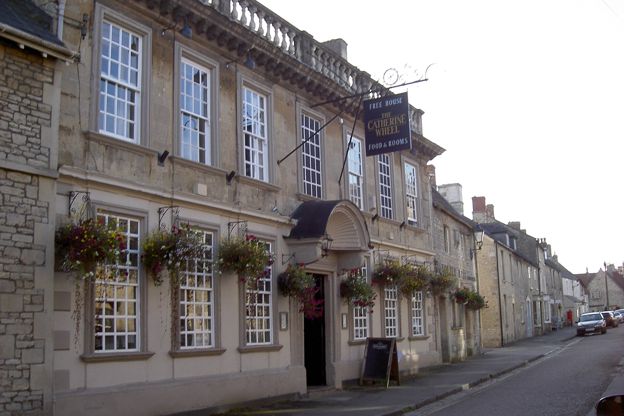
The Catherine Wheel, Marshfield
Pubs · Marshfield
A Grade II* listed seventeenth-century inn on Marshfield's High Street, about 8 miles north of Bath by road, with real ales, three bed and breakfast rooms, a private dining room and dogs welcome in the pub.
Dog-friendly
Verified Oct 2026
-
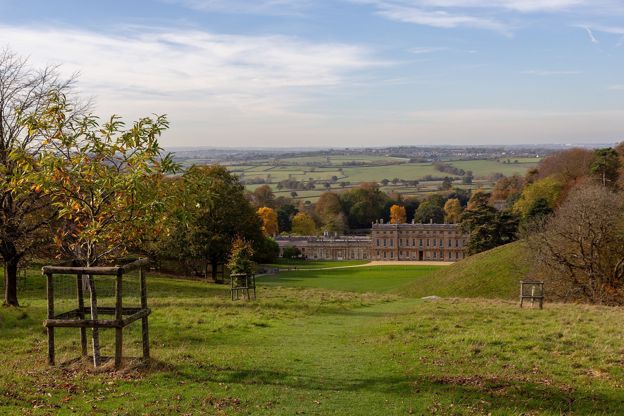
Dyrham Park
Historic houses and heritage · Marshfield
William Blathwayt's baroque house of the 1690s below the Cotswold edge north of Bath, with a 270-acre deer park, a West Garden and Delftware, cared for by the National Trust and open through the winter as well as the summer.
Family-friendly
Verified Oct 2026
Stay near the start
Inns, cottages and hotels within a short drive of where the walk begins, so you can set off early.
Where to stay in Marshfield-
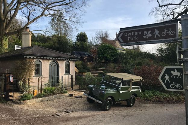
Gatekeepers Lodge
Self-catering · Dyrham
A former toll house on Upper Street, Dyrham, let as a holiday cottage for two, beside Dyrham Park and on the Cotswold Way.
Walker-friendly
Verified Oct 2026
-
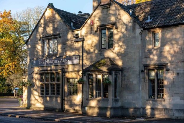
The Northey Arms
Inn · Box
A Butcombe pub with 13 en-suite rooms on the Bath Road at Box, serving food from breakfast to evening, with a big garden and a children's play area.
Dog-friendly · Family-friendly
Verified Nov 2026
More like this
Stories on this walk
-
The Civil War in the Cotswolds
Story · History · 9 minute read
The storming of Cirencester and the battle of Lansdown in 1643, Sudeley Castle besieged and slighted, Campden House burned, the last battle of the first war at Stow in 1646, the Levellers at Burford and Chastleton's hidden Royalist, with where to see each.
More walks to try
-
Cotswold Way: Tormarton to Cold Ashton
Walk · Starts in the South Cotswolds · 3 hrs, 45 mins · Dog-friendly
A 6.6-mile (10.6km) one-way walk on the fourteenth section of the Cotswold Way, moderate and about three and three quarter hours: from Tormarton over the M4, round the wall of Dyrham Park, through Dyrham village and up through Dyrham Woods to Cold Ashton.
-

The Cotswold Way
Walk · Dog-friendly
The Cotswold Way is a 102-mile (164km) National Trail walk from Chipping Campden to Bath along the escarpment, in 15 sections; the official guidebook suggests seven to ten days, and its frequent steep climbs make it hard going.
-
Old Sodbury, the hill fort and the church
Walk · Starts in Chipping Sodbury · 2 hrs · Circular
A 2.5-mile (4km) circular walk from Old Sodbury, easy and stile-free with moderate slopes, in one and a half to two hours: up the Cotswold Way to the Norman church on the hill, over the double ramparts of Sodbury Camp, and back across the fields past medieval fish ponds.