The best viewpoints in the Cotswolds
The Cotswolds end in a long western edge, and from its top you look across the Severn Vale to the Malverns and Wales. These are the best places to stand, and the walks that reach them.
· 11 minute read
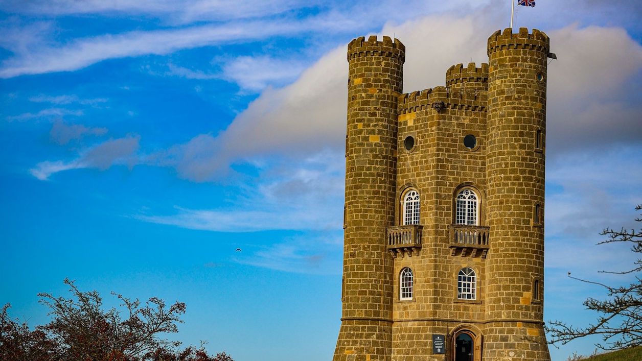
The best viewpoints in the Cotswolds are on its western edge, the escarpment above the Severn Vale and the Vale of Evesham: Broadway Tower and Dover's Hill in the north, Cleeve Hill, the highest ground in the Cotswolds, above Cheltenham, then Leckhampton Hill, Crickley Hill, Painswick Beacon and Haresfield Beacon, and in the south the Tyndale Monument and Wotton Hill. On a clear day the views run to the Malverns, the Forest of Dean and the Black Mountains and Brecon Beacons in Wales.
How we chose: these are the viewpoints, commons and hill forts that our sight pages describe, with what their owners say you can see. Almost all are free on foot, and every one is on or near a walk of ours.
Where is the best view in the Cotswolds?
The best view in the Cotswolds is from the western edge of Cleeve Common, where Cheltenham lies directly below and the view runs over the Vale of Evesham to the Malverns, the Black Mountains and, on the clearest days, the Shropshire hills. Broadway Tower, Haresfield Beacon and Crickley Hill come close, and Dover's Hill above Chipping Campden is the easiest to reach, along a level path from the car park.
Viewpoints in the north Cotswolds
Broadway Tower. James Wyatt's folly of 1798 stands on Beacon Hill, about a mile south-east of Broadway, at the top of the escarpment. Broadway Tower has a museum inside, a red deer park, two cafés and a Cold War nuclear bunker; the tower museum charges for entry, with tickets sold online, and the car park is £3 for up to four hours or £6 for the day (2026). The better way to arrive is on foot: the 6.5km walk from Broadway to the tower climbs Coneygree Lane and comes back down the Cotswold Way. The tower is the last stop of our one-day North Cotswolds trip, at the end of the afternoon.
Dover's Hill. A National Trust spur of the escarpment about a mile north-west of Chipping Campden, about 230m up, with a wide view west over the Vale of Evesham. At Dover's Hill a stone topograph near the car park names the hills and towns you can see, and a level grassy walk of a quarter of a mile (0.4km) there and back runs along the edge, which the Walks on Wheels leaflet (opens in a new tab) rates suitable for all. Robert Dover's Cotswold Olimpicks have been held here, on and off, since 1612. The National Trust car park charges non-members (opens in a new tab) from £1 for an hour to £4 for the day, paid through the JustPark app (2026); members park free. On foot, the 7.2km circuit from Campden climbs the Cotswold Way to it, and the Kiftsgate Stone is under a kilometre further along the trail towards Broadway.
Shenberrow Camp and Beckbury Camp. Two small Iron Age forts on the edge between Broadway and Winchcombe. Shenberrow Camp, high on the edge above Stanton, looks west over the Vale of Evesham, and the Cotswold Way runs through it on the loop from Stanton to Snowshill. Beckbury Camp, above Hailes, looks down over the Isbourne valley; the walk from Hayles Fruit Farm climbs the monks' track to it; the walk leaflet gives the farm's parking fee as £2.50, redeemable against what you spend in the farm shop or tearoom.
Cleeve Hill: the highest point in the Cotswolds
Cleeve Common is the largest common in the Cotswolds National Landscape (opens in a new tab), about 405 hectares of open grassland above Cheltenham, and the highest ground in the Cotswolds. The official top, at 330m, sits on a flat plateau beyond the radio masts with little to see; the viewpoint on the escarpment edge, at about 317m, is the one to walk to. From there Cheltenham lies directly below, and the view runs over the Vale of Evesham to the Malverns, the Black Mountains and, on the clearest days, the Shropshire hills. Cheltenham Racecourse lies under the hill, where the Cheltenham Festival is run each March.
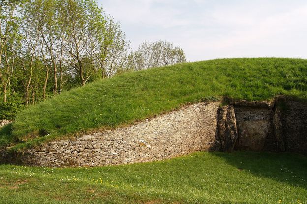
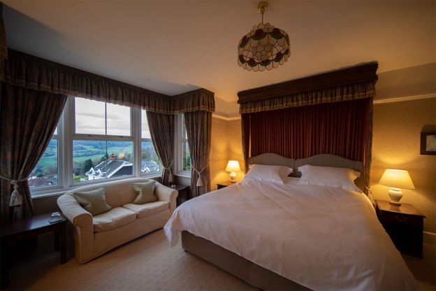
On the cliff edge at Cleeve Cloud is Cleeve Hill camp, a small Iron Age hill fort with two rings of rampart. The 6.4km loop over Cleeve Common and Cleeve Cloud takes about an hour and three quarters; the Quarry and golf club car parks charge £2 a visit (2026), paid by PayByPhone or at the machine outside the golf club. From Winchcombe, the longer walk by Belas Knap to Cleeve Common adds the Neolithic long barrow of Belas Knap. The Cleeve Hill bed and breakfast has a door onto the common.
The edge above Cheltenham and Gloucester
Leckhampton Hill. Common land on the escarpment above the south of Cheltenham, with the ramparts of Leckhampton Camp and its trig point, and the view over Cheltenham and the Severn Vale to the hills of Wales. Leckhampton Hill has car parks on Daisy Bank Road and off Hartley Lane, which walkers report as free, and a waymarked mobility scooter route of 3.6km from Brownstones car park. The 6.3km walk from Daisy Bank Road passes the Devil's Chimney, and the walk from Seven Springs comes along the Cotswold Way.
Crickley Hill. A promontory of the escarpment near Birdlip, owned by the National Trust and Gloucestershire Wildlife Trust (opens in a new tab), with one of the widest views on the scarp. From the end of the spur at Crickley Hill you look over the Severn Vale to May Hill and, on a clear day, the Brecon Beacons. There is a café, and the car park is £2.50 a day (2026), paid at the kiosk by the café or online within 48 hours; National Trust and Wildlife Trust members pay too. Come on a clear day, or in summer for orchids and butterflies.
Painswick Beacon. A hill 283m high north of Painswick, crowned by an Iron Age fort with triple ramparts on its west and south sides, believed to have been a Royalist outpost in 1643, during the siege of Gloucester. On the highest rampart of Painswick Beacon stands a trig pillar, and the view runs west over the Severn Vale towards the Forest of Dean and, on a clear day, the hills of Wales. It is open common land shared with a golf course. Walk up on the 8.2km circuit from Painswick, or park at the small car park off the B4073 near the top.
Haresfield Beacon. A National Trust spur north-west of Stroud where the scarp juts out over the Severn Vale, with a small Iron Age hill fort and a beacon mound carrying the trig point. From Haresfield Beacon the view runs over the Severn estuary to the Forest of Dean and, on a clear day, the Brecon Beacons; a topograph near the Shortwood car park names the hills. The National Trust car park charges non-members from £1 for an hour to £4 for the day (2026), at the machine or through the JustPark app, and is free to members, and the 7.2km loop through Standish Wood climbs back to the fort through the beeches.
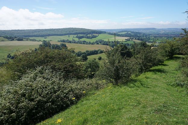
Viewpoints round Stroud: the commons and Swift's Hill
Above Stroud, the commons give views without much climbing. From the western edge of Rodborough Common you look over Stroud, the Frome valley and the Severn Vale, and the National Trust gives the car parks beside the road across it as free, a few metres from the flat top. The easy 3.4km walk round the common passes Rodborough Fort and the Bear of Rodborough. From the western edge of Minchinhampton Common the views run down into the valleys towards Nailsworth and Stroud.
Swift's Hill, a steep wildflower reserve above the Slad valley that appears in Cider with Rosie, looks down the valley and, on a clear day, as far as Wales, the Gloucestershire Wildlife Trust says; it gives April to August as the best time to visit. It is on the Laurie Lee Wildlife Way. At Randwick, the tiered garden of the Vine Tree looks over Stroud and the valleys.

The Cotswolds Info newsletter
Events, new places and the best of the season, about once a month. Unsubscribe at any time.
Viewpoints in the south Cotswolds
The Tyndale Monument and Wotton Hill. Above Wotton-under-Edge, the Tyndale Monument of 1866 stands on Nibley Knoll in memory of William Tyndale, translator of the first printed English New Testament. It is generally open, and if it is locked the notice board says where in North Nibley to find the key; from the top the view runs west over the Severn Vale and the river to Wales and along the Edge both ways. On Wotton Hill, Jubilee Clump, a ring of trees first planted in 1815 to mark the victory at Waterloo and replanted for Queen Victoria's jubilee inside a wall of 1888, looks west over the vale and north to the monument. The easy 5.8km ridge walk links the two, passing Brackenbury Ditches, an Iron Age fort in Westridge Wood.
Sodbury Camp. An Iron Age fort with two wide-spaced ramparts on the edge above Old Sodbury, where Edward IV camped on his way to the battle of Tewkesbury in 1471. From the scarp edge at Sodbury Camp the land falls away west towards the Severn, and on a clear day you can see Wales. The 4km stile-free circuit from Old Sodbury climbs the Cotswold Way to it; park free on Chapel Lane.
The Somerset Monument. At Hawkesbury Upton, the Somerset Monument, about 30m high, stands on the Cotswold Edge beside the Cotswold Way. It is on the Heritage at Risk register and not open to climb, so see it from the lane.
When to go for the best Cotswold views
Go on a clear day: the longest views, to the Malverns and the Welsh hills, need clear air. On a clear evening the light falls across the Severn Vale from the western edge. In winter, when the grass is short, the banks of the hill forts are easiest to read. The commons are grazed by cattle and sheep, so keep dogs on leads, and on open access land on a short lead from 1 March to 31 July. Our guide to walking and the outdoors in the Cotswolds has more, and the Cotswold Way links almost every viewpoint above.
Mentioned in this story
The places, sights and walks in this story, each with a page of its own: what it is, when to go and how to get there.
-
Belas Knap Long Barrow
Historic houses and heritage · Winchcombe
-
Cleeve Hill Hotel
B&B · Winchcombe
-
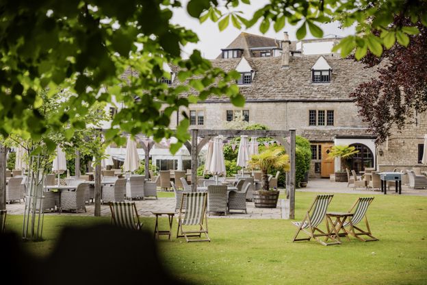
The Bear of Rodborough
Hotel · Stroud
-
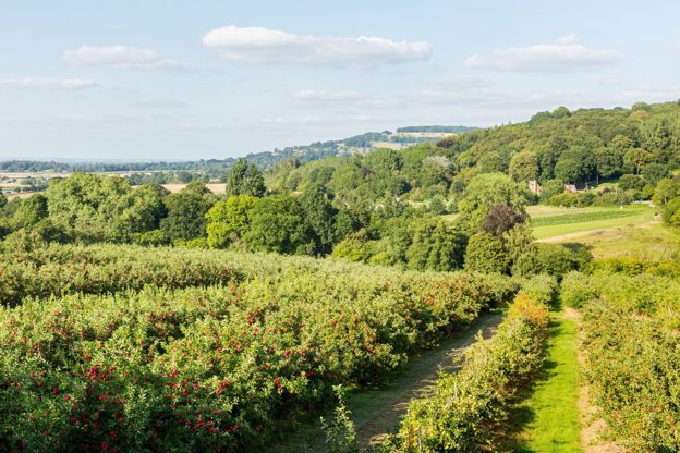
Hayles Fruit Farm
Farm shops and delis · Winchcombe
-
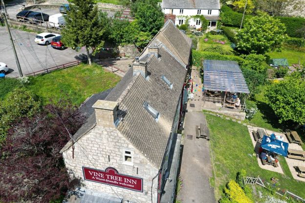
The Vine Tree Inn
Pubs · Stroud
-
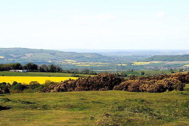
Cleeve Common
Sight · Common or park · The Cotswold Edge
-
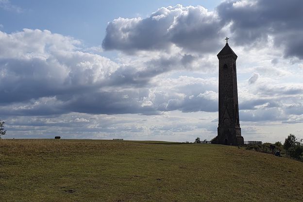
Tyndale Monument, North Nibley
Sight · Monument · Wotton-under-Edge
-
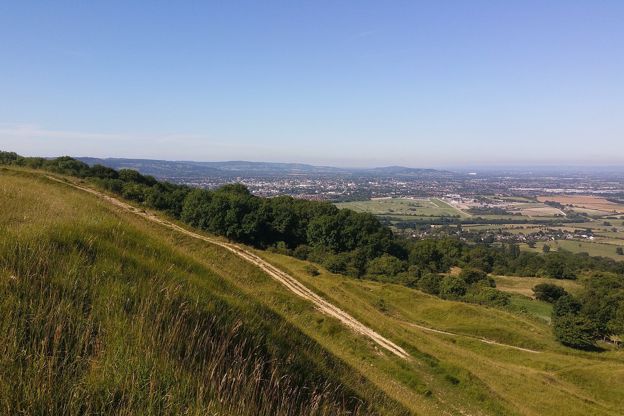
Cleeve Common and Cleeve Cloud
Walk · Starts in the Cotswold Edge · 1 hr, 45 mins · Circular · Dog-friendly
-
Haresfield Beacon and Standish Wood
Walk · Starts in Stroud and the Five Valleys · 2 hrs, 15 mins · Circular
Places to stay near the Cotswold Edge
-
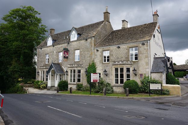
The Royal George Hotel
Pubs · The Cotswold Edge
An eighteenth-century inn in Birdlip, run by Greene King Inns, with a bar and restaurant of pub classics, a large beer garden and 34 bedrooms, where the Cotswold Way sections from Leckhampton Hill and to Painswick meet.
Dog-friendly · Walker-friendly · Family-friendly
Verified Oct 2026
Read next
-
Free things to do in the Cotswolds
Story · Guides · 11 minute read
Free things to do in the Cotswolds: open commons and viewpoints, Neolithic tombs and hill forts, ruins, wool churches, free museums in Malmesbury, Stroud, Woodstock and Burford, the Cotswold Way and Blenheim's public footpaths.
-
Walking, cycling and the outdoors in the Cotswolds
Story · Guides · 5 minute read
The Cotswold Way and other long walks, the cycle routes that follow the railway and the valleys, and the Cotswold Water Park's lakes: how to get outdoors in the Cotswolds.
-
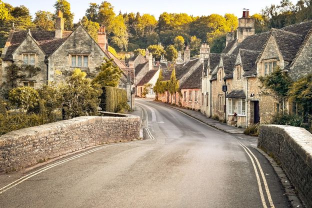
The best villages in the Cotswolds
Story · Guides · 13 minute read
The best villages in the Cotswolds, from Bibury, Castle Combe and the Slaughters to quieter Naunton, Eastleach and Biddestone: what to see in each, a walk from the green and a pub or tearoom.