Simon Burchell, CC BY-SA 4.0, via Wikimedia Commons
Salford and the Rollright Stones
A 5-mile (8km) circular walk from the green at Salford, moderate and about two and a half hours, with stiles: up bridleways and field paths to the Whispering Knights, the King Stone and the King's Men stone circle, then down through Little Rollright and back.
- Distance
- 8.0 km (5.0 mi)
- Difficulty
- Moderate
- Time
- 2 hrs, 30 mins
- Ascent
- 120 m
- Circular
- Circular
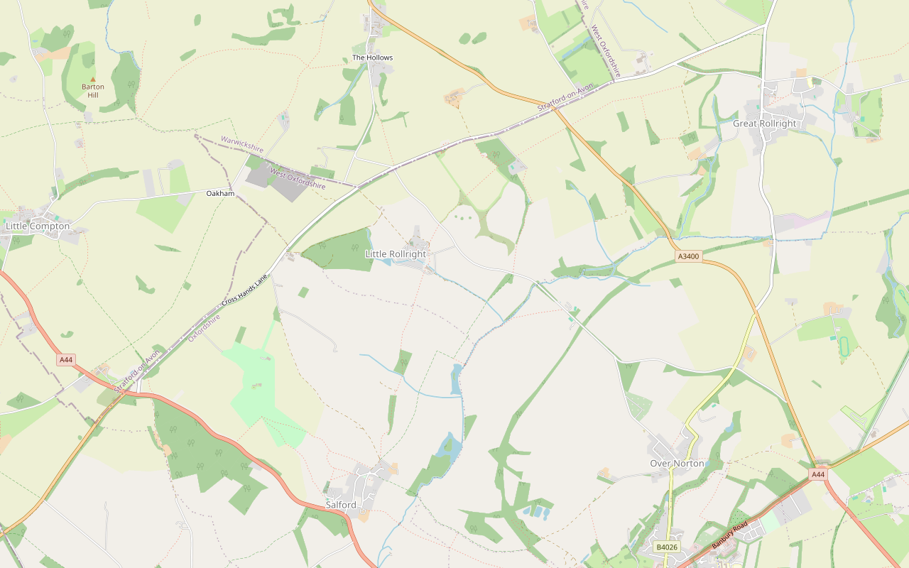
The route
Starts at The Green, Salford Muddy in winterStilesLivestock in fields Download GPX
Step by step
-
Step 1: Salford to the brook
From the lanes by the green in Salford, pick up the bridleway heading north-east out of the village. Walkers have found the start hard to spot, as it looks like a private garden, so follow the bridleway signs. Cross the footbridge and carry on north over the fields.
- Muddy in winter
-
Step 2: Up to Brighthill
Follow the bridleway north over Little Rollright Brook and on up the field paths, climbing gently to Brighthill Farm. In wet winters walkers report overflowing streams to cross on this side.
- Muddy in winter
-
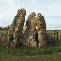
Step 3: The Whispering Knights and the King Stone
Beyond Brighthill, cross the stile and follow the path west along the field edge to the Whispering Knights. Carry on west on the Trust's path to the lane, and cross it with care to the King Stone in its railings.
- Stiles
-
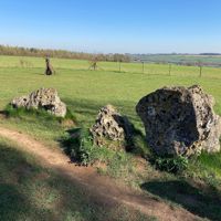
Step 4: The King's Men
Back over the lane, go through the kissing gate to the King's Men stone circle in its copse. Pay the entry fee at the honesty box or by the QR code. Then head back east along the permissive path and over a stile, and turn south down the public footpath.
- Stiles
- Dogs on lead
-
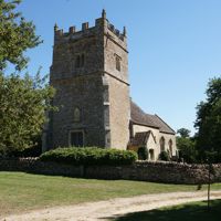
Step 5: Down to Little Rollright
Follow the footpath down the slope to Little Rollright, where St Philip's church, the Old Rectory and Manor Farmhouse stand a short way to the right of the path. Cross Little Rollright Brook.
-
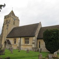
Step 6: Back to Salford
Keep south on the field path through a series of gates, then over the four stiles in the last mile into Salford, finishing on Cooks Lane by the green.
- Stiles
Sights on the way
The sights this walk passes, numbered as on the map.
-
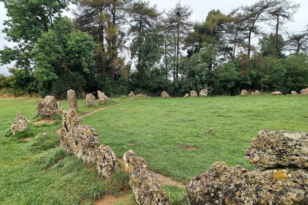
The Rollright Stones
Sight · Hill fort or barrow · The Oxfordshire Cotswolds
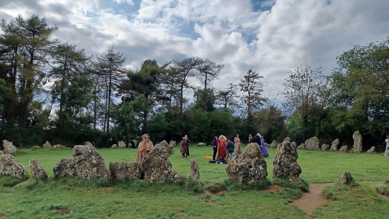
The Rollright Stones are three prehistoric monuments on a ridge on the Oxfordshire and Warwickshire border, built over nearly 2,000 years: the Whispering Knights burial chamber of about 3800 BC, the King's Men circle of about 2500 BC and the King Stone. Open daily; small fee.
The walk in detail
The Salford and Rollright Stones walk is a 5-mile (8km) circular walk from the green at Salford, north-west of Chipping Norton in the Oxfordshire Cotswolds, to the three monuments of the Rollright Stones. It is moderate, with about 120m of climbing and several stiles, and takes about two and a half hours, with no pub on the way.
The stones sit on the ridge at the walk's northern end; Salford and the hamlet of Little Rollright lie in the fields below, and the way back runs through Little Rollright.
Three monuments, two thousand years apart
The Rollright Trust, a charity run by volunteers, owns and manages the stones. It dates the Whispering Knights, the first you reach, to perhaps 3800 BC: a portal dolmen, a burial chamber of four upright stones and a fallen capstone, about 400m east of the circle. The capstone sat on top until the eighteenth century, and the Trust reckons more than 60 people may have been needed to move the stones.
The King's Men circle was put up around 2500 BC. Seventy-odd weathered stones of local oolitic limestone stand in a ring about 31m across, and the Trust thinks there may once have been about 105, set shoulder to shoulder. It is a Dark Sky Discovery Site, used by local astronomers as a field observatory. Across the lane, the King Stone was most likely raised around 1500 BC as a memorial to a burial ground beside it; its odd shape is mostly the work of nineteenth-century souvenir hunters chipping off pieces, which helped bring the stones into legal protection in the 1880s.
The folklore of a king, his army and his plotting knights turned to stone by a witch is in our story on ley lines and the Rollright Stones, and the stones are among our strange things in the Cotswolds.
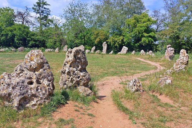
Visiting the stones
There is no automatic public right of access to the stones, and the Trust asks for a small fee: £2 for adults and £1 for children aged 7 to 16, paid online, by a QR code on site, at the honesty box by the circle in daylight, or to the warden on duty. Walkers report wardens asking for the same. The site is normally open all year. Do not sit or climb on the stones, which are scheduled monuments covered in old and delicate lichens, and keep dogs on leads, away from the stones and out of the circle. Benches by the King's Men and the Whispering Knights make a picnic stop, but there are no toilets or other facilities at the stones.
The Trust says the road past the stones is often busy with lorries, so cross carefully, and warns of thefts from cars in the two small laybys.

The Cotswolds Info newsletter
Events, new places and the best of the season, about once a month. Unsubscribe at any time.
Little Rollright and Brighthill
On the way up, Brighthill Farmhouse is probably seventeenth century, remodelled in 1782, the year on a datestone that once sat over its door. On the way down, Little Rollright's church of St Philip has a chancel probably of the early thirteenth century and a tower built, or rebuilt, in 1617 for William Blower, whose arms and that date are on a tablet on it. The Old Rectory beside it has a datestone of 1640, and a barn north of the church carries two, one inscribed WB 1616, probably for Blower, and one of 1801.
What walkers report
The Black Horse in Salford closed in September 2025, as walkers also reported that autumn, and was offered for sale at auction in October 2026, so bring food: there is nowhere to eat on the walk. Expect stiles, which several walkers had to lift dogs over (May and August 2026), and sheep rather than cattle in the fields (September 2026). In summer parts are overgrown and buggy (June and July 2026). After a wet winter it is muddy and boggy, with overflowing streams to cross (December 2025, February 2026), and in the shooting season walkers have heard guns nearby and met pheasants. It is quiet midweek, busier at the stones.
Parking and dogs
The route gives no car park: walkers report limited roadside parking in the village, so leave room for residents, and one found the start hard to find because it looks like a private garden (December 2025). Some walkers start at the stones instead, but the Rollright Trust asks people not to park in its two small laybys, which fill quickly, as a base for a longer walk. One walker found the loop better walked the other way round.
Dogs are welcome on the walk but must be on leads at the stones, away from them and out of the circle, as the Rollright Trust asks. Walkers lifted dogs over several stiles and met sheep and pheasants, so keep a lead handy; our guide to the Cotswolds with a dog has the rules near sheep.
Paths and nearby walks
The route follows Salford and Rollright bridleways, field footpaths and, near the stones, the Trust's own permissive paths; the stretch from the King's Men down to Little Rollright is a public footpath. For a shorter visit, the National Landscape lists a half-mile walk at the stones among its easiest routes, in our guide to the accessible Cotswolds. A few miles south-west, Kingham, Daylesford and the Evenlode is a flatter walk of about the same length, from a village with a station and two pubs, and our guide to Kingham has more on it.
A few miles west, Chastleton House is a Jacobean house built on the estate Robert Catesby sold in 1602, as our story on Catesby, Chastleton and the Gunpowder Plot tells. From Kingham station, the car-free loop to Bledington crosses the Evenlode into Gloucestershire to the King's Head.
Stay near the start
Inns, cottages and hotels within a short drive of where the walk begins, so you can set off early.
Where to stay in the Oxfordshire Cotswolds-
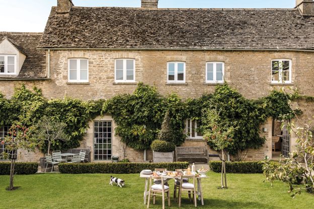
Daylesford Stays cottages
Self-catering · Kingham
Self-catering cottages in Daylesford village and on Daylesford's organic farm near Kingham, all within two miles of the farm shop, and all of them dog-friendly.
Dog-friendly
Verified Nov 2026
-
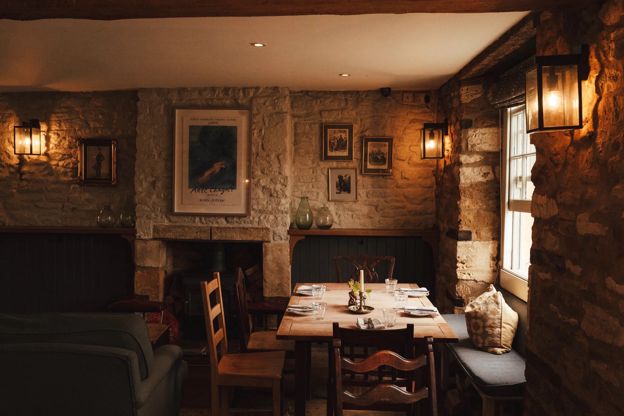
The Kingham Plough
Inn · Kingham
A pub with six rooms and a cottage on the green at Kingham, open daily from 8.30am, with dogs and families welcome.
Car-free · Dog-friendly · Family-friendly
Verified Nov 2026
-
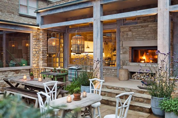
The Wild Rabbit
Inn · Kingham
A Daylesford pub with rooms and cottages in a 17th-century house at Kingham, with three AA Rosettes and dinner from Wednesday to Sunday.
Wedding venues
Verified Nov 2026
More like this
Stories on this walk
-
Clarkson's Farm: visiting Diddly Squat and the Farmer's Dog
Story · Guides · 7 minute read
Where Clarkson's Farm is made, what you can and cannot see at Diddly Squat Farm Shop near Chadlington and at the Farmer's Dog near Burford, and how to visit without the worst of the queues.
-
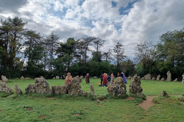
Ley lines and the Rollright Stones
Story · Strange Things · 5 minute read
Alfred Watkins saw straight old tracks across the English landscape in 1921. Later writers made them lines of mystic energy. Here is what is actually known.
More walks to try
-
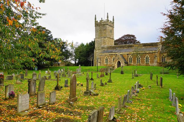
Kingham, Daylesford and the Evenlode
Walk · Starts in Kingham · 1 hr, 30 mins · Circular · Dog-friendly
A flat 4.4-mile (7.1km) circular walk of about an hour and a half from Kingham: north-west on bridleways across Daylesford's fields to the Evenlode, back down the river meadows and over the Cotswold Line on the level. Walkers report it wet and often flooded in winter.
-
Kingham station and Bledington
Walk · Starts in Kingham · 3 hrs · Circular
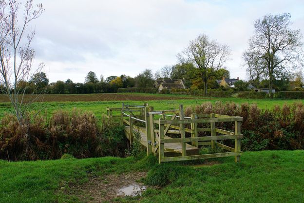
A 3.5-mile (6km) car-free circular walk from Kingham station, easy and two to three hours with stiles and a boggy patch: along the River Evenlode into Gloucestershire, over the old railway and past a pond, then to Bledington's green and the King's Head, and back by the river.
-
Moreton-in-Marsh and Batsford
Walk · Starts in Moreton-in-Marsh · 2 hrs · Circular
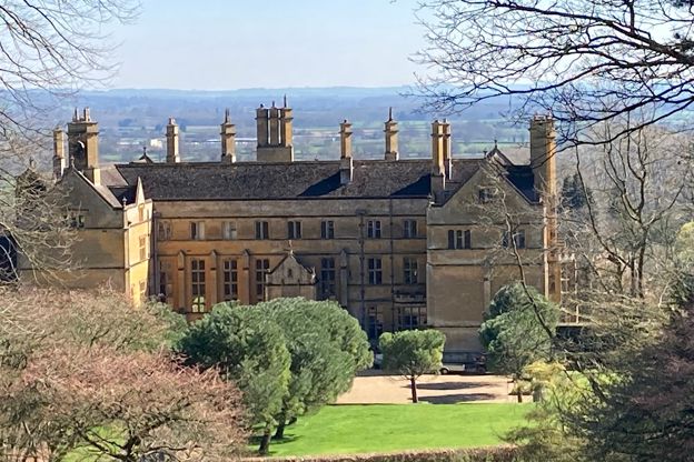
A 4-mile (6.4km) circular walk from Moreton-in-Marsh's war memorial, easy, stile-free and about two hours: west through field gates to Batsford, along the deer park below Batsford House, east on the watershed lane to Dorn and back past the mound of a Roman fort.