Wayland Smith, CC BY-SA 2.0, via Wikimedia Commons
The Bulwarks, Minchinhampton
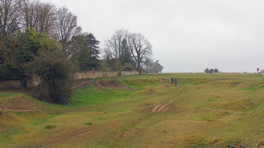
The Bulwarks is a Late Iron Age bank and ditch that sweeps across Minchinhampton Common north and north-west of the town: a bank 10m to 12m wide with a stone face, dated by pottery found in the 1937 excavation. It lies on free National Trust common land.
Hill fort or barrow
MinchinhamptonThe Bulwarks is a long bank and ditch that curves across Minchinhampton Common on the north and north-west side of Minchinhampton. It is Late Iron Age, dug and piled up in the last centuries before the Romans, and it is free to walk beside at any time.
History
Nobody knows for certain what the Bulwarks was for. It is a linear earthwork, a long bank rather than the closed ring of a hill fort, and there is a second Iron Age bank near Amberley. The Victoria County History calls it an ancient earthwork and notes that the woodland beyond it, in the west of the parish, was the custom wood where the tenants took timber for fuel and repairs.
The 1937 excavation
The bank was partly excavated in 1937 by Mrs Clifford. She found that its face towards the ditch had been built up with a stone wall, a revetment. Pottery from beneath the bank and from the bottom of the ditch dated it to the Late Iron Age. The Amberley bank, which runs north-east to south-west just north-east of Amberley church, gave the same kind of pottery from under its bank and in its ditch.
Historic England first scheduled the common's earthworks in 1927, and the Bulwarks is now part of a single scheduled monument that also takes in the prehistoric fields, the medieval Amberley Camp, a rabbit warren, the quarries and the anti-glider trenches of the Second World War.
What to see
The bank is still 10m to 12m wide and about 1.5m high at its highest, with its ditch on the east side, 10m wide and about 1.2m deep. Follow it on foot and you can see how it bends in a long arc across the common. The Royal Commission's survey of 1976 traced it for at least 1⅛ miles, about 1.8km, and judged that, carried on by a second bank, the Bulwarks probably once surrounded an area of more than 200 acres that the town now largely fills.
Come in low light, early or late in the day or in winter, when the shadows pick out the bank and ditch in the turf. Elsewhere on the common you will find the humps of old quarries and the low pillow mounds of the warren.
Visiting
The Bulwarks lies on open National Trust common land, free, with no gates or opening hours. The ground is grass, uneven and without surfaced paths. Cattle graze the common between May and October, Stroud District Council's leaflet for the commons says, and wander across the roads, so drive slowly. Dogs are welcome under close control; the National Trust asks for a short lead around livestock and from March to August, when skylarks and other birds nest on the ground. Please do not dig, drive or ride on the bank: it is protected as a scheduled monument.
Getting there
From the Market Square in the town, Bell Lane runs past Holy Trinity Church onto the common, and the bank is a few minutes' walk north. By car, use the small National Trust car parks beside the roads across the common, or the Friday Street car park in the town (GL6 9JL). Stagecoach West's 620 bus from Stroud stops in the Market Square and at Tom Long's Post, on the common, about six or seven times a day each way, Monday to Saturday, with no Sunday service.
Nearby
The Neolithic long barrow of Whitfield's Tump is on the north-west of the same common, and the Long Stone stands in farmland south-east of the town. North across the road is Rodborough Common, with its castellated Rodborough Fort. The Old Lodge, the inn on the common, and the Amberley Inn are the places for lunch, and our guide to Stroud and the Five Valleys covers the valleys below.
Walks past The Bulwarks, Minchinhampton
-
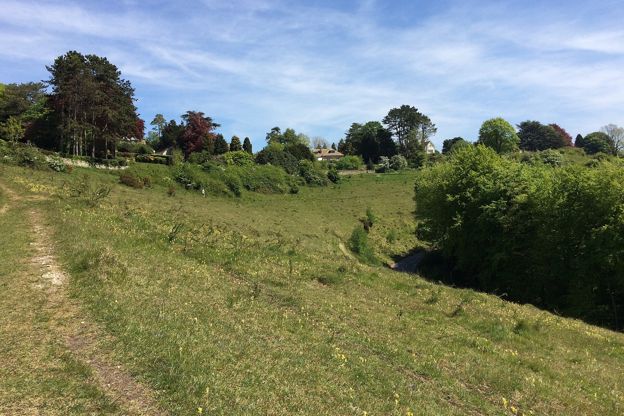
Rodborough Common and the fort
Walk · Starts in Stroud and the Five Valleys · 45 mins · Circular · Dog-friendly
A 2-mile (3.4km) circular walk on Rodborough Common above Stroud, easy, nearly level and about 45 minutes: up to the battlemented folly of Rodborough Fort, down the open western edge, and back past the Bear and an ice-cream stop. Grassy, and grazed by cattle.
Stay and eat near The Bulwarks, Minchinhampton
-

The Old Lodge
Inn · Nailsworth
An inn with six rooms on Minchinhampton Common, about two miles by road from Nailsworth, breakfast included and food all day.
Walker-friendly
Verified Nov 2026
-
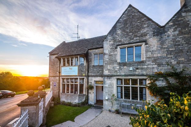
The Amberley Inn
Inn · Nailsworth
An inn with 13 en-suite rooms on the hillside above the Woodchester valley at Amberley, near Nailsworth and Stroud, which describes itself as a restored 16th-century inn.
Dog-friendly · Family-friendly
Verified Nov 2026
-
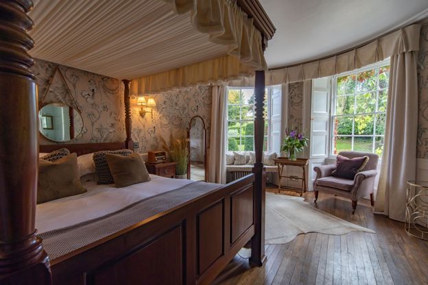
Burleigh Court
Hotel · Minchinhampton
A Grade II listed country house hotel below Minchinhampton Common, above the Golden Valley, with 18 rooms, a two-rosette restaurant and a garden spa with a sauna, hot tub and plunge pool.
Dog-friendly · EV charging · Wedding venues
Verified Oct 2026
More sights to see
-
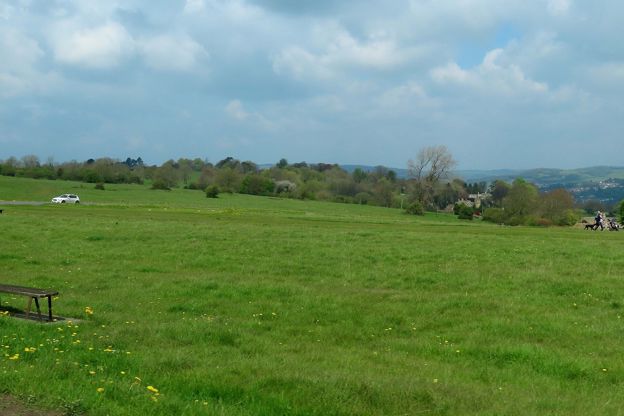
Minchinhampton Common
Sight · Common or park · Minchinhampton
Minchinhampton Common is a wide sweep of limestone grassland above Stroud and Nailsworth, in the care of the National Trust since 1913, where commoners' cattle graze and an Iron Age bank, a long barrow, pillow mounds and wartime trenches lie in the turf. Free to wander.
-

Whitfield's Tump, Minchinhampton Common
Sight · Hill fort or barrow · Minchinhampton
Whitfield's Tump is a Neolithic long barrow on Minchinhampton Common, a low mound 26m long where early farmers buried their dead, named from the tradition that the preacher George Whitefield spoke from it in 1743. A scheduled monument on free National Trust land.
-
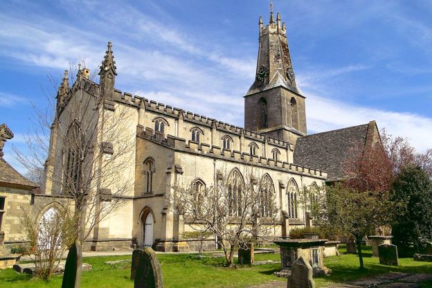
Holy Trinity Church, Minchinhampton
Sight · Church · Minchinhampton
Holy Trinity is Minchinhampton's Grade I parish church, known for its fourteenth-century tower whose spire was cut short in 1563 and crowned with a stone coronet, a south transept lit by a great rose window, and the grave of the astronomer James Bradley.