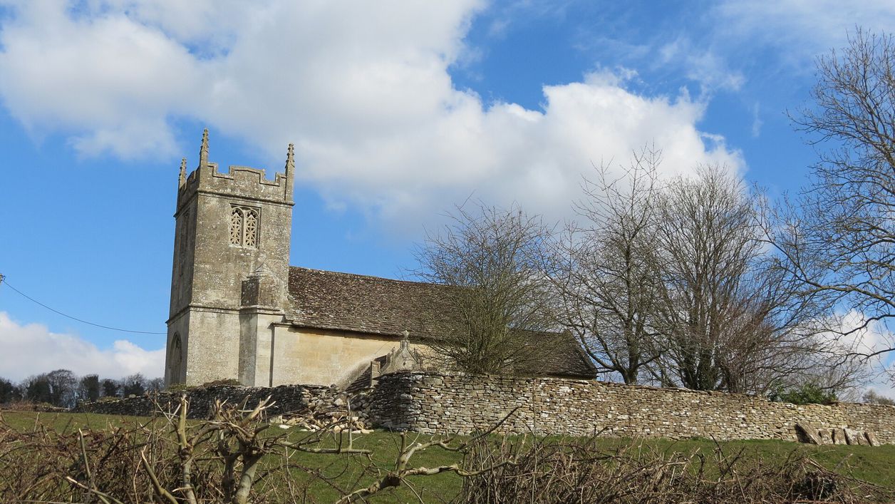
Martin Dawes, CC BY-SA 2.0, via Wikimedia Commons
Biddestone heritage trail
A 6.5-mile (10.5km) circular walk from Biddestone village hall, two to two and a half hours, moderate with stiles and short steep climbs. It goes round the green, over the fields to Slaughterford's paper mill and the White Hart at Ford, and back down the By Brook.
- Distance
- 10.5 km (6.5 mi)
- Difficulty
- Moderate
- Time
- 2 hrs, 30 mins
- Ascent
- 188 m
- Circular
- Circular
The route
Starts at Biddestone Village Hall, Yatton Road StilesSteep sectionMuddy in winterRoad walking Download GPX
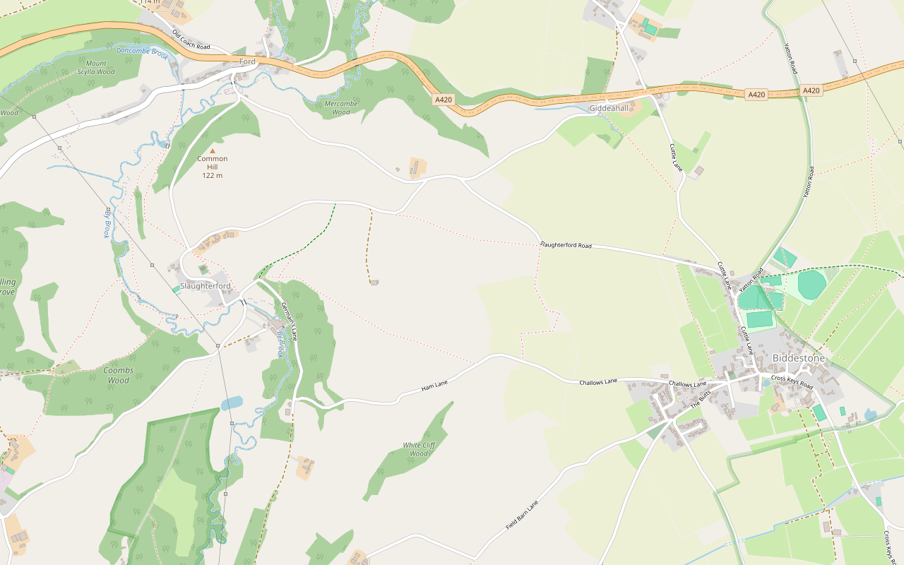
Step by step
-
Step 1: Round Biddestone
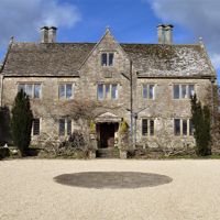
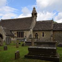
From the front of the sports pavilion by the village hall, take the path on the left beside the road down the ramp into Cuttle Lane. Turn left to the junction of Church Road and The Green, and walk on past The Close to the White Horse and the pond. Follow the path to the war memorial, then carefully follow the road out of the village and turn left into Chippenham Lane to see the entrance to Biddestone Manor. Retrace your steps to Gable Cottage at the entrance to The Green, and follow the path past the green to the pond. Pass Elm Lodge, carefully cross Church Road to the wellhead and pump, and walk along Church Road past the red telephone box, turning right to visit St Nicholas' Church.
-
Step 2: The Butts and Ham Lane
Back on the road, walk on past the church and take the left fork by a large Wellington pine, past Mountjoy Farm to the Butts. At the lychgate of the cemetery extension turn right into The Tynings, then Little Challows, and left into Challows Lane. Follow Challows Lane, which becomes Ham Lane, for 890m to the second footpath on the right. Go up the verge and over the stile, cross the field diagonally to its corner, turn left and carry on to a stile in the fence. Over it, bear right diagonally over the brow of the hill to the far bottom of the field beside Backpack Woods, cross the stile in the fence and follow the tree line on your left through the trees into a pasture sloping downhill.
- Stiles
-
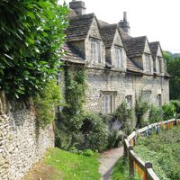
Step 3: Down to Slaughterford
Go on downhill through the tree line to a stile with steps down to Germains Lane. Turn left, pass two bungalows on your left and take the byway on your right through Slaughterford Mill. Beyond the mill site, follow the byway to a track on the right that leads back out to the lane from Slaughterford to Thickwood. Turn right over the By Brook and follow the lane round to the left, past Brookside Cottage onto the raised footpath and past the post box in the wall, to the metal gate into the grounds of St Nicholas' Church.
- Stiles
- Muddy in winter
-
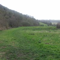
Step 4: Over Common Hill to Ford
Follow the footpath to the right of the church wall to the stile in the hedge on the far side of the field. Cross it and go down the steps to the lane opposite. Walk up the lane through Common Hill Plantation to a T-junction, then turn left over a bridge to the White Hart at Ford, where there are refreshments and toilets.
- Stiles
-
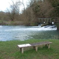
Step 5: Down the By Brook
From the White Hart turn left onto the road from Ford to Colerne, taking care: it has no pavement and can be busy. Pass the houses on the right and cross the By Brook at the entrance to Doncombe Mill. Go through the kissing gate opposite the mill and follow the brook on your left to a weir footbridge. With the brook now on your right, keep to the lower path over two stiles to a metal sluice with a footbridge, and cross it, closing both gates behind you. Turn left with the brook on your left to two footbridges over it, and enter the woods at the Rag Mill.
- Stiles
- Muddy in winter
-
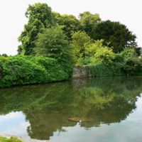
Step 6: Back to Biddestone
Continue down the track to Slaughterford Lane, go ahead and take Germains Lane to the left as far as the bridleway on your left. Follow the bridleway up through three gates to a track, and go left to Slaughterford Lane. Turn right and, with care, follow the lane for 250m to the first left bend. Go through a gate on the right and follow the fence on your left to a stile in the hedge, then ahead to another stile. The footpath crosses the large field diagonally, but if farming has blocked it, skirt the field to the left instead; either way, turn right along Slaughterford Road and follow it carefully for 530m to a footpath on the right. Follow it along the left side of the field, through a kissing gate, to a slabbed stone stile, and step down into Challows Lane. Turn left past Church Row and the church, take the alley behind the wellhead into Cuttle Lane, and go left along it to the ramp on the right up to the path by the cricket field and back to the village hall.
- Stiles
Sights on the way
The sights this walk passes, numbered as on the map.
-
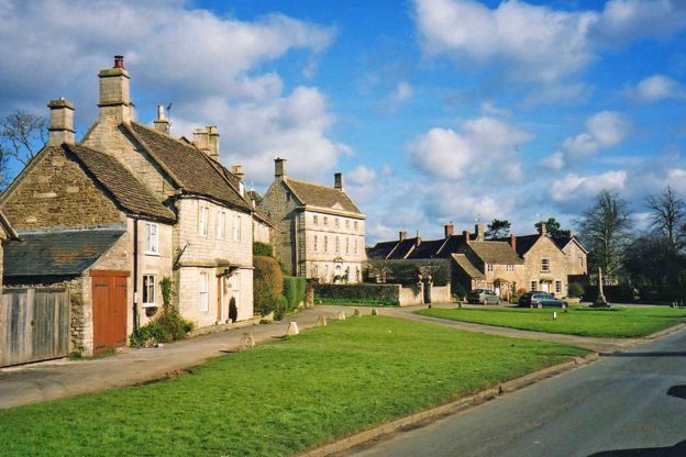
Biddestone green and pond
Sight · Common or park · Biddestone
Biddestone's green is the large open heart of a Wiltshire stone village near Castle Combe, with a duck pond made in 1661, a pub of the eighteenth century, a war memorial and houses from the seventeenth century on. Free and open at any time.
-
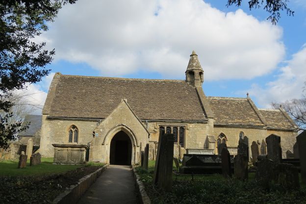
St Nicholas' Church, Biddestone
Sight · Church · Biddestone
St Nicholas' in Biddestone is a small Norman church near Castle Combe, listed Grade I, with a twelfth-century doorway and font, a rare bell turret under a little spire, box pews, a gallery and Mountjoy memorials. Open daily until dusk.
-
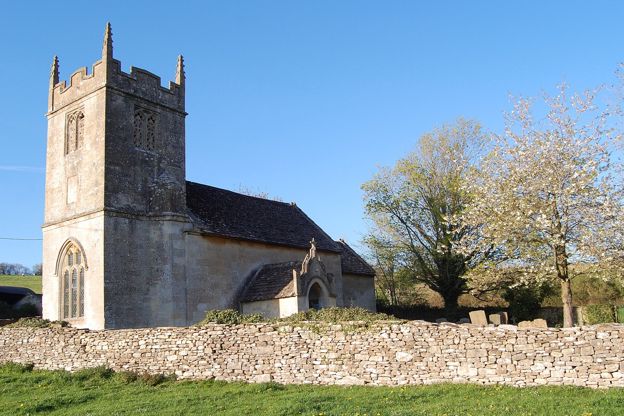
St Nicholas' Church, Slaughterford
Sight · Church · Biddestone
St Nicholas' is the small church of Slaughterford in the By Brook valley near Biddestone, reached across a field: a fifteenth-century tower with a nave rebuilt in 1823 after the church had lain ruined, by tradition, since Cromwell's troops wrecked it.
The walk in detail
The Biddestone heritage trail is a 6.5-mile (10.5km) circular walk from the village hall in Biddestone, to Slaughterford and Ford (the older leaflet says 6.6 miles). It is moderate, with 188m of climbing, stiles and two short, steep climbs, and takes two to two and a half hours. The White Hart at Ford is halfway, and the White Horse is on the green.
It is one of a series of heritage trails round Corsham made with the support of the local councils and the Corsham Walking Festival. It tours the green, climbs over Common Hill to Ford and comes back down the brook past the ruins of the Rag Mill.
Biddestone's green
The trail visits many of Biddestone's listed houses, and begins with a slow circuit of the green. The Close, set back behind a stone wall, was made from three cottages in 1929, the leaflet says; its listing records an eighteenth-century house largely reconstructed from 1924 to 1929, with a panelled Perpendicular-style archway inside, possibly reused. The leaflet calls it a contender for the oldest house in the village. Its garden held Attwood's agricultural machinery works, where the Attwood plough was made, until 1914.
The pond was made by William Mountjoy in about 1661 to improve his pasture, and is fed by a spring the leaflet says never runs dry. Opposite is the White Horse, an eighteenth-century inn whose porch carries a datestone of 1872 with the initials of T. H. A. Poynder of Hartham Park; the leaflet says an inn here was called the George in the middle of the seventeenth century. The war memorial, a limestone cross more than 3m tall on a granite base, was dedicated in 1920.
Chippenham Lane leads to the entrance of Biddestone Manor, an early seventeenth-century house listed Grade II*, with triple-gabled fronts and much restoration after 1914. Its barn carries a datestone of 1705, and behind the wall by the stable gate is the site of St Peter's, a church recorded in Domesday and pulled down in 1846. Back on the green, the leaflet singles out Willow House: three storeys with a formal front, dated 1730 and built, the leaflet says, for the maltster Samuel Alborne (S. Aldbourne in its listing).
St Nicholas' Church and the Butts
St Nicholas' is Biddestone's twelfth-century church, listed Grade I. The south doorway is twelfth century, with a carved tympanum showing a cross in a beaded circle, and so is the round font with its band of zig-zag. The bell turret on the nave is thirteenth century, topped with a short fifteenth-century spire. Inside are box pews of about 1800, a late eighteenth-century west gallery and a series of wall plaques of about 1695 to 1823, several of them to the Mountjoy family.
The gallery has a story. The leaflet says a gallery was built in 1712 for the congregation of Slaughterford, whose church had been wrecked by Cromwell's men in 1649, and that the two parishes quarrelled enough to need separate doors; the listing dates the present gallery to the late eighteenth century. Beyond the church, Mountjoy Farm opens onto the Butts, the village's archery ground, which the leaflet ties to Henry III's law of 1252 requiring men to be armed.
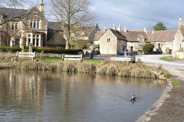
Slaughterford and its mills
Slaughterford is a hamlet of mills and a church in the By Brook valley, the first village on the trail after Biddestone. Ham Lane and the fields beyond it bring you over the brow of the hill with Slaughterford below: its church, the old brewery and the By Brook valley.
Slaughterford Mill, also called Chapps Mill, was a fulling mill until 1790. It turned to paper in 1805, back to cloth by 1818 and to paper again by 1827, and made paper until it closed in 1994. The brook above it was raised and widened to hold a reservoir of water, and small businesses now use the site.
St Nicholas' at Slaughterford keeps a small fifteenth-century tower. The leaflet says Cromwell's troops wrecked the church and it lay in ruins for 200 years; its listing records the nave, chancel and porch rebuilt in 1823 by G. Forder of Winchester, with an inscription recording the rebuilding after two centuries of disuse, and new tracery in 1883.
Ford, the By Brook and the Rag Mill
The White Hart at Ford is the halfway stop, with refreshments and toilets, and our Ford, Long Dean and Castle Combe walk starts from its door. The inn and the leaflet call it a sixteenth-century coaching inn, and its listing dates it to the seventeenth, possibly on an earlier core, with a south range of about 1830 to 1840. Local tradition, repeated in the leaflet, says scenes from the original Doctor Dolittle were shot there in the 1960s; the film's records name nearby Castle Combe.
The return follows the By Brook, about 12 miles long, which the leaflet says once turned twenty watermills, first for corn, then fulling wool, then paper. Doncombe Mill, where you join the brook, was probably a fulling mill in 1704, made paper from the 1790s and became a corn mill in 1887 before it was turned into a house. The Rag Mill, the first of three fulling mills on the brook in the late sixteenth century, later had the valley's earliest paper machine; it was demolished in 1964, but its undershot wheel, about 4.6m across, and the remains of a rag boiler are still there. Cotswold Voluntary Wardens cleared the site in 2018, and a plaque on the gate marks it. From the Rag Mill you can see the stack of Slaughterford's brewery, which ran from 1858 to 1915.

The Cotswolds Info newsletter
Events, new places and the best of the season, about once a month. Unsubscribe at any time.
Parking, buses and food
The car park and the pub are both in Biddestone, at the start. Park in the public car park behind the village hall on Yatton Road, SN14 7BZ, and park thoughtfully. There is a bus stop by the pond on The Green, but buses are few. Faresaver's 635 and 636 between Chippenham and Marshfield (the 636 by way of Corsham) stop there only a few times a day on weekdays, and none run at weekends. The 635 also stops at Ford. Coachstyle's X79 between Hullavington and Bath calls at the pond once each way on Thursdays only.
The White Horse is on the route at the start and the end. It is dog friendly, with a garden at the back. It is closed on Mondays except bank holidays and opens only from 5pm from Tuesday to Thursday, so on those days the White Hart is the only lunch stop; it reopened with a new landlord in September 2025. The White Hart at Ford opens every day from breakfast (7.30am on weekdays, 8am at weekends), serves food from then until 9pm or 10pm and welcomes dogs.
Stiles, mud and roads
This is a walk for boots, with stiles, mud and three stretches of road. There are several stiles, one of them a slabbed Cotswold stone stile at the end, as well as gates, kissing gates and footbridges. The paths through woods and fields and beside the By Brook can be muddy, so wear suitable footwear, as the leaflet asks. Keep dogs under close control, as the Countryside Code asks, and our guide to the Cotswolds with a dog has more on livestock and stiles.
Take care on three stretches of road: the road from Ford towards Colerne, which has no pavement and can be busy; 250m of Slaughterford Lane; and 530m of Slaughterford Road. One large field near the end is farmed, and you may have to skirt it rather than cross. The leaflet recommends OS Explorer 156 alongside it.
More near Biddestone
Castle Combe and Lacock are the nearest places for more walking and a meal. Castle Combe is 3.6 miles away by road, and the White Hart on its Street is a dog-friendly Wadworth pub. Biddestone was a location for Sky 1's Agatha Raisin and the Quiche of Death, which our guide to Cotswolds film locations covers. For another Wiltshire walk with history on the way, try Lacock, Naish Hill and Bowden Park, which starts near Lacock Abbey.
Places on the way
-
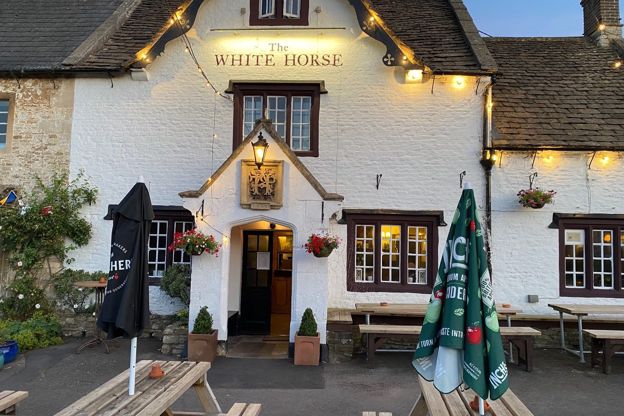
The White Horse, Biddestone
Pubs · Biddestone
A dog-friendly pub on the green at Biddestone serving pub classics, with a garden at the back, curry night on Thursdays and a quiz on the first Tuesday of the month.
Dog-friendly · Walker-friendly
Verified Oct 2026
Stay near the start
Inns, cottages and hotels within a short drive of where the walk begins, so you can set off early.
Where to stay in Biddestone-
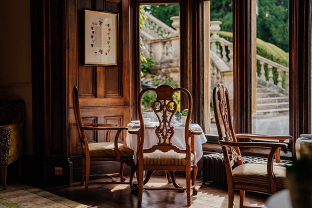
The Manor House
Hotel · Castle Combe
A hotel in a manor house of seventeenth-century origins at Castle Combe, part of the Exclusive Collection, with the Bybrook restaurant.
Dog-friendly · Wedding venues · EV charging
Verified Oct 2026
-
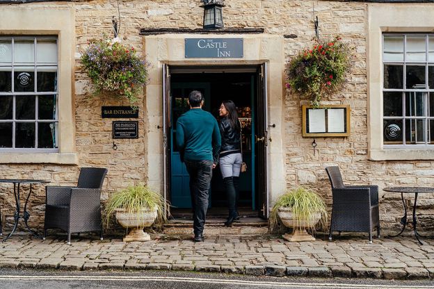
The Castle Inn
Inn · Castle Combe
An inn with 12 rooms on West Street, Castle Combe, part of the Exclusive Collection, with a menu holding two AA rosettes.
Dog-friendly
Verified Oct 2026
-
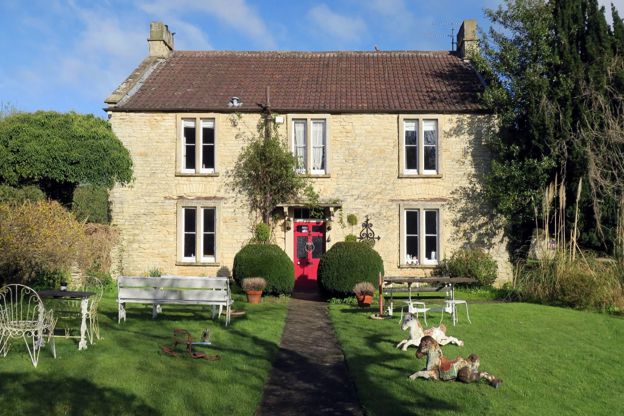
Fosse Farmhouse
B&B · Castle Combe
A farmhouse bed and breakfast full of vintage finds on the Fosse Way at Nettleton Shrub, a mile or so from Castle Combe, with three dog-friendly holiday cottages in its old farm buildings.
Dog-friendly · Family-friendly
Verified Nov 2026
More like this
More walks to try
-
Ford, Long Dean and Castle Combe
Walk · Starts in Castle Combe · 2 hrs, 15 mins · Circular
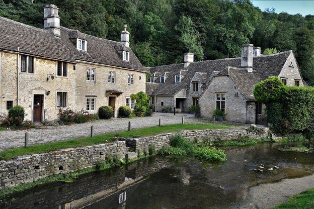
A 4.5-mile (7.2km) circular walk from the White Hart Inn at Ford, moderate and two to two and a half hours: up the By Brook valley by Long Dean and through the woods into Castle Combe, down The Street past the Market Cross, and back through Becker's Wood and Out Woods.
-
Cotswold Way: Tormarton to Cold Ashton
Walk · Starts in the South Cotswolds · 3 hrs, 45 mins · Dog-friendly
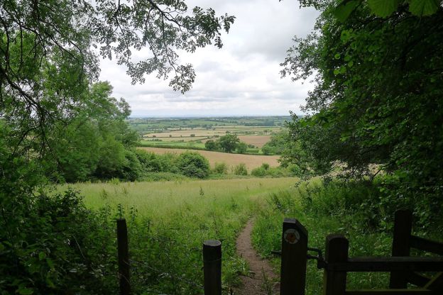
A 6.6-mile (10.6km) one-way walk on the fourteenth section of the Cotswold Way, moderate and about three and three quarter hours: from Tormarton over the M4, round the wall of Dyrham Park, through Dyrham village and up through Dyrham Woods to Cold Ashton.
-
Cotswold Way: Cold Ashton to Bath
Walk · Starts in Marshfield · 6 hrs · Dog-friendly
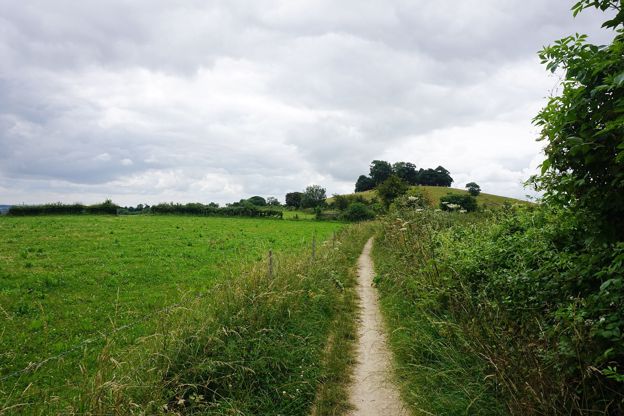
A 10.2-mile (16.5km) one-way walk on the last section of the Cotswold Way, hard and about six hours: from Cold Ashton down to Lower Hamswell, up to the Lansdown battlefield, along the top past Bath Racecourse, and down through Weston to the stone disc at Bath Abbey.