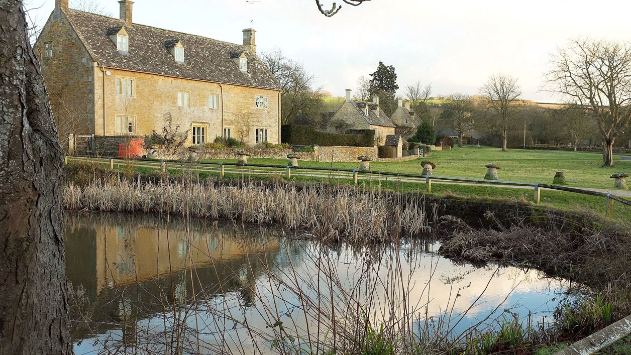
Derek Harper, CC BY-SA 2.0, via Wikimedia Commons
Bourton-on-the-Water and Wyck Rissington
A 4-mile (7km) circular walk from the war memorial in Bourton-on-the-Water, about two hours, easy and without stiles but muddy at times. It passes a roundhouse on Greystones Farm, crosses the Eye and the Dikler to Wyck Rissington's church, and returns by Rissington Mill.
- Distance
- 7.0 km (4.3 mi)
- Difficulty
- Easy
- Time
- 2 hrs
- Ascent
- 37 m
- Circular
- Circular
The route
Starts at The war memorial in the High Street, Bourton-on-the-Water follows the Oxfordshire Way for a while Muddy in winter Download GPX
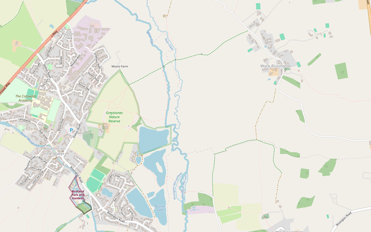
Step by step
-
Step 1: Bourton to the roundhouse
From the war memorial, walk beside the River Windrush to the first bridge, turn left and cross the road to the small green opposite. Follow the Oxfordshire Way sign down an alley, bearing right to Station Road. Cross the road, turn left, and after the petrol station turn right into Cemetery Lane and straight away into Greystones Lane. At the farm, go through a gate, turn right across the yard and through two gates onto a track for 220m. The roundhouse is at the bottom.
-
Step 2: Through the reserve to the Oxfordshire Way
After the roundhouse, turn left through a gate and bear slightly left across the field to a gate. Bear half right to a gap in the hedge and another gate, then turn straight away left with the hedge on your left, through two fields to a gate into woodland. Follow the track through the trees past the Play Trail and its wooden sculptures. At a crossroads of paths, turn right through a gate onto the Oxfordshire Way and the Gustav Holst Way, past a notice board.
-
Step 3: Over the Eye and the Dikler to Wyck Rissington
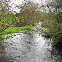
Walk ahead along a wide path through a meadow to a metal gate, and on to a wooden bridge over the River Eye. Keep straight ahead to a metal gate and a small bridge over the River Dikler. Keep straight on along the path, then a stone track along the edge of a field, to the road at Wyck Rissington.
-
Step 4: Through the village and south
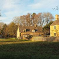
Turn right through the village, past the pond and the church, and stay on the road until it turns sharp left. Go straight ahead here on a wide winding track, through two gates, to a T-junction. Turn right through a gate and along the field edge. At the end, turn sharp left through the metal gate and walk straight ahead across three fields to the drive of Rissington Mill.
-
Step 5: Rissington Mill, the lake and back
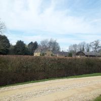
Turn right along the drive until it turns square right, where a gate stands between two tall cylindrical bushes. Go through it, ahead through another gate past the garden walls and across two bridges. Turn right across the field beside the stream to a kissing gate, go straight ahead to a gap in the trees opposite and turn left on a path round the lake. After circling the lake, come out onto a stone track and turn left through a gate. Follow the lane to the cemetery entrance, take the path on the left to Station Road, turn left for 20m, cross the road and retrace your steps along the walled path to the start.
Sights on the way
The sights this walk passes, numbered as on the map.
-
Bourton-on-the-Water war memorial
Sight · Monument · Bourton-on-the-Water
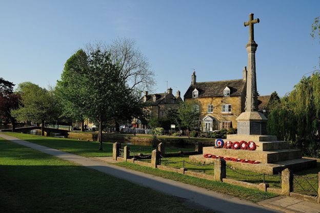
Bourton-on-the-Water's war memorial is a tall stone cross of 1920 on the green beside the Windrush, raised by the village for its 27 men who died in the First World War, with 12 names added after the Second. Listed Grade II; open at all times.
-
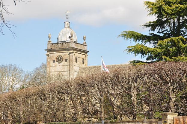
St Lawrence's Church, Bourton-on-the-Water
Sight · Church · Bourton-on-the-Water
St Lawrence's is Bourton-on-the-Water's parish church on the High Street: a chancel of 1328, a Georgian tower of 1784 under a lead dome and a nave taken back to the Gothic style in 1891. Grade II*, open daily from about 10am to 4pm, step-free and dog friendly.
-
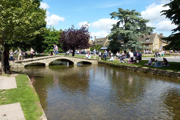
Narrow Bridge, Bourton-on-the-Water
Sight · Bridge · Bourton-on-the-Water
Narrow Bridge is the oldest dated of the low stone footbridges over the Windrush in Bourton-on-the-Water, built in 1756 with three rusticated arches and low parapets. Listed Grade II with three of its neighbours, it is crossed free at any time.
-
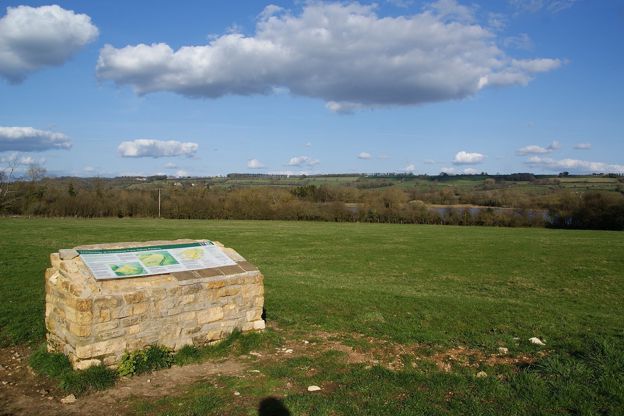
Salmonsbury Camp
Sight · Hill fort or barrow · Bourton-on-the-Water
Salmonsbury Camp is an Iron Age fortified enclosure of about 23 hectares just east of Bourton-on-the-Water, its double banks still up to 2m high on three sides, with Roman and Saxon finds and a charter of AD 779. A scheduled monument on Greystones Farm reserve.
-
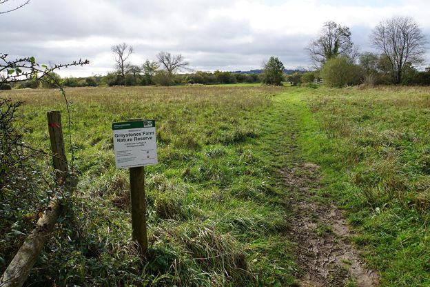
Greystones Farm nature reserve
Sight · Nature reserve · Bourton-on-the-Water
Greystones Farm is Gloucestershire Wildlife Trust's 66-hectare farm reserve on the edge of Bourton-on-the-Water: flower-rich meadows that are an SSSI, the Dikler and the Eye, a replica roundhouse and the banks of Salmonsbury Camp. Free and open all year.
-
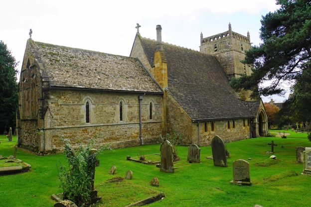
St Laurence's Church, Wyck Rissington
Sight · Church · Bourton-on-the-Water
St Laurence's is the Grade I church of Wyck Rissington near Bourton-on-the-Water, consecrated in 1269, where the young Gustav Holst was organist in 1892 and 1893. It keeps a Norman corbel table, diamond-shaped lights and a mosaic of a rector's lost maze. Open daily in daylight.
The walk in detail
The Bourton-on-the-Water and Wyck Rissington walk is a 4-mile (7km) circular route from the war memorial in Bourton-on-the-Water, on the Cotswolds National Landscape's Miles Without Stiles list. It is easy, with 37m of climb, takes about two hours and can be muddy. Its highlights are a roundhouse, three small rivers and a church maze, with Bourton's pubs at the end.
The leaflet was last checked by its authors in June 2020, so check its route page before you set off.
The war memorial and Dial House
The walk starts at the war memorial on the green beside the Windrush, where the High Street meets Sherborne Street. Its listing describes a tall stone Latin cross on an octagonal shaft, in a gated enclosure with a chain on low stone posts. A public meeting in January 1920 decided to build it for the 27 men of the village who had died, and it was unveiled on 7 December 1920; the names of 12 men who died in the Second World War were added later.
On the High Street, the Dial House is a hotel in a house with the date 1698 inscribed on it, enlarged and restored around 1920. Its listing picks out the porch with stone seats, topped by a sundial and a ball finial.
Greystones Farm and the roundhouse
The first mile crosses Greystones Farm, a Gloucestershire Wildlife Trust nature reserve, past a roundhouse built in the Iron Age style. Greystones Lane brings you to the farm, and the roundhouse stands at the bottom of the track beyond the farmyard; the leaflet says it is typical of homes in the area during the Iron Age. The reserve takes in Salmonsbury Camp, an Iron Age enclosure of about 23 hectares between the Dikler and the Windrush, which is a scheduled monument and the subject of our shorter Salmonsbury and the lakes loop.
The path north goes through woodland past the Play Trail, with its wooden sculptures, and the leaflet notes a number of badger setts here. The Wildlife Trust asks for dogs to be kept on leads on the reserve, and on short leads of 2m or less from 1 March to 31 July. It says the path from the farmyard to the roundhouse is suitable for wheelchairs and pushchairs, and there is a bench by the River Eye.
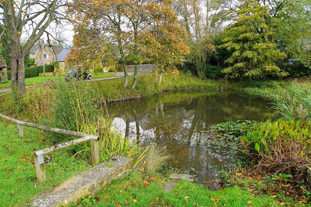
The Eye, the Dikler and Wyck Rissington
The middle of the walk follows the Oxfordshire Way over two rivers to Wyck Rissington. At the crossroads of paths the Oxfordshire Way shares its line with the Gustav Holst Way, named after the composer whose life our story on famous Cotswold people follows. A wide path through a meadow leads to a wooden bridge over the River Eye, and then a small bridge over the River Dikler: with the Windrush, those are the walk's three small rivers. A stone track along a field edge brings you up to the road in Wyck Rissington.
The walk goes through the village past the pond and St Laurence's church, where the leaflet's maze is inside. The church is listed Grade I, with work of the twelfth to fifteenth centuries, restored in 1879. Its listing records a tub-shaped font of about 1200, fragments of early fourteenth-century glass in the chancel lancets, and twelve plaques of olive wood on the chancel walls, probably Flemish, of the fifteenth or sixteenth century, which once formed part of a rosary. Before 1264 the church's rents went to Eynsham Abbey, and the listing suggests the monks of Eynsham may have built the chancel and tower.
Rissington Mill and the lakes
The way back runs south past Rissington Mill and round a small lake into Bourton. A winding track and a field edge lead to three fields and the drive of Rissington Mill. The leaflet's landmark for the next turn is a gate between two tall cylindrical bushes, where the drive turns square right; beyond it you pass the garden walls and cross two bridges.
The way home follows a stream to a kissing gate and goes round a small lake before joining a stone track and the lane past the cemetery. From there a walled path takes you back to the High Street.

The Cotswolds Info newsletter
Events, new places and the best of the season, about once a month. Unsubscribe at any time.
Food, parking and toilets
All the food on this walk is in Bourton, at the start and finish; there is no pub or café in Wyck Rissington on the leaflet. The Croft is a café and restaurant on the riverside by the Windrush, serving breakfast, lunch and afternoon tea. The Willow is a Fuller's pub on the High Street, open from 10am, with outside tables and dogs and families welcome, and the Old New Inn serves food and has a beer garden.
The leaflet points you to the village's pay car parks. The council's Rissington Road car park (GL54 2BN) is free before 10am and charged from 10am to 8pm, by card or PayByPhone. The nearest public toilets are at the Rissington Road car park and the Church Rooms, 50p when we checked. If you are staying, our page on places to stay in Bourton-on-the-Water lists hotels and inns.
Paths, gates and mud
There are no stiles, but expect mud somewhere on the way. The paths are unsurfaced, with field gates, metal gates, a kissing gate and several footbridges, and the National Landscape's route page grades the walk 2 of 4, for basic fitness. The leaflet warns of mud without saying where. On Greystones Farm the Wildlife Trust closes its own meadows walk in autumn and winter, and into spring when the water is high, because the ground gets boggy; check its reserve page before a winter walk. The road walking is on Bourton's streets and lanes at each end and through Wyck Rissington.
Longer walks from Bourton
Bourton is the start of several longer walks to the west. Bourton, Upper Slaughter and Lower Slaughter is a 6-mile circuit of the two villages, and for a full day, the walk from Bourton by the Slaughters to Naunton is about 10 miles on the Wardens' Way and the Windrush Way. If you have children with you, Birdland, on the Windrush in Bourton since 1957, is a short walk from the start.
Places on the way
-
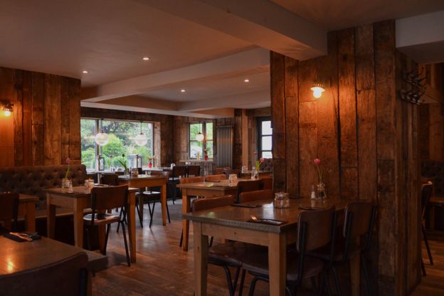
The Croft
Cafes and tearooms · Bourton-on-the-Water
A café and restaurant on Riverside in Bourton-on-the-Water, by the Windrush, serving breakfast, lunch and afternoon tea daily and dinner on Fridays and Saturdays.
Dog-friendly · Family-friendly
Verified Nov 2026
-
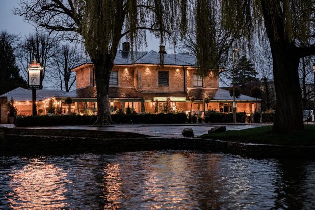
The Willow
Pubs · Bourton-on-the-Water
A Fuller's pub on the High Street in Bourton-on-the-Water, open from 10am, with a garden and outside seating, food all day, and dogs and families welcome.
Dog-friendly · Family-friendly
Verified Oct 2026
-
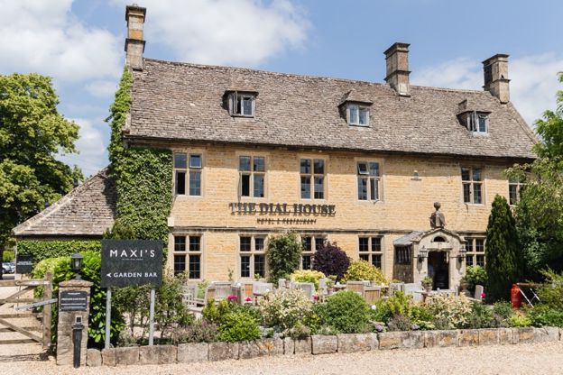
The Dial House
Hotel · Bourton-on-the-Water
A hotel with 13 rooms on Bourton-on-the-Water's High Street, five of them designed by Laurence Llewelyn-Bowen, with a restaurant, a garden and parking for guests.
Verified Nov 2026
-
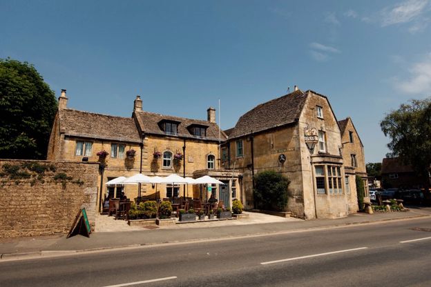
The Old New Inn
Pubs · Bourton-on-the-Water
A Grade II listed eighteenth-century inn in Bourton-on-the-Water with nine rooms, classic British food, a beer garden and the Model Village in its grounds.
Dog-friendly
Verified Nov 2026
-
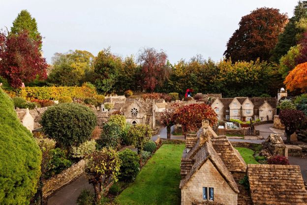
The Model Village, Bourton-on-the-Water
Family days out · Bourton-on-the-Water
A one-ninth scale model of Bourton-on-the-Water as it was in the 1930s, itself listed Grade II, in the garden of the Old New Inn.
Family-friendly
Verified Oct 2026
-

Birdland Park and Gardens
Wildlife and nature · Bourton-on-the-Water
A bird park on the Windrush at Bourton-on-the-Water since 1957, with what it calls England's only breeding King Penguins, flamingos, pelicans and a nature reserve.
Family-friendly · Dog-friendly · Car-free
Verified Oct 2026
Stay near the start
Inns, cottages and hotels within a short drive of where the walk begins, so you can set off early.
Where to stay in Bourton-on-the-Water-
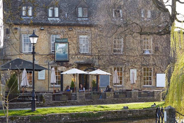
Old Manse Hotel
Inn · Bourton-on-the-Water
A Cotswold-stone inn of 1748 on Victoria Street, Bourton-on-the-Water, with 15 rooms, three of them for dogs, and pub food all day, run by Greene King Inns.
Dog-friendly
Verified Nov 2026
-
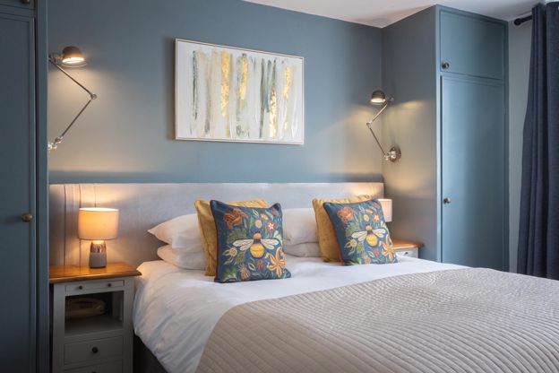
Chester House Hotel
Hotel · Bourton-on-the-Water
A family-owned hotel with 22 rooms on Victoria Street, Bourton-on-the-Water, with L'Anatra Italian Kitchen, a walled garden, a car park and rooms for small dogs.
Dog-friendly
Verified Nov 2026
-
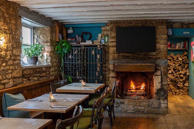
The Mousetrap Inn
Inn · Bourton-on-the-Water
A nineteenth-century inn with eleven rooms at Lansdowne, Bourton-on-the-Water, with a restaurant and bar, a small car park and dogs in its ground-floor twins.
Dog-friendly
Verified Oct 2026
More like this
Stories on this walk
-
Gustav Holst and the Cotswolds
Story · History · 8 minute read
The composer of The Planets was born in Cheltenham, was organist at Wyck Rissington as a teenager and wrote a symphony called The Cotswolds: where to see and hear his Cotswold years.
More walks to try
-
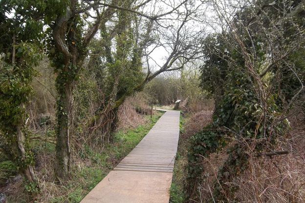
Bourton, Salmonsbury and the lakes
Walk · Starts in Bourton-on-the-Water · 45 mins · Circular · Dog-friendly
A 2-mile (3.1km) circular walk from the middle of Bourton-on-the-Water, flat and easy, in 45 minutes to an hour. It goes out along Rissington Road and back through Greystones Farm reserve, past a replica roundhouse and the banks of Salmonsbury Camp, and is often wet underfoot.
-
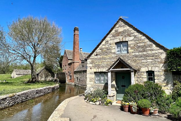
Bourton, Upper Slaughter and Lower Slaughter
Walk · Starts in Bourton-on-the-Water · 2 hrs, 15 mins · Circular
A 6-mile (9.7km) circular walk from Rissington Road in Bourton-on-the-Water, two to two and a half hours of moderate walking with a few stiles. It heads west on bridleways, up a quiet lane to Upper Slaughter, and down the River Eye to Lower Slaughter's mill.
-
Bourton-on-the-Water, the Slaughters and Naunton
Walk · Starts in Bourton-on-the-Water · 5 hrs · Circular
A 10-mile (16.4km) circular walk from Bourton-on-the-Water, four to five hours of moderate walking with stiles and steep slopes. It follows the Wardens' Way through Lower and Upper Slaughter to Naunton, then comes home down the Windrush valley on the Windrush Way.