Ruth Sharville, CC BY-SA 2.0, via Wikimedia Commons
Malmesbury and the River Avon
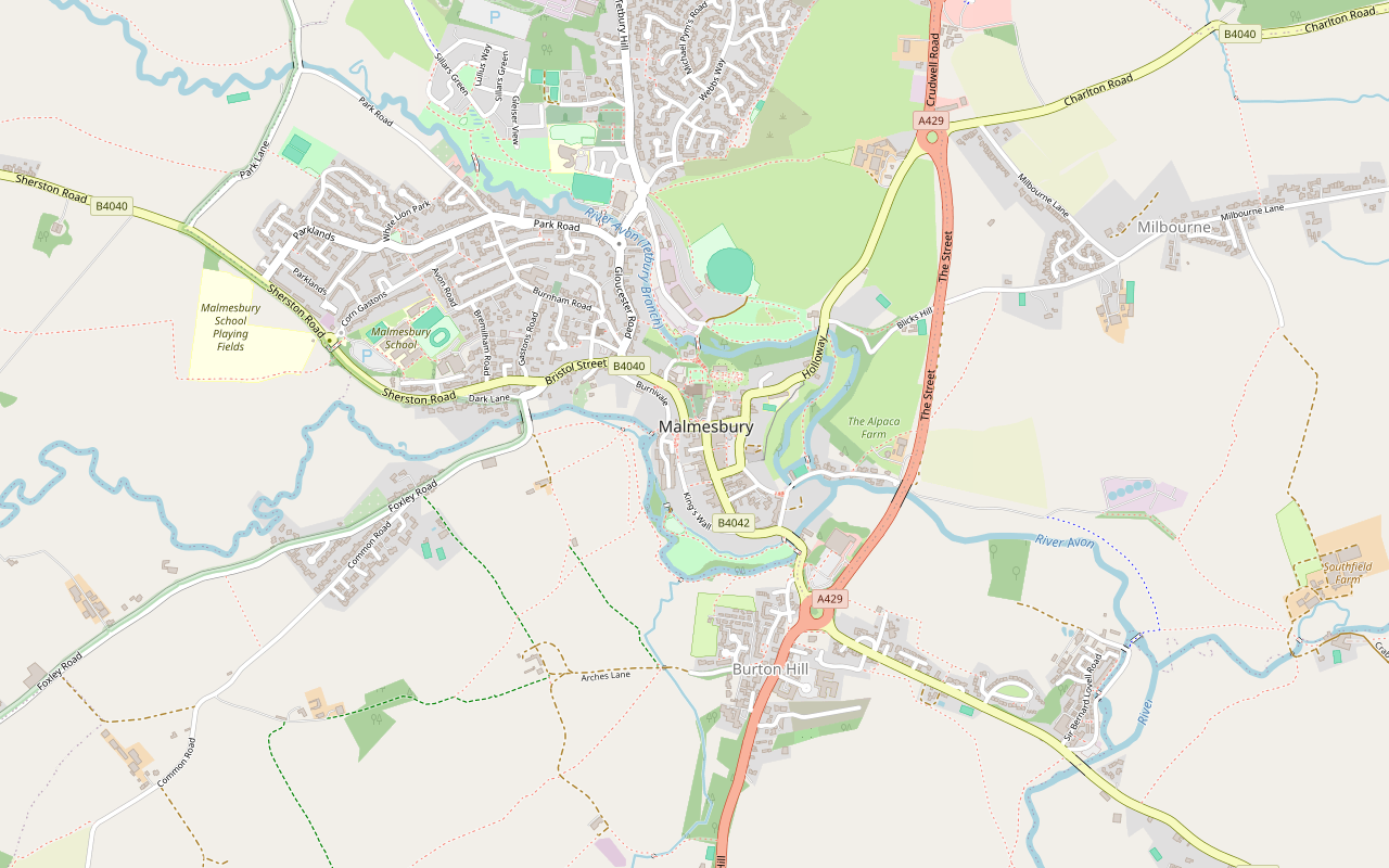
A 2.5-mile (3.9km) circular walk from Cross Hayes in Malmesbury, easy and about an hour, mostly level with some stiles: down from the Market Cross past Daniel's Well, along the Avon by the meads and the silk mills, and back round under the abbey.
- Distance
- 3.9 km (2.4 mi)
- Difficulty
- Easy
- Time
- 1 hr
- Ascent
- 38 m
- Circular
- Circular
The route
Starts at Cross Hayes, by the Town Hall and the Athelstan Museum StilesMuddy in winterRoad walkingCafé on route Download GPX
Step by step
-
Step 1: The Market Cross to Daniel's Well
From Cross Hayes by the Town Hall, walk along Oxford Street to the Market Cross and turn left into Gloucester Street. Go down the steps on public footpath MALM16 and follow the footpaths west down the hill to the river at Daniel's Well.
-
Step 2: Along the river
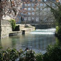
Turn south on footpath MALW31 across the meadow, then follow the riverside paths south and east below the town, past St Aldhelm's Mead and King Athelstan's Mead, to the Silk Mills at Burton Hill.
-
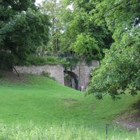
Step 3: Round the east side
Walk up St John's Street a short way, then take the long footpath north and west round the eastern side of the town, by the old railway, until it brings you out below the abbey and Abbey House Gardens.
-
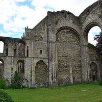
Step 4: Westport and back
Follow Gloucester Road and Bristol Street into Westport and the Three Cups, then Foxley Road a short way. Take footpath MALW33 back east to the river and climb the outward path to Gloucester Street, the Market Cross and Cross Hayes.
Sights on the way
The sights this walk passes, numbered as on the map.
-
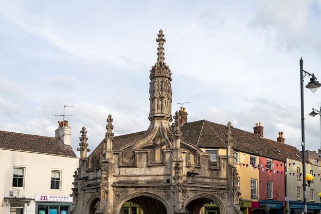
Market Cross, Malmesbury
Sight · Historic building · Malmesbury
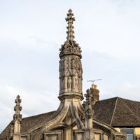
Malmesbury's octagonal stone market cross of the late fifteenth or early sixteenth century, a vaulted shelter with pinnacles, flying buttresses and a lantern of saints, built, John Leland wrote, to keep poor market folk dry. Grade I; free.
-
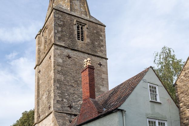
St Paul's Bell Tower, Malmesbury
Sight · Historic building · Malmesbury
The tower and spire of St Paul's, Malmesbury's medieval parish church, left standing alone on the edge of the abbey churchyard after the church fell. It has clocks below its spire and still holds a ring of eight bells, long rung for the abbey. Grade I.
-
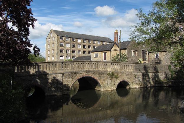
River Avon at Malmesbury
Sight · River · Malmesbury
The two branches of the Bristol Avon that almost ring Malmesbury's hilltop and meet below it, with riverside meads, old mill sites, Daniel's Well and a level path round the town. Free, on public paths and town council parks.
-
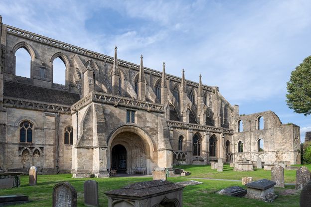
Malmesbury Abbey
Sight · Church · Malmesbury
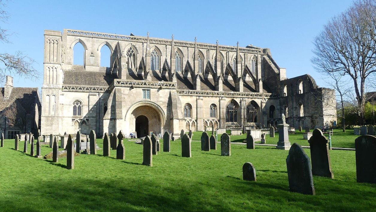
The surviving nave of Malmesbury's great Norman abbey church, built mostly about 1160 to 1180 and the parish church since 1541, with a south porch of carved Romanesque Apostles and King Athelstan's empty tomb. Grade I; free, open daily.
The walk in detail
The Malmesbury river walk is a 2.5-mile (3.9km) circular walk from Cross Hayes round Malmesbury, the Wiltshire hilltop town almost ringed by the Avon. It is nearly level, with a few stiles, and takes about an hour. It passes the Market Cross, the meads and the abbey, with the Three Cups pub on the way back.
The Market Cross and the abbey
The walk starts at Cross Hayes, by the Town Hall, home of the free Athelstan Museum, and within a few minutes passes the Market Cross. It is listed Grade I: a late fifteenth or early sixteenth-century octagon with a central shaft and a lierne vault, built, as the antiquary John Leland wrote in the 1540s, to keep the poor market folk dry when it rained.
On the way back the route passes beneath the abbey, begun probably under Bishop Roger in the early twelfth century and built mostly between about 1160 and 1180. After the Dissolution it was cut down to six bays of the nave, and it has been the parish church since 1541. Its west tower fell about 1662. The museum tells the story of Eilmer, the monk who, as William of Malmesbury told it about a century later, flew about a furlong from a tower around 1000 and broke both legs, and of King Athelstan, whose fifteenth-century tomb in the abbey is empty.
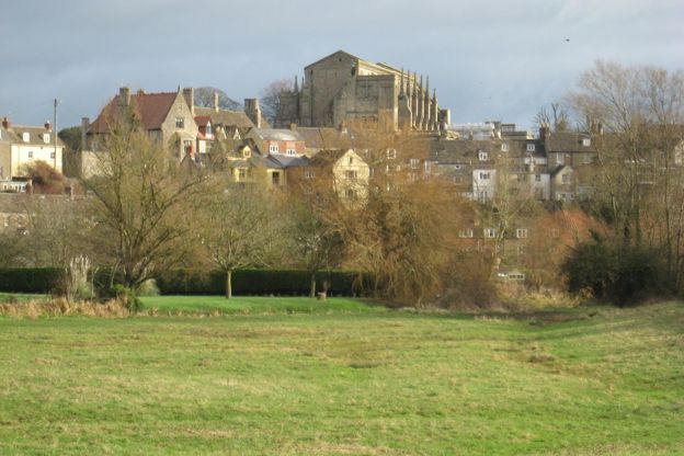
Along the river
Below the town the walk follows the Tetbury and Sherston branches of the Avon, which almost meet at the town's north-western corner and join again at its southern end, through the riverside meads. The path drops to Daniel's Well and follows the river through St Aldhelm's Mead, a town park with play areas and public toilets, and King Athelstan's Mead to the Silk Mills at Burton Hill. The Victoria County History records that Burton Hill Mill made silk ribbon from about 1850 and employed 281 people in 1862. On the east side the path runs by the line of the old railway and through Conygre Mead, a nature reserve of about 2.58 hectares owned by the Malmesbury River Valleys Trust and a Local Nature Reserve since 2005.
Malmesbury lies just outside the Cotswolds National Landscape, whose boundary runs about 400m west of the town centre, so this is a walk on the edge of it.

The Cotswolds Info newsletter
Events, new places and the best of the season, about once a month. Unsubscribe at any time.
What walkers report
The paths are mostly flat, along the river and across meadows, with a few stiles that walkers say dogs can manage. After rain some stretches are muddy. With the steps down from Gloucester Street and the stiles, it is not a walk for a pushchair. Part of the way back is on roads, including a short stretch of Foxley Road, so take care there with children.
It is popular with dog walkers, and several mention space to let a dog run by the river.
Food, drink and parking
Malmesbury has cafés round the Market Cross. The Three Cups in Westport, a dog-friendly pub, is on the way back, and the Old Bell, which says it has looked after travellers since 1220, stands beside the abbey; the Kings Arms on the High Street is a coaching inn with a tapas restaurant. The Town Hall at the start has a café and public toilets. Inside the abbey, the Abbey Café serves soup, toasties and cakes from Monday to Saturday, with tables in the Cloister Gardens in warm weather.
The long-stay car park at Station Yard, below the abbey, is free for up to two hours and then charges, and the way up into the town from it is by steep steps; there is short-stay parking outside the Town Hall at the start (Malmesbury Town Council). Our guide to the Cotswolds on a rainy day has the museum among its free indoor stops, and our pick of places to stay in Malmesbury has where to spend a night in the town.
More walks nearby
Tetbury is about 5 miles north, with its own town walk and a longer one to Ashley, and Silk Wood at Westonbirt is a little further. Further south-west, in the By Brook valley, Castle Combe has a woodland walk from Ford.
Places on the way
-
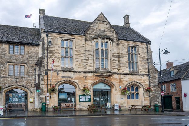
Athelstan Museum
Museums and galleries · Malmesbury
Malmesbury's free museum in the Town Hall, with the stories of King Athelstan and Eilmer the flying monk, a wheelchair lift and dogs welcome.
Dog-friendly · Rainy days · Family-friendly
Verified Oct 2026
-
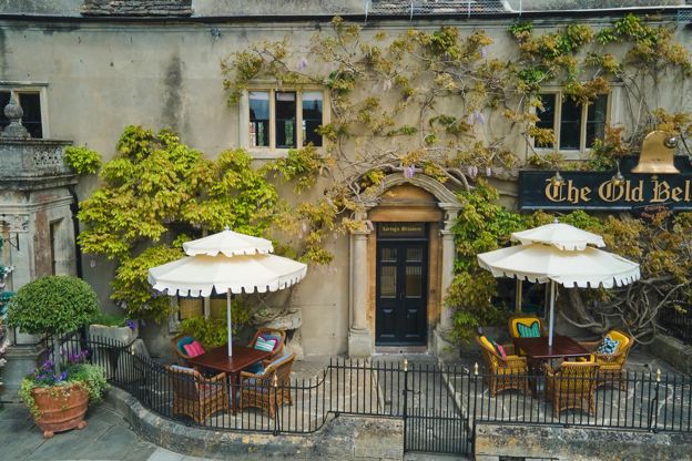
The Old Bell
Hotel · Malmesbury
A Grade I listed hotel beside Malmesbury Abbey, which says it has welcomed guests since 1220, with the Abbey Row restaurant, afternoon tea and dogs welcome.
Dog-friendly
Verified Nov 2026
-
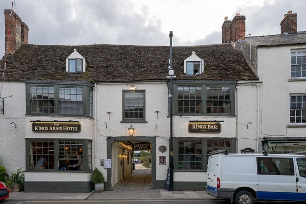
The Kings Arms, Malmesbury
Inn · Malmesbury
A refurbished coaching inn with 15 rooms and a tapas restaurant on Malmesbury's High Street, two minutes' walk from the abbey.
Verified Nov 2026
-
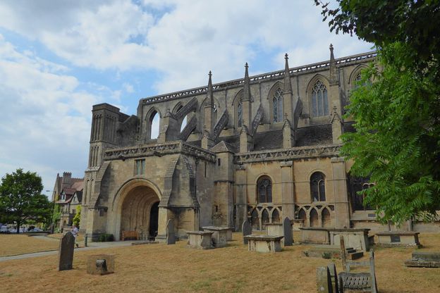
The Abbey Café, Malmesbury
Cafes and tearooms · Malmesbury
A café inside Malmesbury Abbey, open Monday to Saturday from 9.30am to 3.30pm, with Fairtrade coffee, soup, toasties and cakes, and tables in the Cloister Gardens in warm weather.
Verified Nov 2026
Stay near the start
Inns, cottages and hotels within a short drive of where the walk begins, so you can set off early.
Where to stay in Malmesbury-
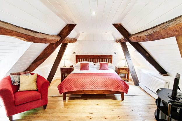
The Stables at The Rookery
Self-catering · Malmesbury
Two self-catering cottages for couples on the edge of Malmesbury: the Stables, in a listed stone stable, and the Coach House, where dogs stay free.
Dog-friendly
Verified Oct 2026
-
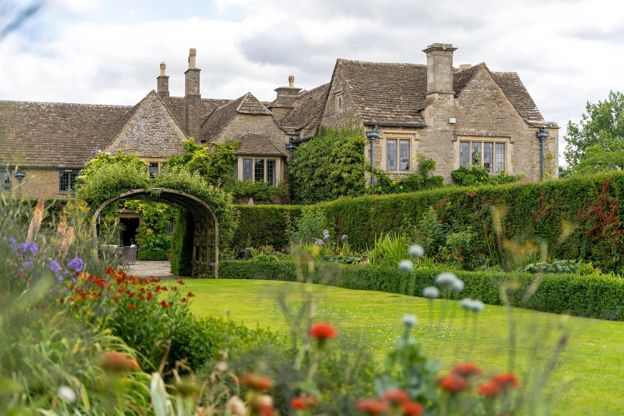
Whatley Manor
Hotel · Malmesbury
A country house hotel and spa with 23 rooms in 12 acres with 22 gardens at Easton Grey, near Malmesbury, with a Michelin-starred restaurant and seven dog-friendly rooms.
Dog-friendly · Wedding venues · EV charging
Verified Nov 2026
-
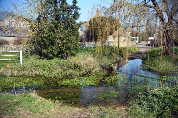
Pettifers
Hotel · Malmesbury
A dog-friendly bed and breakfast hotel at Crudwell, near Malmesbury, with 18 rooms in the main building and a courtyard, walled gardens and a two-bedroom cottage next door.
Dog-friendly · Wedding venues
Verified Nov 2026
More like this
Stories on this walk
-
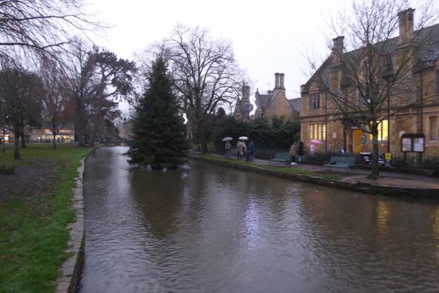
The Cotswolds in December
Story · Guides · 8 minute read
The Cotswolds in December: the shortest days, light trails and late shopping, the attractions that close over Christmas and the ones that stay open, the quiet week between Christmas and New Year, short walks on firm ground and where to stay for it.
More walks to try
-
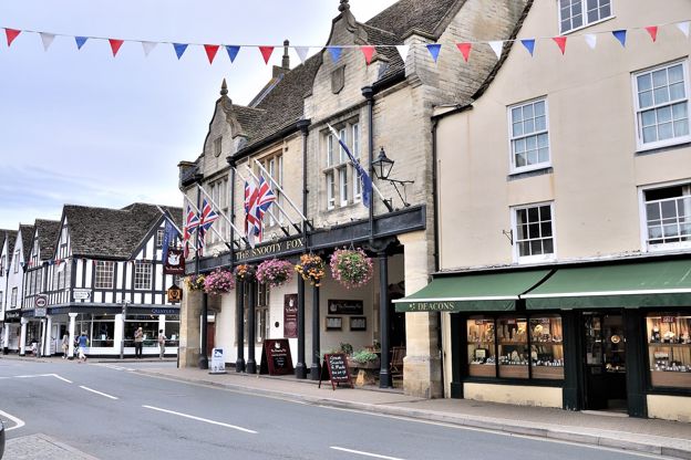
Tetbury town walk
Walk · Starts in Tetbury · 45 mins · Circular
A 1.7-mile (2.7km) easy loop round Tetbury from the Old Railyard car park, about 45 minutes on paved paths: St Saviour's and the old police court, the packhorse bridge at Cutwell, Bath Bridge, St Mary's, the Market House and back along the old railway to the Goods Shed.
-
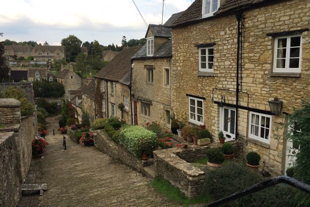
Tetbury and Ashley
Walk · Starts in Tetbury · 3 hrs · Circular
A 6.5-mile (10.5km) moderate circular walk of about three hours from Tetbury's Goods Shed, with stiles: along the old railway line, over the fields to Ashley and its Norman church, and back on the Monarch's Way past a brick pillbox, walking towards the town's spire.
-
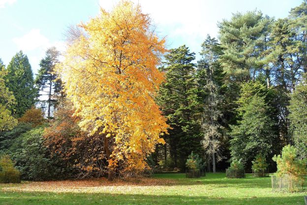
Silk Wood at Westonbirt Arboretum
Walk · Starts in Tetbury · 1 hr · Circular · Dog-friendly
A 2.6-mile (4.2km) easy, nearly level loop of about an hour through Silk Wood at Westonbirt, the National Arboretum, from the treetop walkway out to the Waste Gate, round by Oak Avenue and the maples and back along The Link. Inside the arboretum, so entry is paid.