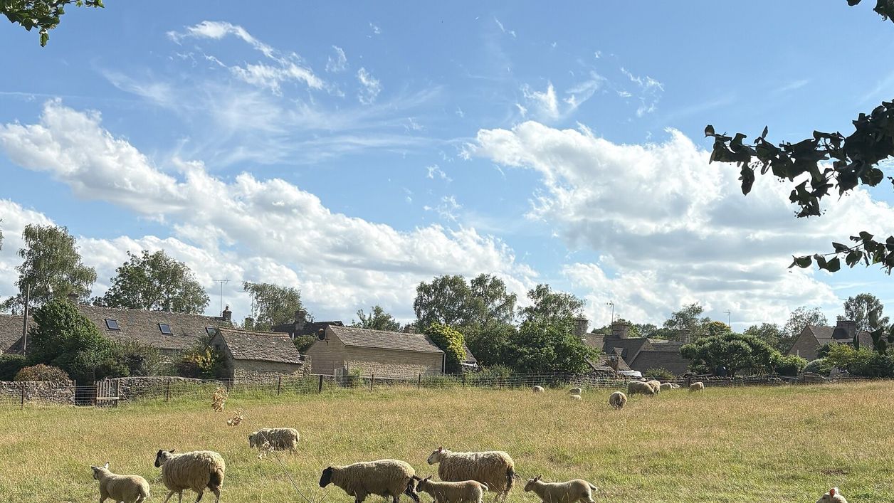
Joecompan, CC BY-SA 4.0, via Wikimedia Commons
Stow and Lower Swell
A 3.6-mile (5.8km) moderate loop from Stow-on-the-Wold of about an hour and three quarters, down the fields by Nether Swell to the River Dikler at Hyde Mill, up Mill Lane to Lower Swell's Norman church and Lutyens war memorial, and back to Stow beside the B4068.
- Distance
- 5.8 km (3.6 mi)
- Difficulty
- Moderate
- Time
- 1 hr, 45 mins
- Ascent
- 130 m
- Circular
- Circular
The route
Starts at Back Walls, Stow-on-the-Wold Road walkingLivestock in fieldsMuddy in winterSteep section Download GPX
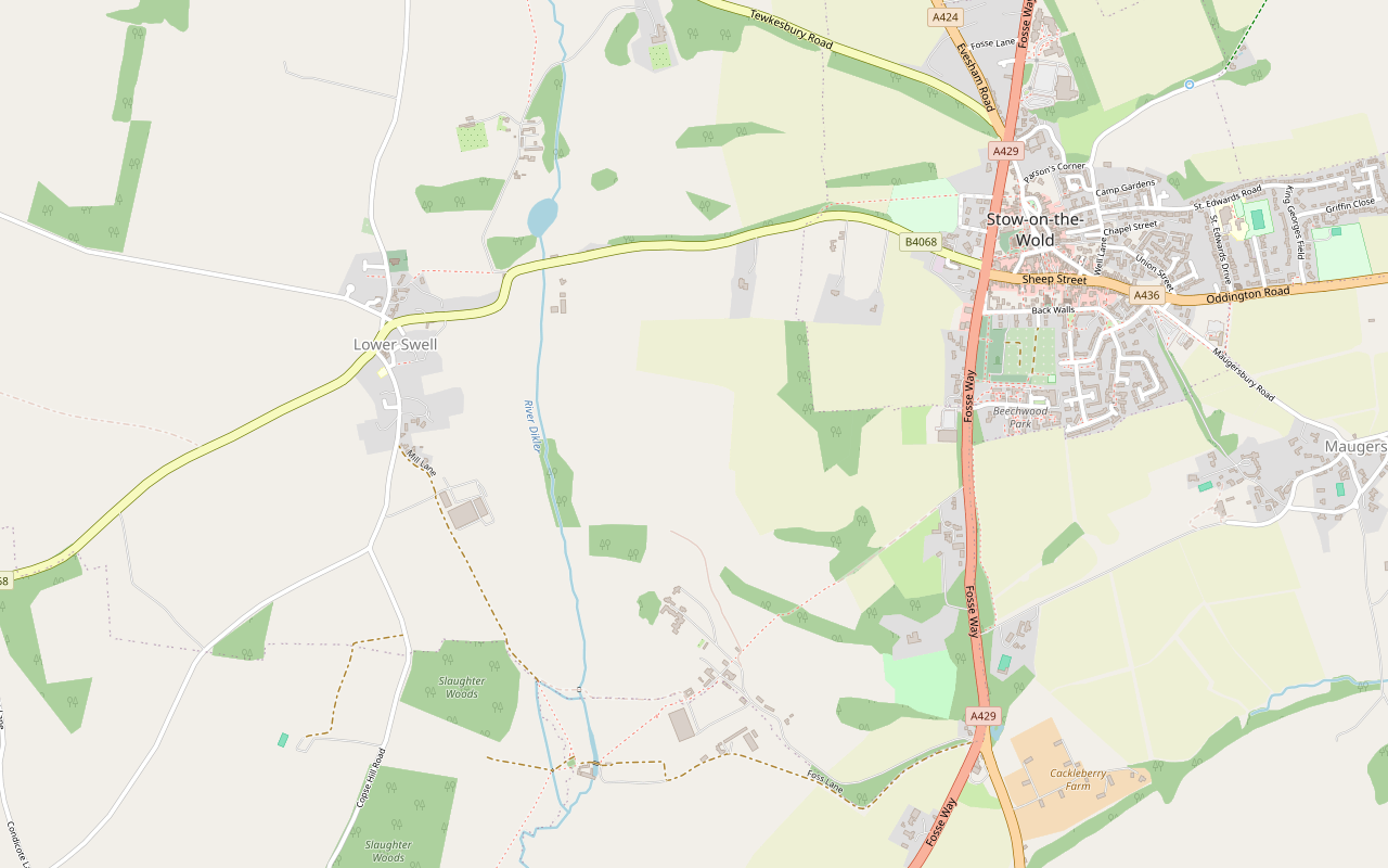
Step by step
-
Step 1: Out of Stow to the Fosse Way
From Back Walls, walk west round the edge of the old town to the Fosse Way (A429) and follow its pavement south past Beechwood Park. Where a public footpath leaves on the right by a drive, take it.
-
Step 2: Down to Nether Swell and Hyde Mill
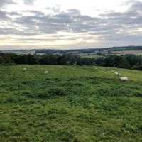
The footpath runs south-west down the fields, beside farm drives in places, to Nether Swell Manor Farm. Carry on along the footpath and then the bridleway down to the River Dikler at Hyde Mill. Expect stock in these fields and mud after rain.
- Muddy in winter
- Dogs on lead
-
Step 3: Up Mill Lane to Lower Swell
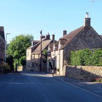
Turn north up the bridleway by Slaughter Woods, which becomes Mill Lane, and follow the lane north into Lower Swell past the school to the war memorial on its small green.
- Dogs on lead
-
Step 4: St Mary's and back to Stow
Take the footpath to St Mary's church and through the churchyard to the fields east of it. Rejoin the B4068 and follow it east, past the Spa Cottages, back towards Stow; walkers report a path beside the road for most of this stretch. The last part climbs to the edge of the town. Return along Back Walls to the start.
- Steep section
Sights on the way
The sights this walk passes, numbered as on the map.
-
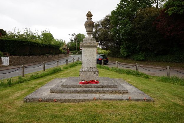
Lower Swell war memorial
Sight · Monument · Stow-on-the-Wold
Lower Swell's war memorial is a flaming urn on a stone pedestal on the village green, designed by Sir Edwin Lutyens and unveiled in 1921. Lutyens had worked at Abbotswood nearby for Mark Fenwick. It is on the Stow and Lower Swell walk, open at all times. Grade II.
-
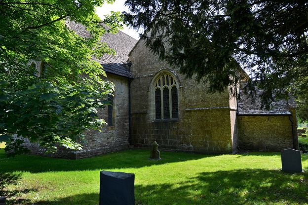
St Mary's Church, Lower Swell
Sight · Church · Stow-on-the-Wold
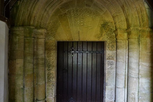
St Mary's at Lower Swell, a mile west of Stow, is two churches in one: a twelfth-century nave and chancel, now the south aisle and chapel, beside a larger church of 1852. Its Norman doorway has a Tree of Life tympanum and its old chancel arch rare carvings. Grade II*.
-
Pineapple Spa, Lower Swell
Sight · Historic building · Stow-on-the-Wold
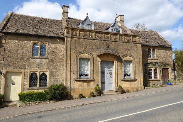
The Pineapple Spa is a row of cottages beside the B4068 between Lower Swell and Stow-on-the-Wold that began as a spa over a mineral spring found in 1807, with a front in the Indian style of Sezincote and a stone door hood crowned by a pineapple. Grade II*; private.
-
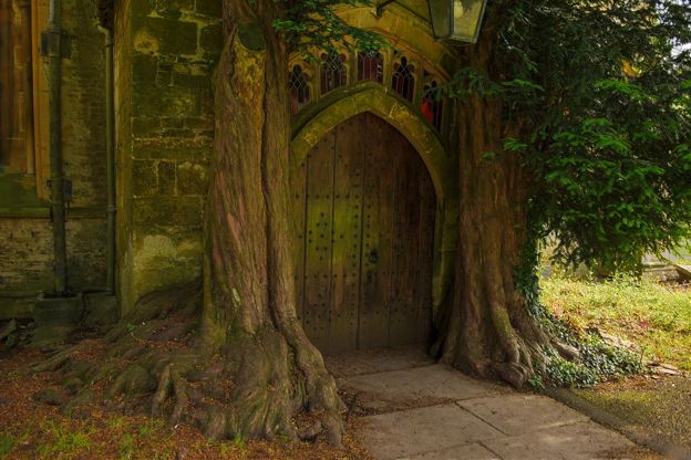
St Edward's Church, Stow-on-the-Wold
Sight · Church · Stow-on-the-Wold
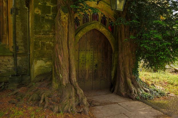
St Edward's is Stow-on-the-Wold's Grade I parish church, beside the Market Square, with a fifteenth-century tower seen across the wold and a north door framed by two yews. Royalist prisoners were held inside after the battle of 1646. Open daily.
The walk in detail
The Stow and Lower Swell walk is a 3.6-mile (5.8km) loop from Back Walls in Stow-on-the-Wold, by Hyde Mill to the Norman church at Lower Swell. It is moderate, with about 130m of climbing, most of it at the end, and takes about an hour and three quarters. Stow's pubs and tearoom are at the start.
AllTrails' surface data puts about a third of it on tarmac, and walkers say the road stretches at the start and finish are the price of the quiet middle: the fields down to the Dikler, Mill Lane and the village of Lower Swell.
Nether Swell and the Dikler
The first half of the loop drops through the fields of Nether Swell to the River Dikler at Hyde Mill, the lowest point of the walk at about 141m. The footpath from the Fosse Way crosses the fields past the manor farmhouse, a late eighteenth-century house of coursed stone, and near Nether Swell Manor, built in 1903 to 1909 by E Guy Dawber for Sir John Scott in a free Jacobean style.
At the bottom the path meets the river at Hyde Mill. Our Stow and Maugersbury walk comes down to the same mill from the other side.
Lower Swell
Lower Swell, at the top of Mill Lane, has the walk's sights: a war memorial on the green, the Norman church of St Mary's and a spa of 1807. The memorial, a flaming urn on a stone pedestal, is by Sir Edwin Lutyens and was unveiled on 31 July 1921; he is thought to have had the commission through Mark Fenwick, for whom he worked at Abbotswood nearby.
St Mary's is two churches in one. The original twelfth-century church is now the south aisle and chapel of a larger church built on in 1852 by J C Buckler and Son, with a chancel of 1870 and glass and wall paintings by Clayton and Bell. Look at the Norman doorway: its tympanum is carved with a Tree of Life and a dove pecking at the fruit, which the listing thinks was never finished.
On the B4068 east of the village, the Spa Cottages of about 1807 were built over a spring, with a front in what the listing calls the Hindu style of Sezincote and a stone hood topped by a pineapple. A roundel over one door records a carbonated chalybeate spring discovered in 1807. The Golden Ball Inn, a farmhouse of about 1700 turned inn, is in the village too, though walkers note the route does not pass its door.

The Cotswolds Info newsletter
Events, new places and the best of the season, about once a month. Unsubscribe at any time.
What walkers report
Walkers through 2026 mostly mention the roads: the loop starts down the pavement of the Fosse Way and finishes along the B4068. They describe both as busy, though there is a path beside the road for most of the return. Walkers in 2026 met sheep, cattle and horses in the fields in between, so dogs spend much of the loop on a lead. The climb back up to Stow comes at the end.
Food in Stow, before or after
The food on this walk is in Stow, since the route does not pass the Golden Ball in Lower Swell. The Old Bakery Tearoom in Fountain Court lets dogs in, the Bell on Park Street is a pub with rooms, the Porch House on Digbeth Street serves breakfast, lunch and dinner, and the Old Butchers on Park Street is a restaurant in a former butcher's shop. Huffkins, in a listed seventeenth-century building on the Square, is open every day for breakfast, lunch and afternoon tea, and welcomes dogs.
Stow stands more than 230m up where the Fosse Way and other roads meet, and St Edward's church, Grade I, has Saxon origins and a fifteenth-century tower. In the battle of Stow in March 1646 the Royalists were beaten in the last battle of the first Civil War. To stay the night, see our places to stay in Stow-on-the-Wold.
Parking and getting there
The nearest council car park is on Maugersbury Road (GL54 1HH), which charges (from £4.40 for two hours, card or PayByPhone, no cash), and the council's Fosseway car park by Tesco (GL54 1BX) is free. There are paid public toilets on the Market Square. Without a car, the 801 bus stops in Stow about hourly every day, with a shorter day on Sundays, on its way between Moreton-in-Marsh station, Bourton and Cheltenham; our guide to the Cotswolds without a car has the connections.
Longer and shorter walks from Stow
For a full day, the loop from Bourton to Stow uses the same path to Nether Swell. For something shorter a few kilometres west, the walk from Lower Slaughter to Upper Slaughter is an easy 2-mile there-and-back up the River Eye, and our guide to the Cotswolds with a dog has more walks where dogs are welcome.
Places on the way
-
The Old Bakery Tearoom
Cafes and tearooms · Stow-on-the-Wold
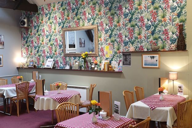
A tearoom in Fountain Court off Digbeth Street, Stow-on-the-Wold, run by Jackie and Alan since 2005, where all the food is made on the premises and dogs come in.
Dog-friendly
Verified Oct 2026
-
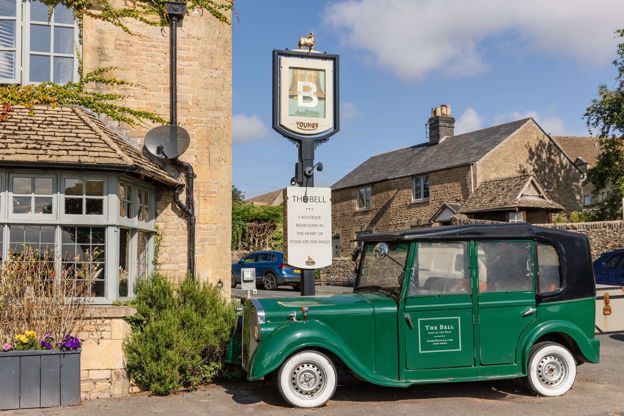
The Bell at Stow
Inn · Stow-on-the-Wold
A Young's pub with 14 rooms on Park Street, Stow-on-the-Wold, with dogs welcome in dog-friendly rooms.
Dog-friendly · Family-friendly
Verified Nov 2026
-
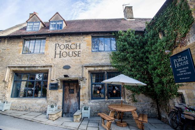
The Porch House
Inn · Stow-on-the-Wold
An inn with 13 rooms on Digbeth Street, Stow-on-the-Wold, serving breakfast, lunch and dinner every day, which calls itself England's oldest inn.
Dog-friendly
Verified Oct 2026
-

The Old Butchers
Restaurants · Stow-on-the-Wold
A restaurant in a former butcher's shop on Park Street, Stow-on-the-Wold, run by Pete and Louise Robinson since 2005 and listed by Michelin.
Family-friendly
Verified Oct 2026
-
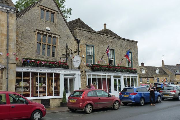
Huffkins, Stow-on-the-Wold
Cafes and tearooms · Stow-on-the-Wold
The Stow branch of Huffkins, the Burford bakery founded in about 1890, in a listed seventeenth-century building on the Square, open every day for breakfast, lunch and afternoon tea, with dogs welcome.
Dog-friendly
Verified Nov 2026
Stay near the start
Inns, cottages and hotels within a short drive of where the walk begins, so you can set off early.
Where to stay in Stow-on-the-Wold-
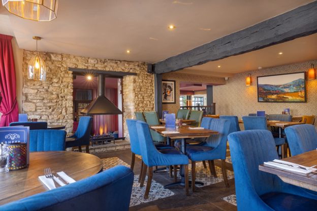
The Sheep on Sheep Street
Inn · Stow-on-the-Wold
An inn with 22 rooms and a restaurant on Sheep Street, Stow-on-the-Wold, open from breakfast to late every day, with some rooms for dogs.
Dog-friendly
Verified Nov 2026
-
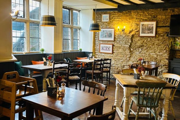
The Kings Arms, Stow
Inn · Stow-on-the-Wold
A former coaching inn on Stow's Market Square with ten rooms, three of them split-level stable rooms, a restaurant and its own parking.
Dog-friendly
Verified Oct 2026
-
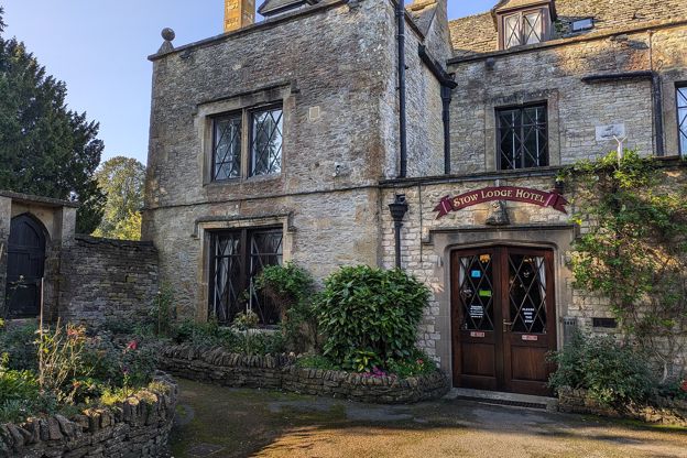
Stow Lodge Hotel
Hotel · Stow-on-the-Wold
A family-run hotel with 20 rooms in Stow's former rectory of 1763 on the Square, with a restaurant, a bar, gardens and a private car park; no pets.
Verified Oct 2026
More like this
More walks to try
-
Stow-on-the-Wold and Maugersbury
Walk · Starts in Stow-on-the-Wold · 2 hrs · Circular
A 3.75-mile (5.5km) circular walk without stiles from the Cross in Stow-on-the-Wold, easy with 130m of ups and downs and about two hours: past the Porch House and Maugersbury Manor to the Fosse Way, down to Hyde Mill and back up through white gates by Nether Swell.
-
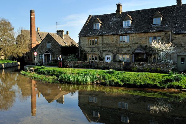
Lower Slaughter to Upper Slaughter
Walk · Starts in Lower Slaughter · 45 mins · Circular · Dog-friendly
A 2-mile (3.1km) there-and-back from Lower Slaughter, easy and almost level, in 45 minutes to an hour: on the Wardens' Way from Lower Slaughter's mill up the River Eye through riverside fields to Upper Slaughter's ford, church and manor, and back the same way.
-
Bourton-on-the-Water, the Slaughters and Naunton
Walk · Starts in Bourton-on-the-Water · 5 hrs · Circular
A 10-mile (16.4km) circular walk from Bourton-on-the-Water, four to five hours of moderate walking with stiles and steep slopes. It follows the Wardens' Way through Lower and Upper Slaughter to Naunton, then comes home down the Windrush valley on the Windrush Way.