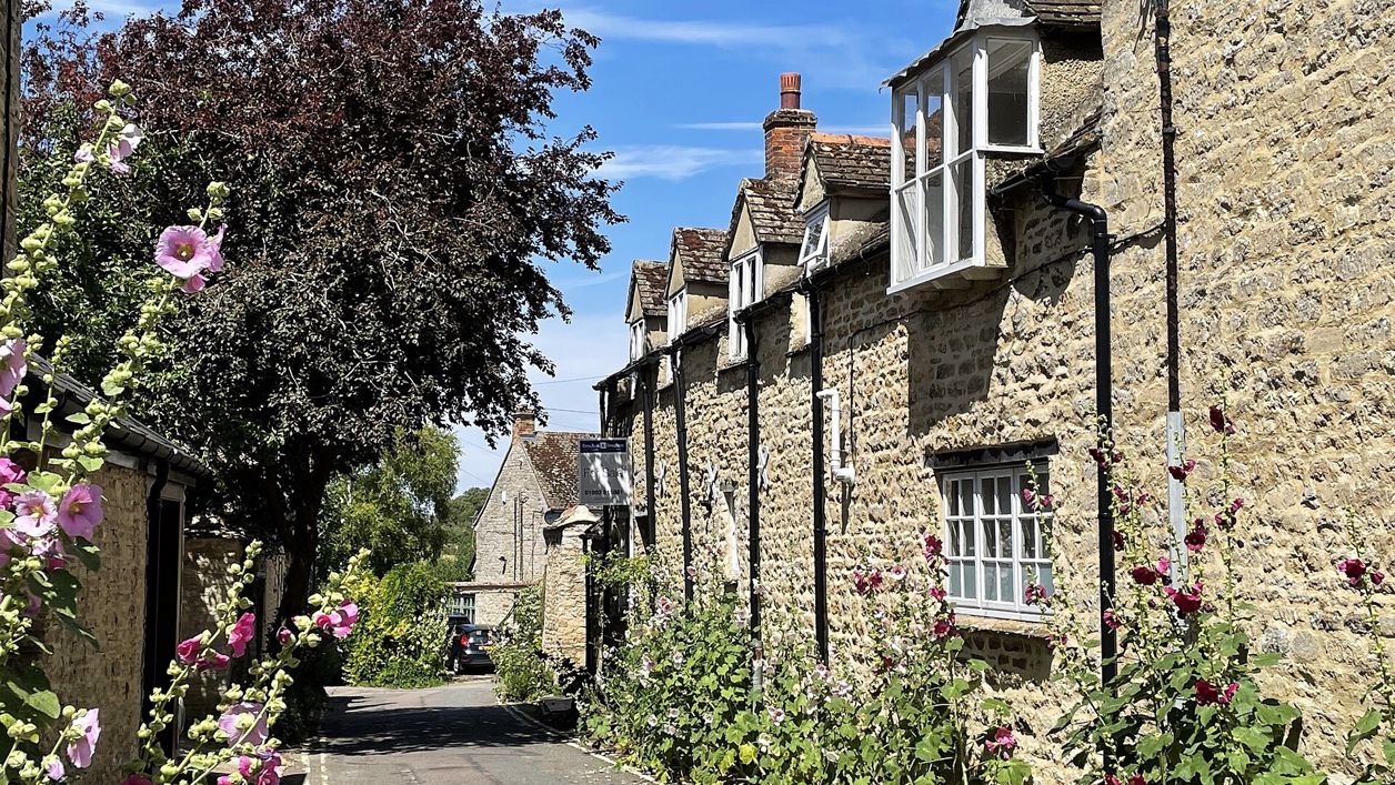
David Lewis, CC BY-SA 2.0, via Wikimedia Commons
Woodstock town walk
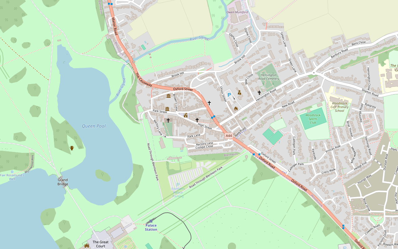
A 1.1-mile (1.7km) easy heritage loop round Woodstock from the stocks in Park Street to Hawksmoor's Woodstock Gate into Blenheim, along the coaching inns of Oxford Street and Market Street to the Town Hall and the Hensington Gate, and back through the churchyard.
- Distance
- 1.7 km (1.1 mi)
- Difficulty
- Easy
- Circular
- Circular
The route
Starts at By the stocks in Park Street, opposite the church, Woodstock Café on route Download GPX
Step by step
-
Step 1: Park Street to Oxford Street
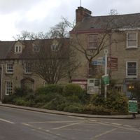
Start by the stocks in Park Street, opposite the church, and walk west along Park Street. Round the corner is the Woodstock Gate into Blenheim. Retrace your steps past Chaucer's House and turn left down Chaucer's Lane, then carry on into Harrison's Lane and down towards the main road. From the embankment above Oxford Street, look across the road to the Octagon House and, to your left in the far distance, the Column of Victory.
-
Step 2: Oxford Street, Market Street and the Town Hall
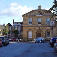
Go down onto Oxford Street and follow the road round to the right, past the Marlborough Arms. Walk down Market Street past the Feathers to the Bear, then head back to the Town Hall. Vickers is to your right.
-
Step 3: High Street and Oxford Road
Walk a few metres down the High Street past Brothertons, with 6 and 8 High Street on the other side, Ye Anciente House at No 20 (the leaflet's Harriet's Tearooms), and Cromwell's House at No 28. At Oxford Road, look across to Hope House on the corner of Hensington Road, then carry on down Oxford Road past Caroline Court to the Hensington Gate.
-
Step 4: Rectory Lane and the churchyard
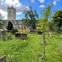
Retrace your steps and turn left into Rectory Lane, past the old police station and the flats of Cockpit Close on your left. Just after the back entrance to the Bear, go through the stone archway and kissing gate into the churchyard, and come out onto Park Street opposite the stocks. To avoid the kissing gate and steps, carry on up Rectory Lane and turn right into Park Street. The walk ends at Fletcher's House.
Sights on the way
The sights this walk passes, numbered as on the map.
-
Woodstock Town Hall
Sight · Historic building · Woodstock
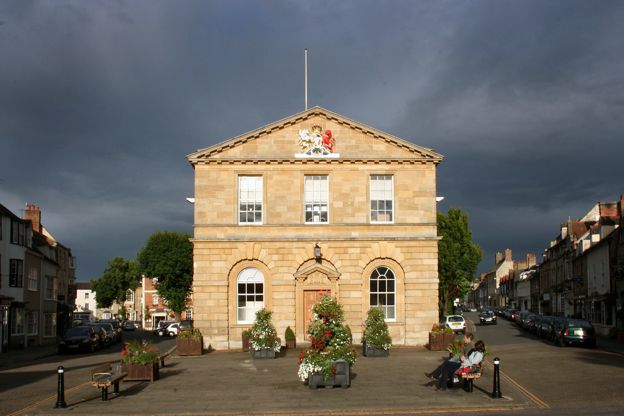
Woodstock Town Hall in the Market Place was designed by Sir William Chambers and built in 1766 to 1767 at the Duke of Marlborough's expense, over an open market hall enclosed in 1898, with a marble sundial on its south wall. Grade II.
-
St Mary Magdalene, Woodstock
Sight · Church · Woodstock
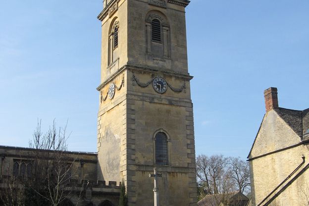
St Mary Magdalene is Woodstock's church on Park Street, founded with the twelfth-century town and long a chapel of Bladon, with a Norman zigzag doorway, a classical tower of 1784 to 1786 with chimes of 1792 made to play tunes, and a sundial with odd numerals. Grade II*.
The walk in detail
The Woodstock town walk is an easy 1.1-mile (1.7km) loop round Woodstock from the stocks in Park Street, opposite the church, on pavements, lanes and a churchyard path. It passes 21 numbered buildings, from Hawksmoor's gate into Blenheim to the coaching inns, and pubs such as the Punchbowl. The leaflet gives no time; it is nearly level.
It comes from West Oxfordshire District Council's Woodstock Town Walk leaflet, and it is a loop through the streets rather than a countryside walk.
A town built for visitors
Woodstock grew up to serve the royal hunting park next door, and later Blenheim. The leaflet's history begins with the Norman kings' love of hunting. In the early twelfth century Henry I enclosed the park at Woodstock with a wall seven miles long, which the leaflet calls the earliest known park wall in England, and New Woodstock, the main part of the town, was laid out in the late twelfth century by Henry II, who bought land beside the park for inns to house his attendants. In 1704 the estate was granted to the Duke of Marlborough for his victory at Blenheim. In the 70 years that followed, many timber-framed houses in the town were rebuilt or given the symmetrical stone fronts that make it look Georgian today.
Park Street and the Woodstock Gate
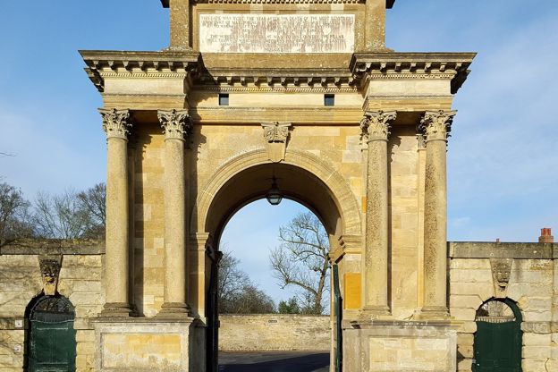
Park Street, where the walk starts, runs west to the Woodstock Gate, the main entrance to Blenheim. It is lined with Georgian houses, many with the stone door hoods on iron brackets that the leaflet calls typical of Woodstock. The gate into Blenheim Palace was designed by Nicholas Hawksmoor in 1723; the leaflet says it was meant for the Oxford road until a smallholder refused to give up his land. Blenheim's palace and park are a World Heritage Site, and the palace is Winston Churchill's birthplace.
On the way back, Chaucer's House takes its name, the leaflet says, from the son of the poet, who had a house here. Its listing gives it medieval origins, a rebuilding in the late seventeenth century for Nicholas Baynton and a new front of about 1740. From the embankment above Oxford Street you can see the Octagon House, a converted chapel, and in the far distance the Column of Victory, about 41m high and topped by a statue of the first Duke of Marlborough.
The coaching inns
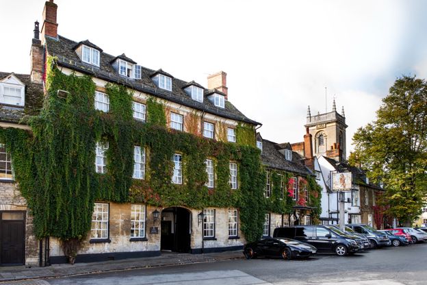
Oxford Street and Market Street still show the coaching age of the late eighteenth and early nineteenth centuries, with three old inns in a few hundred metres. The Marlborough Arms keeps its arched gateway and cobbled yard; its listing dates the front to about 1750, with earlier origins. The Feathers has a carved fourteenth-century figure on its wall. The Bear is a five-bay Georgian block with a central coach entrance, an earlier block of 1700 with a doorway carved with two bears fighting over grapes, and a smaller sixteenth-century gabled wing beyond.
The Town Hall was designed by Sir William Chambers in 1766, with an open market hall on the ground floor that was enclosed in 1898. In a niche on its south wall is a marble sundial, the near twin of the one on the church, which our story on the two Woodstock sundials explains.
High Street to the Hensington Gate
The walk's eastern end runs down the High Street and Oxford Road to Hawksmoor's second gate into Blenheim, the Hensington Gate. On the way, Brothertons was an ironmonger's from 1712 to 1980, with a two-storey bay window and a horseman carved above it. Opposite, 6 and 8 High Street, once one house, has 1710 on its rainwater head, Ye Anciente House at No 20, which the 2009 leaflet names as Harriet's Tearooms, is early seventeenth century with finely carved bargeboards, and No 28, Cromwell's House of about 1640, is where the leaflet says Cromwell supposedly stayed during the siege of Woodstock Manor.
Hope House on the corner of Hensington Road is listed Grade II*: its listing dates it to about 1708, built for Miles Parker in the Baroque style, and the leaflet says it may have been designed by Vanbrugh, the architect of Blenheim. Caroline Court was built in 1797 as almshouses for Caroline, Duchess of Marlborough. The Hensington Gate beyond it has flower baskets carved by Grinling Gibbons, and its massive piers were moved here in the 1770s.

The Cotswolds Info newsletter
Events, new places and the best of the season, about once a month. Unsubscribe at any time.
Rectory Lane, the church and the stocks
The way back is by Rectory Lane and through the churchyard of St Mary Magdalene to the stocks. Cockpit Close on Rectory Lane stands on the site of an eighteenth-century cockfighting pit, later a glove factory demolished in 1961. The path through the churchyard shows the oldest parts of the church: a Norman south doorway with zigzag ornament and two thirteenth-century windows.
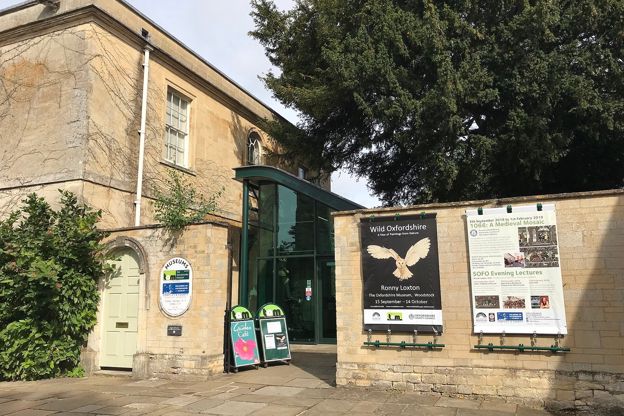
Back on Park Street, a blue plaque on No 5 recalls Edmund Hiorne, the town clerk in the Civil War, who had to beg forgiveness on his knees in the House of Commons for giving the town's armour to the Royalists. Across the street are the stocks, listed as seventeenth or eighteenth century, with four leg holes. The leaflet explains that a crime against another person put both feet in, and one against yourself, such as drunkenness, only one. The walk ends at Fletcher's House, which its listing dates to 1613 and 1614, built for Thomas Brown, an alderman, and refronted about 1795. It is now the Oxfordshire Museum, free and closed on Mondays, whose Woodstock gallery covers the town's glove making and the polished cut steel it was known for in the eighteenth century.
Food, drink and dogs
The walk passes most of the town's inns, so there is somewhere to eat at almost every corner. The Punchbowl on Oxford Street is a family-run Arkell's pub that calls itself super dog friendly, and the King's Arms on Market Street is a Fuller's hotel and restaurant. The leaflet says nothing about dogs, but the route keeps to streets and the churchyard path, so a lead is all a dog needs. For a night in the town, see our places to stay in Woodstock.
Parking, buses and paths
The council's Hensington Road car park is free, with 4-hour and 10-hour bays, and the leaflet's map marks parking near the route. The S3 bus from Oxford station stops outside Blenheim Palace roughly hourly, and the S7 links Woodstock with Oxford, Hanborough station and Witney.
The route is on pavements, lanes and the churchyard path, with a kissing gate and steps into the churchyard; the leaflet's alternative keeps to Rectory Lane and Park Street instead. The Woodstock Town Walk leaflet (opens in a new tab) has the map.
Longer walks into Blenheim
To go through the gates rather than past them, the 4.5-mile circuit of Blenheim's park from Bladon crosses the park by the Grand Bridge, though most of it needs a Park and Gardens ticket. The walk from Combe into Blenheim Park uses the park's public footpaths, past Fair Rosamund's Well and the lake.
Places on the way
-
The Oxfordshire Museum
Museums and galleries · Woodstock
The county museum in Woodstock, free, with galleries on Oxfordshire's history including Woodstock's gloves and cut steel, a garden and a café.
Rainy days · Car-free
Verified Oct 2026
-
Blenheim Palace
Historic houses and heritage · Woodstock
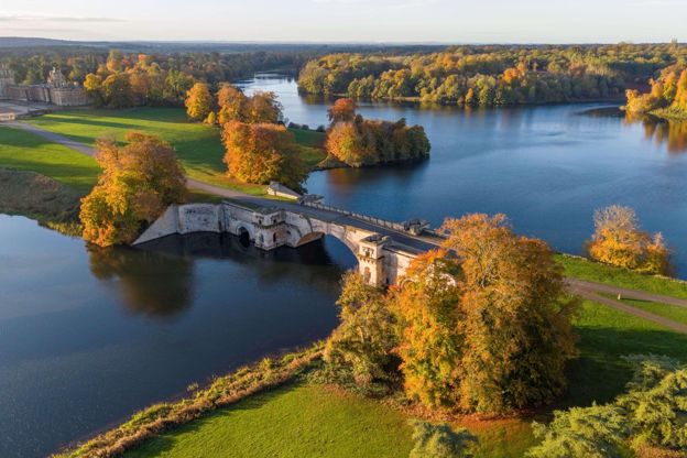
Vanbrugh's palace at Woodstock, Churchill's birthplace and a World Heritage Site, with Capability Brown's park, formal gardens and a ticket that lasts a year.
Family-friendly · Dog-friendly · Car-free
Verified Oct 2026
-
The Bear Hotel
Hotel · Woodstock
A Macdonald hotel in a Grade II* listed old inn on Park Street, Woodstock: 54 rooms with four-posters and suites, a restaurant, afternoon tea and dogs welcome, a short walk from Blenheim.
Dog-friendly · Wedding venues
Verified Nov 2026
-
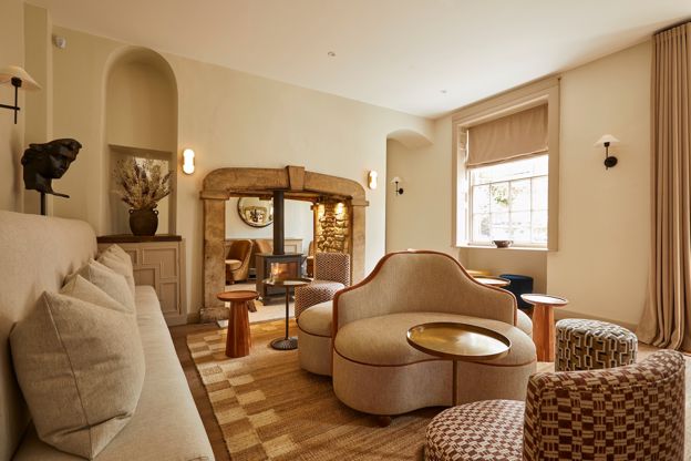
The Feathers
Hotel · Woodstock
A hotel with 18 rooms and five suites on Market Street, Woodstock, with two AA Rosettes and a Michelin Key, a few minutes from Blenheim's gates.
Verified Nov 2026
-
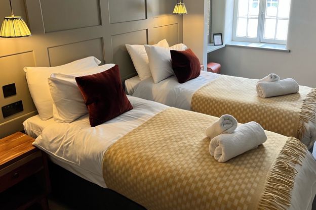
The Punchbowl
Inn · Woodstock
A family-run Arkell's pub with nine rooms, most of them family rooms, on Oxford Street, Woodstock, with EV charging and dogs welcome.
Dog-friendly · Family-friendly · EV charging
Verified Oct 2026
-
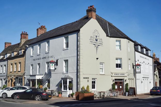
The King's Arms
Inn · Woodstock
A Fuller's inn with 15 rooms on the corner of Market Street, Woodstock, in a Grade II listed building, with dogs welcome and breakfast included.
Dog-friendly · Car-free
Verified Oct 2026
Stay near the start
Inns, cottages and hotels within a short drive of where the walk begins, so you can set off early.
Where to stay in Woodstock-
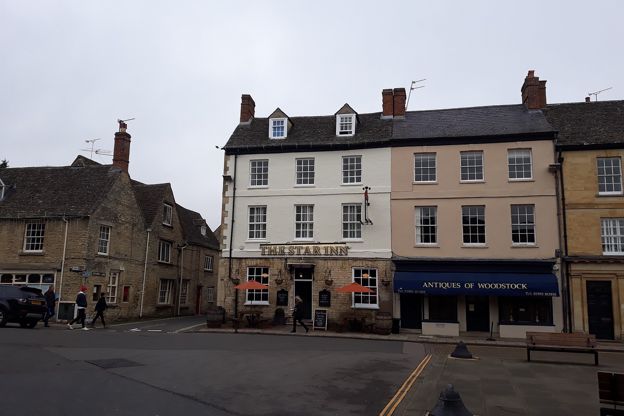
The Star Inn
Pubs · Woodstock
A Grade II inn on the north side of the Market Place in Woodstock, serving pub classics and burgers all day without bookings, with cask ales and four rooms.
Family-friendly
Verified Oct 2026
-
The Crown, Woodstock
Inn · Woodstock
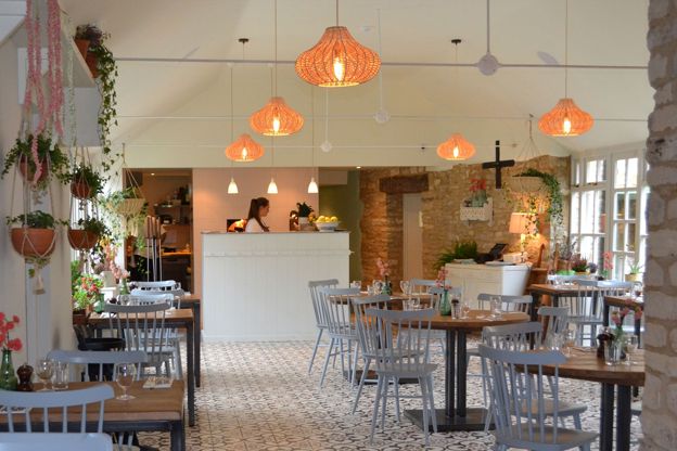
An inn on Woodstock's High Street, in a building it describes as Grade II listed and eighteenth century, with five en-suite rooms, a three-bedroom cottage, a townhouse apartment and a restaurant.
Wedding venues
Verified Oct 2026
-
The Duke of Marlborough
Inn · Woodstock
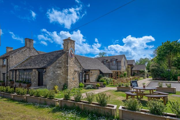
A family and dog-friendly pub with thirteen rooms and a large car park at Woodleys, on the A44 just north of Woodstock.
Dog-friendly · Family-friendly
Verified Nov 2026
More like this
Stories on this walk
-
Afternoon tea in the Cotswolds
Story · Guides · 10 minute read
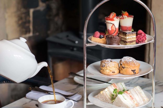
Where to have afternoon tea in the Cotswolds: country house hotels at the Slaughters and Buckland, old inns in Woodstock, Broadway and Malmesbury, and tearooms in Chipping Campden, Stow and Bourton, with times, prices and booking.
More walks to try
-
Blenheim Park from Bladon
Walk · Starts in Woodstock · 2 hrs · Circular
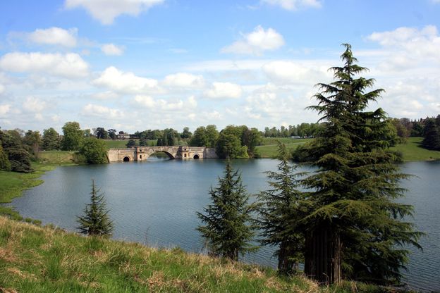
A 4.5-mile (7.2km) circular walk from Bladon round Blenheim's park, about two hours, easy and on estate roads. It crosses New Bridge, goes through High Park to Vanbrugh's Grand Bridge, past the palace and back by the walled garden. About half needs a Park and Gardens ticket.
-
Combe and Blenheim Park
Walk · Starts in Woodstock · 3 hrs · Circular
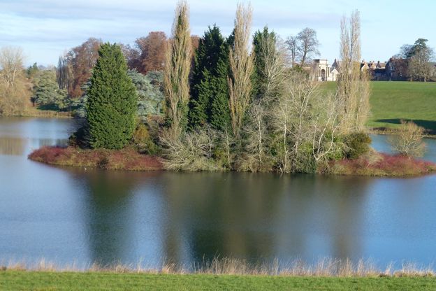
A 6.7-mile (10.8km) circular walk from Combe, moderate and about three hours: over stiled fields to East End, into Blenheim Park, mostly on its public footpaths, past Fair Rosamund's Well and the lake, north to the park wall and back down the western edge to Combe's green.
-
Witney Lake and Cogges
Walk · Starts in Witney · 1 hr, 15 mins · Circular
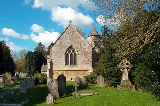
A 3.2-mile (5.1km) easy, flat loop of about an hour and a quarter from the middle of Witney: down the Windrush through the meadows to Witney Lake, back by farm tracks and a lane to Cogges, its manor farm, café and church.