 |
| The Local Time is Tuesday, 23-Apr-2024 18:10:53 CEST |
Lower Slaughter Tourist Information and Travel Guide |
|
|||
| YOU ARE HERE: Main Home Page > Places to Visit > Lower Slaughter |
|
|
|
|
 |
|||||||||||||||||||||||||||||||||||||||||||||||||||||||||
|
|||||||||||||||||||||||||||||||||||||||||||||||||||||||||
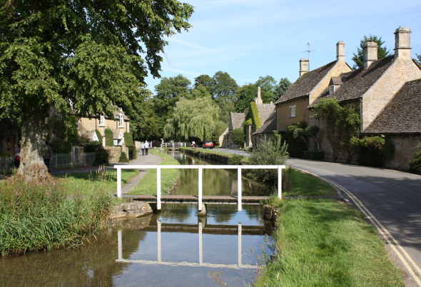
 The name of the village of Lower Slaughter stems from the Old English name for a wet land 'slough' or 'slothre' (Old English for muddy place) upon which it lies. This quaint village sits beside the little Eye stream and is known for its unspoilt limestone cottages in the traditional Cotswold style. The name of the village of Lower Slaughter stems from the Old English name for a wet land 'slough' or 'slothre' (Old English for muddy place) upon which it lies. This quaint village sits beside the little Eye stream and is known for its unspoilt limestone cottages in the traditional Cotswold style.
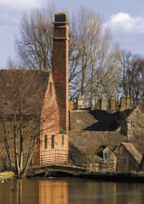
The stream running through the village is crossed by two small bridges and the local attraction is a converted mill with original water wheel selling craft type products and includes a cafe.. ATTRACTIONS The old mill museum and strolling along the river to the village of Upper Slaughter several walking minutes away. You will find the Old Mill at the western end of the village, built in the nineteenth century, and last used commercially in 1958. The Mill now has a tea and gift shop. VOTED MOST ROMANTIC STREET IN BRITAIN (2011) Copse Hill Road in Lower Slaughter, Gloucestershire Cotswolds, has been named as the most romantic street in Britain in a poll for Google Street View. Over 20,000 people voted last month on a shortlist drawn up by a judges panel of travel, shopping and lifestyle experts.
For the most romantic street, the judges were looking for such features as beautiful architecture, stunning views, a romantic ambience, secluded getaways, and restaurants & hotels. |
|||||||||||||||||||||||||||||||||||||||||||||||||||||||||
The Walk |
|||||||||||||||||||||||||||||||||||||||||||||||||||||||||
A Nice Walk from Lower Slaughter to Upper Slaughter (1 mile – 25 minutes approx) Walk through the village to the Old Mill. Take the footpath that runs along the side of the mill. Signposted ‘Wardens Way’ Walk along the riverbank and then cross three fields. Cross a stone footbridge over the river. Walk to the road then turn right. Re-cross the river and turn immediately left sign posted 'unsuitable for motors'. Walk ahead for 150 yards. At the ford, re-cross the river by a stone footbridge. Walk up the hill and at the small village square; take the road to the left. Walk 50 yards and turn right at the footpath sign. Retrace your steps back to Lower Slaughter. See Bourton-on-the-Water for walk to Lower Slaughter. |
|||||||||||||||||||||||||||||||||||||||||||||||||||||||||
The Church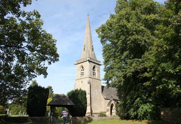 St Mary's Church in Lower Slaughter |
|||||||||||||||||||||||||||||||||||||||||||||||||||||||||
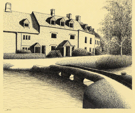 Ink Sketch of the village of Lower Slaughter by Richard Grassi |
|||||||||||||||||||||||||||||||||||||||||||||||||||||||||
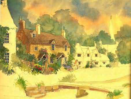 Watercolour of Lower Slaughter by Lesley Holmes |
|||||||||||||||||||||||||||||||||||||||||||||||||||||||||
|
|||||||||||||||||||||||||||||||||||||||||||||||||||||||||
Cotswold Village of Lower Slaughter |
|||||||||||||||||||||||||||||||||||||||||||||||||||||||||
| This page last modified Thursday, 11-Feb-2021 13:24:04 CET | |||||||||||||||||||||||||||||||||||||||||||||||||||||||||

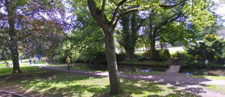
 Gordon Mitchell, aged 88, who retired to Lower Slaughter in 1986 died July 2009.